


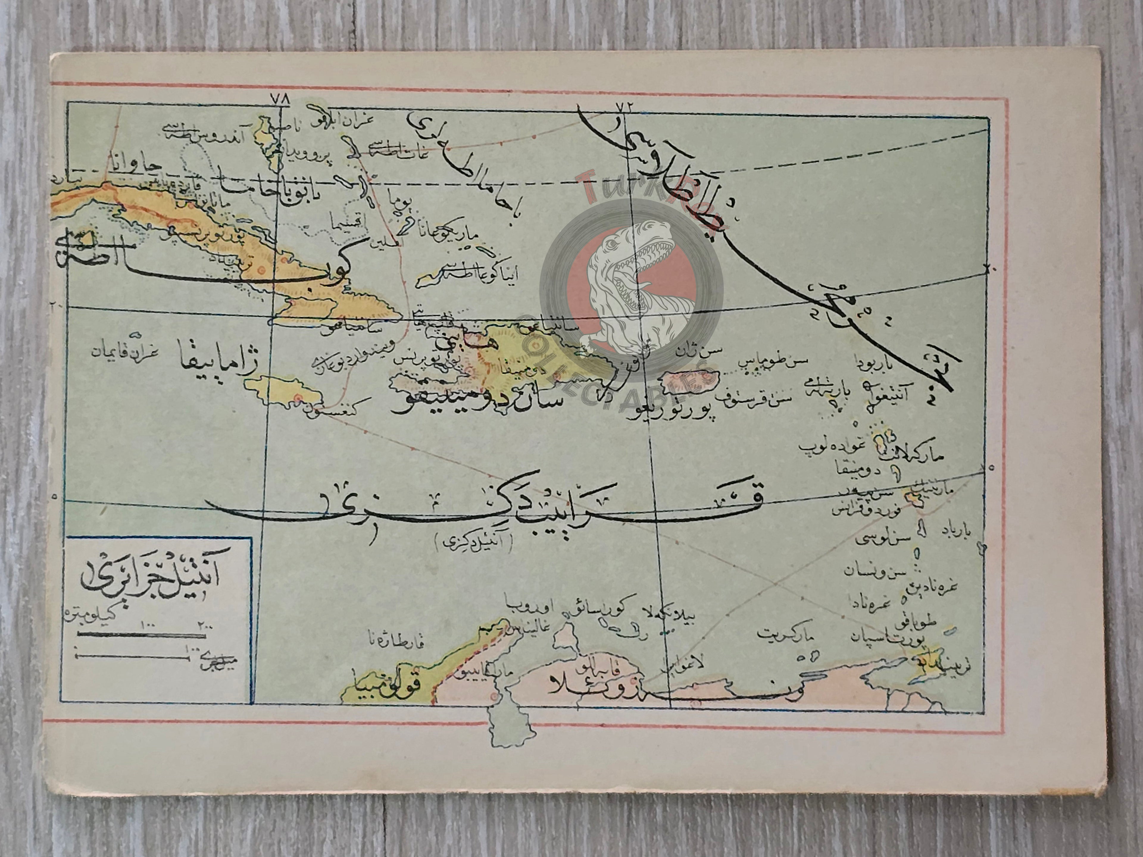

Antilles 1907 Ottoman Atlas Map Ottoman Empire Cuba Haiti Mehmed Eşref
1907 Ottoman Pocket Map of Antilles From “Umum-i Vilayet-i Şahane’yi Havi Küçük Atlas” by Mehmed Eşref
Description:
This is an original 1907 (Hijri 1325) miniature map of Antilles. It was published in the Umum-i Vilayet-i Şahane’yi Havi Küçük Atlas, authored by Mehmed Eşref. This rare atlas included a 32-page brochure in Ottoman script and 128 maps (some composed of two parts), printed on thick paper and loosely inserted after the text. Many of the maps of certain areas worldwide are the first and possibly only Ottoman maps of those regions.
Measuring just 14.5 x 10.3 cm, this finely printed map was part of a compact educational atlas designed for students or officials requiring portable geographic references during the late Ottoman period. It reflects the political landscape of Antilles during the early 20th century and is labeled in Ottoman Turkish script, providing a distinctively non-Western cartographic viewpoint.
Despite its small size, the map contains a remarkable amount of detail, illustrating the extent of European colonial influence at the time alongside the Ottoman understanding of global geography.
Features:
- Date of publication: 1907 (Hijri 1325)
- Author: Mehmed Eşref
- Title: Umum-i Vilayet-i Şahane’yi Havi Küçük Atlas
- Language: Ottoman Turkish
- Size: 14.5 x 10.3 cm
- Condition: Minor age-toning, Very good for age
This is a rare and compact historical artifact from the Ottoman Empire’s educational publishing tradition. An excellent addition to collections focused on antique maps, Ottoman print culture, or Antilles history.