


Arabian Peninsula 1906 Ottoman Atlas Map Saudi Arabia Palestine Qatar Hejaz Railway Empire
Ottoman Turkish Map - Arabian Peninsula
Description:
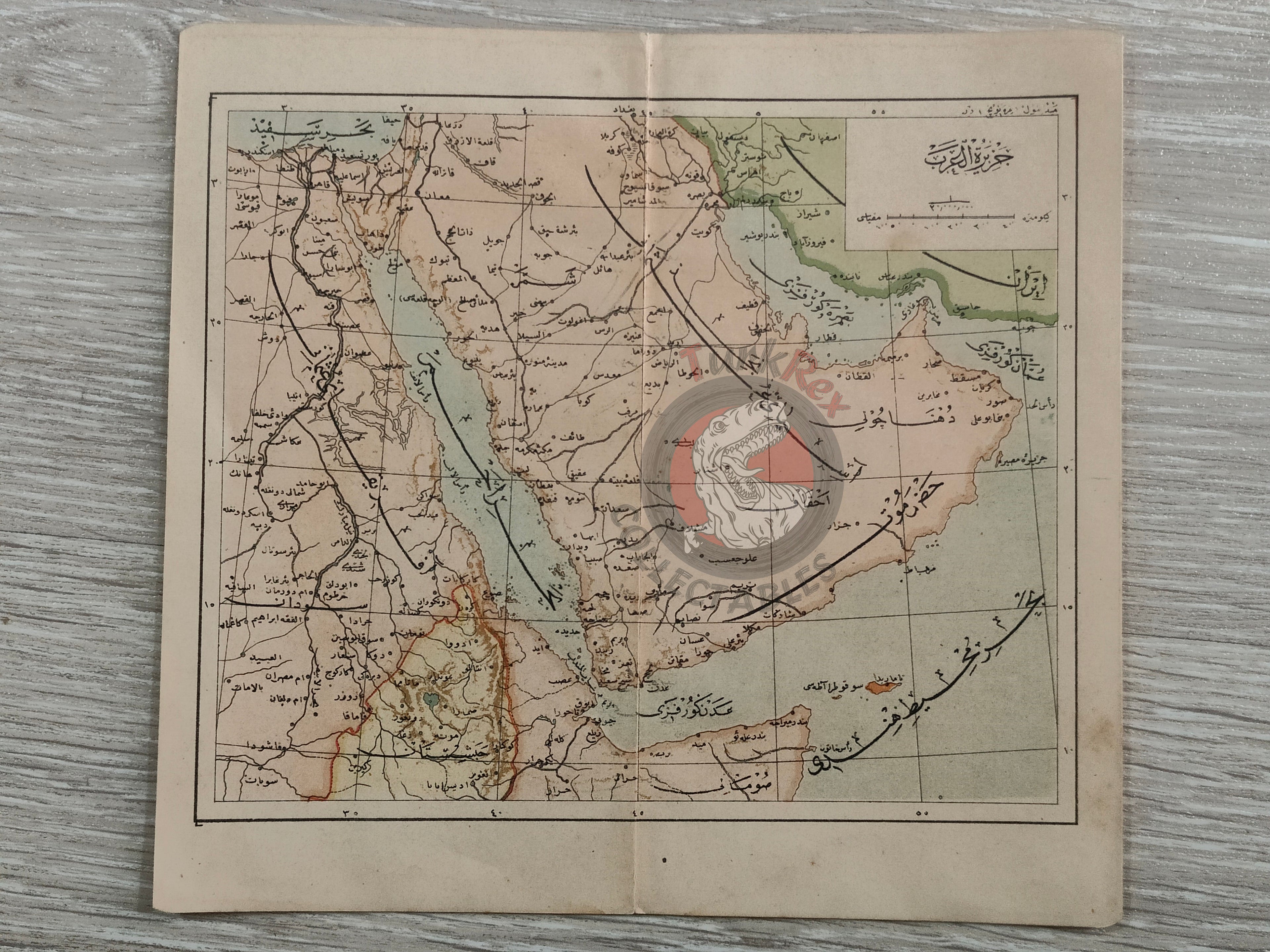
An Ottoman Turkish map of the Arabian Peninsula, published in Tüccarzade İbrahim Hilmi’s Umumi Cep Atlas. The atlas was printed in 1324 AH (1906 CE).
The map measures 19 × 17.6 cm and depicts key geographic features, including the route of the Hejaz Railway. At the time, the region was part of the Ottoman Empire; today, it encompasses Qatar, Saudi Arabia, Israel, Palestine, Jordan, Lebanon, Kuwait, Iraq, Yemen, Oman, the United Arab Emirates, and Egypt.
This map exemplifies the educational and cartographic materials produced in the late Ottoman period and provides a historical reference for the geography and infrastructure of the Arabian Peninsula during the early 20th century.
Key Features:
-
Title/Subject: Arabian Peninsula
-
Format: Atlas map
-
Dimensions: 19 × 17.6 cm
-
Publisher: Tüccarzade İbrahim Hilmi, Istanbul
-
Significance: Includes the Hejaz Railway route; illustrates Ottoman-era territorial and geographic knowledge of the Arabian Peninsula