


Arabian Peninsula 1907 Ottoman Atlas Map Saudi Arabia Palestine Qatar Hejaz Railway Empire
Ottoman Turkish Map – Arabian Peninsula 1907
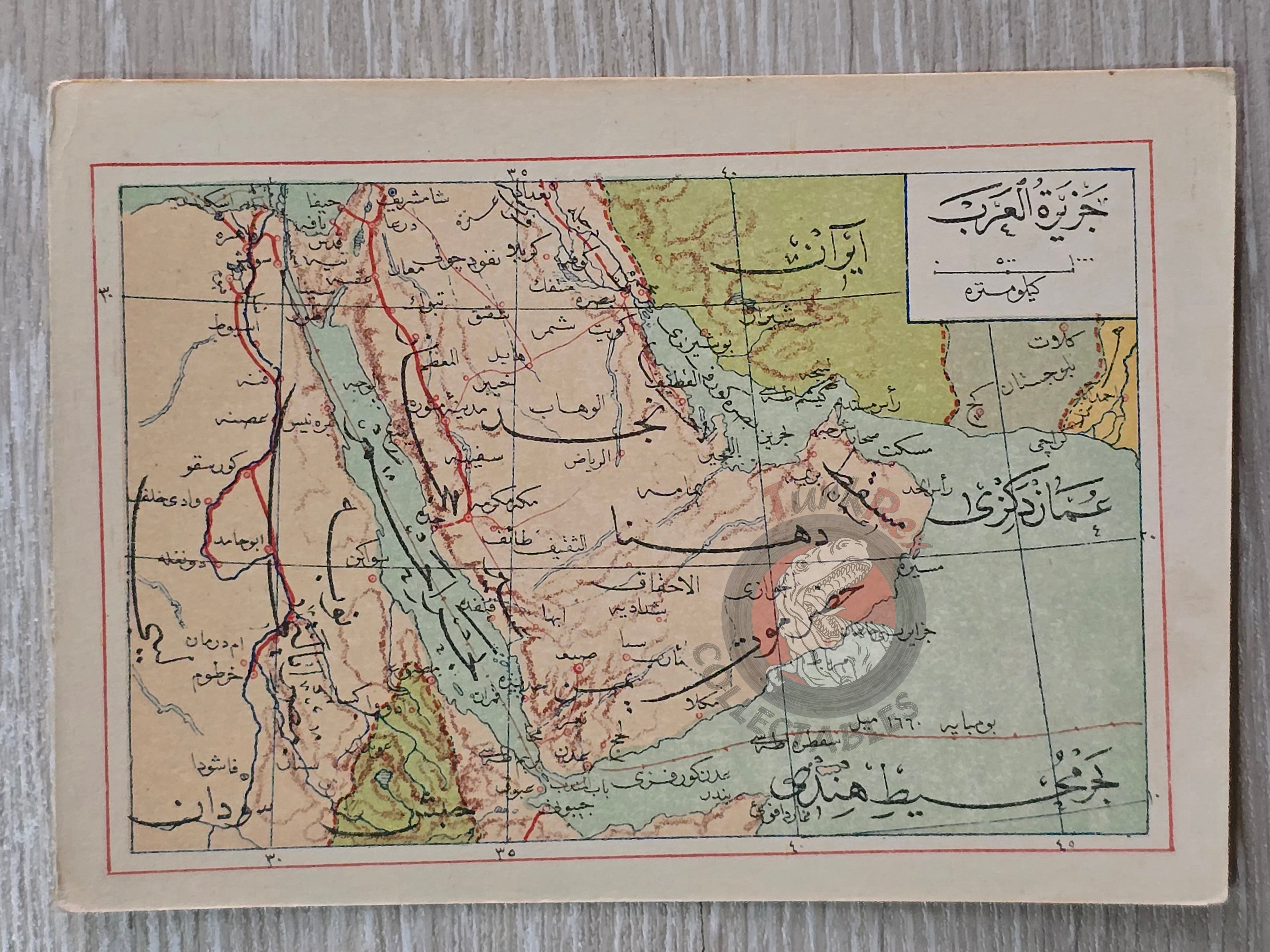
Description:
A rare Ottoman Turkish map of the Arabian Peninsula, published in Mehmed Eşref’s Umum-i Vilayet-i Şahane’yi Havi Küçük Atlas. This atlas, printed in 1325 AH (1907 CE), included a 32-page brochure in Ottoman script and 128 maps (some composed of two parts), printed on thick paper and loosely inserted after the text. Many of these maps represent the first and possibly only Ottoman depictions of these regions.
The map measures 14.5 × 10.3 cm and shows key geographic features, including the Hejaz Railway route. At the time, the region was under Ottoman control; today it encompasses Qatar, Saudi Arabia, Israel, Palestine, Jordan, Lebanon, Kuwait, Iraq, Yemen, Oman, the United Arab Emirates, Iran, and Egypt.
This map is an important example of early 20th-century Ottoman cartography and reflects the Empire’s geographic knowledge and educational practices.
Key Features:
-
Title/Subject: Arabian Peninsula
-
Format: Small atlas map
-
Dimensions: 14.5 × 10.3 cm
-
Publisher: Mehmed Eşref, Istanbul
-
Significance: Includes the Hejaz Railway; part of a rare Ottoman atlas with first-time regional maps