


Arabian Peninsula 1916 Ottoman Map Saudi Arabia Palestine Qatar Hejaz Railway Empire
Ottoman Turkish Educational Map – Arabian Peninsula (Coğrafya-yı Osmani, 1916)
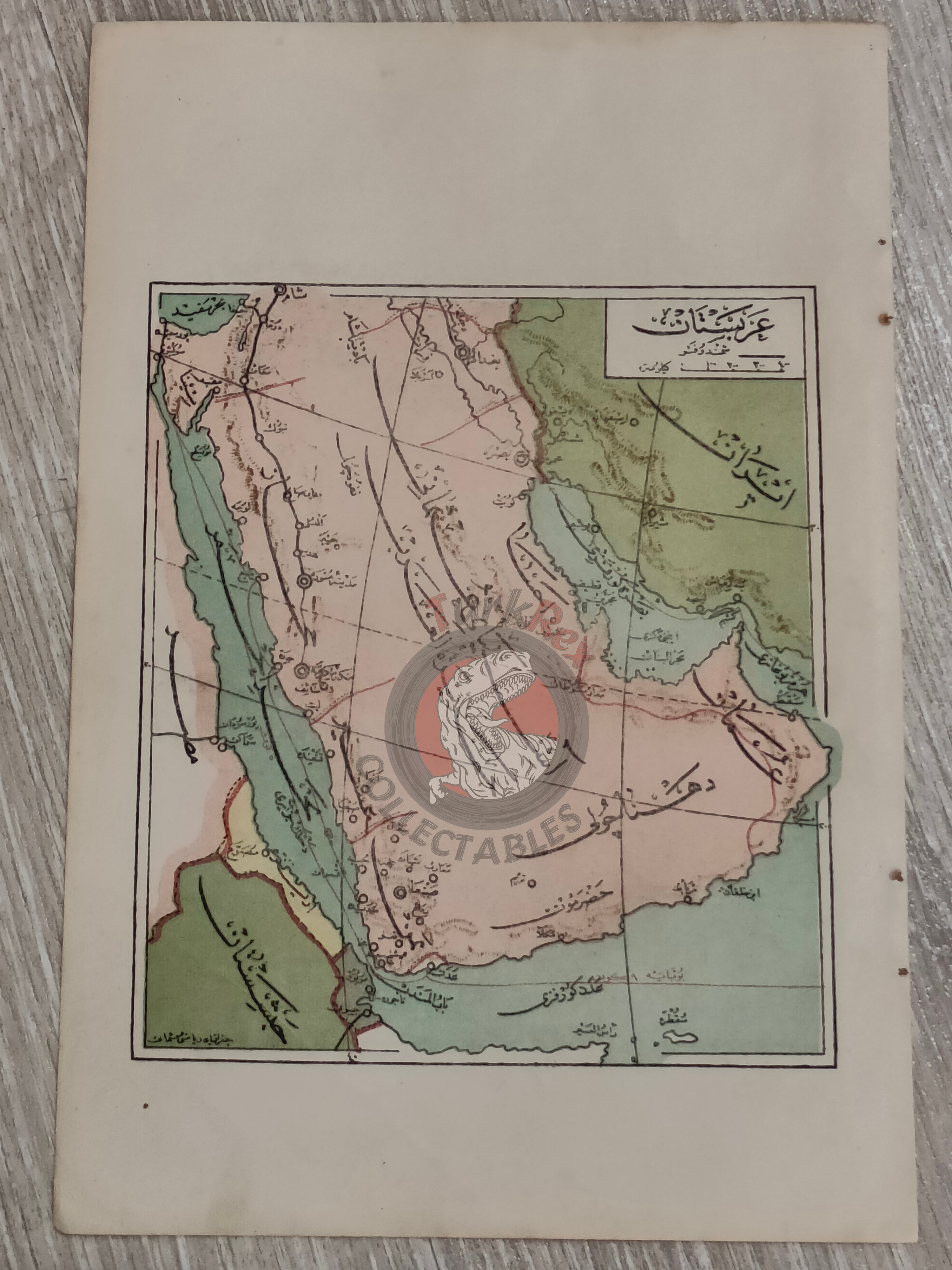
Description:
An Ottoman Turkish educational map of the Arabian Peninsula, published in Safvet Geylangil’s Coğrafya-yı Osmani. This schoolbook, intended for the first-year curriculum of the Mekâtib-i İbtidâiye Devre-i Âliye (higher elementary schools), was printed in 1332 AH (1916 CE).
The map measures 24.4 × 16.5 cm and was designed as a teaching aid, reflecting how geography was taught in late Ottoman schools. It features the route of the Hejaz Railway, a key symbol of Ottoman infrastructure and authority in the region.
Today, the territories shown on the map correspond to Qatar, Saudi Arabia, Israel, Palestine, Jordan, Lebanon, Kuwait, Iraq, Yemen, Oman, the United Arab Emirates, Egypt, and Iran.
This map stands as an important example of educational cartography in the late Ottoman Empire, illustrating not only the geography of the Arabian Peninsula but also the empire’s effort to integrate modern infrastructure into school curricula.
Key Features:
-
Title/Subject: Arabian Peninsula (educational map)
-
Author: Safvet Geylangil
-
Source: Coğrafya-yı Osmani (schoolbook for elementary education)
-
Date: 1332 AH / 1916 CE
-
Dimensions: 24.4 × 16.5 cm
-
Content: Arabian Peninsula with the Hejaz Railway
-
Significance: Educational map used in Ottoman schools; combines geography with contemporary infrastructure