


Arabian Peninsula 1922 Ottoman Map Saudi Arabia Palestine Qatar Empire Islam History
Ottoman Turkish Map – Arabian Peninsula (İslam Tarihi, 1922)
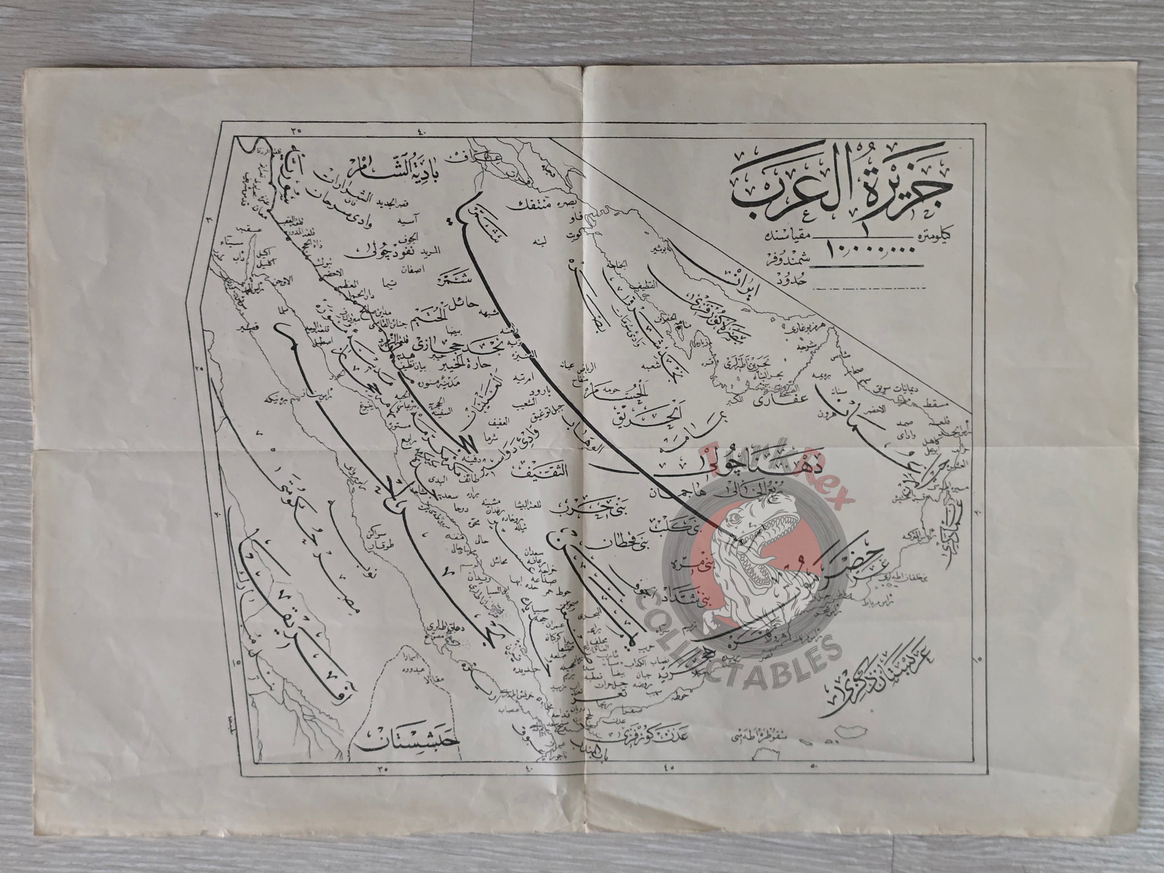
Description:
A large Ottoman Turkish map of the Arabian Peninsula, published in Şemsettin Günaltay’s İslam Tarihi. The book was printed in 1338 AH (1922 CE) in Istanbul by the Tedkikat ve Telifat-ı İslamiyye Heyeti (Islamic Research and Publications Committee).
The map measures 41.2 × 28.5 cm, making it a relatively large-format example compared to contemporary Ottoman atlas maps. It was intended as an illustrative supplement to Günaltay’s monumental historical work, which sought to provide a comprehensive account of Islamic history.
Geographically, the map depicts the Arabian Peninsula, a region that today corresponds to Qatar, Saudi Arabia, Israel, Palestine, Jordan, Lebanon, Kuwait, Iraq, Yemen, Oman, the United Arab Emirates, and Egypt.
This piece is a rare survival of Ottoman scholarly cartography from the final years of the Empire, combining historical narrative with geographic visualization.
Key Features:
-
Title/Subject: Arabian Peninsula
-
Author: Şemsettin Günaltay
-
Source: İslam Tarihi
-
Publisher: Tedkikat ve Telifat-ı İslamiyye Heyeti, Istanbul
-
Date: 1338 AH / 1922 CE
-
Dimensions: 41.2 × 28.5 cm
-
Content: Arabian Peninsula during late Ottoman period