


Arabian Peninsula with Suez Canal Inset Ottoman Atlas Map Saudi Arabia Palestine Hejaz Railway Empire
Ottoman Turkish Map - Arabian Peninsula with Suez Canal Inset
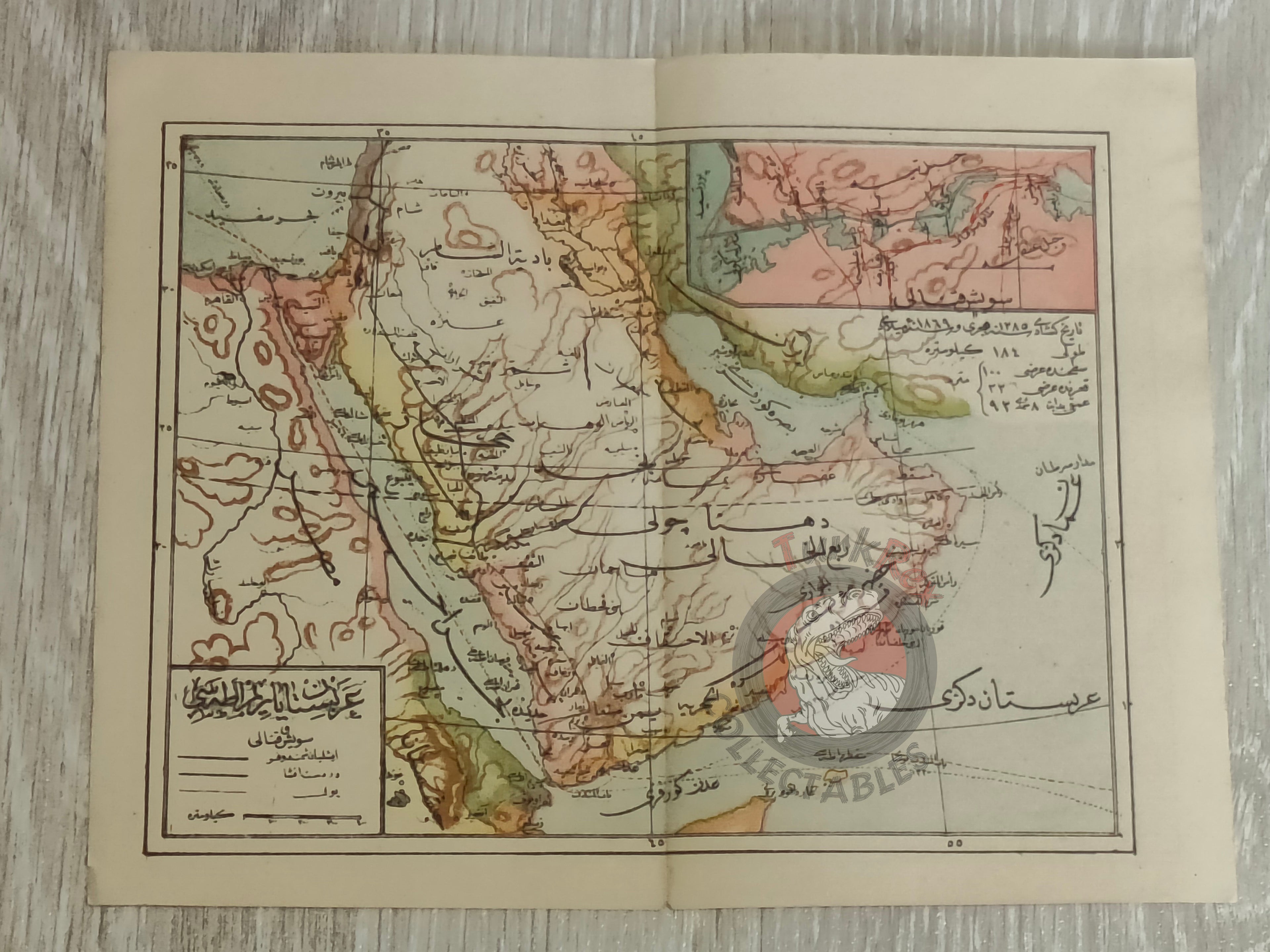
Description:
An Ottoman Turkish map of the Arabian Peninsula measures 22.3 × 17.6 cm and provides a detailed representation of the Arabian Peninsula during the late Ottoman period. It prominently features the route of the Hejaz Railway, a vital line connecting the empire’s Arab provinces with the capital. A distinctive feature is the inset map of the Suez Canal (upper right corner), underlining its strategic importance at the time.
In modern terms, the territories shown now encompass Qatar, Saudi Arabia, Israel, Palestine, Jordan, Lebanon, Kuwait, Iraq, Yemen, Oman, the United Arab Emirates, and Egypt. This map is a fine example of early 20th-century Ottoman cartography, combining both regional geography and key infrastructural details.
Key Features:
-
Title/Subject: Arabian Peninsula with Suez Canal inset
-
Source: Early 20th century (exact source unidentified)
-
Dimensions: 22.3 × 17.6 cm
-
Content: Arabian Peninsula; includes Hejaz Railway route and inset of the Suez Canal
-
Significance: A rare Ottoman atlas map reflecting geopolitical and infrastructural priorities of the late empire