


Asia and Africa 1928 Ottoman Atlas Map Faik Sabri Saudi Arabia Middle East Palestine
Ottoman Turkish Map of Asia and Africa – from Orta Atlas by Faik Sabri Duran (1928)
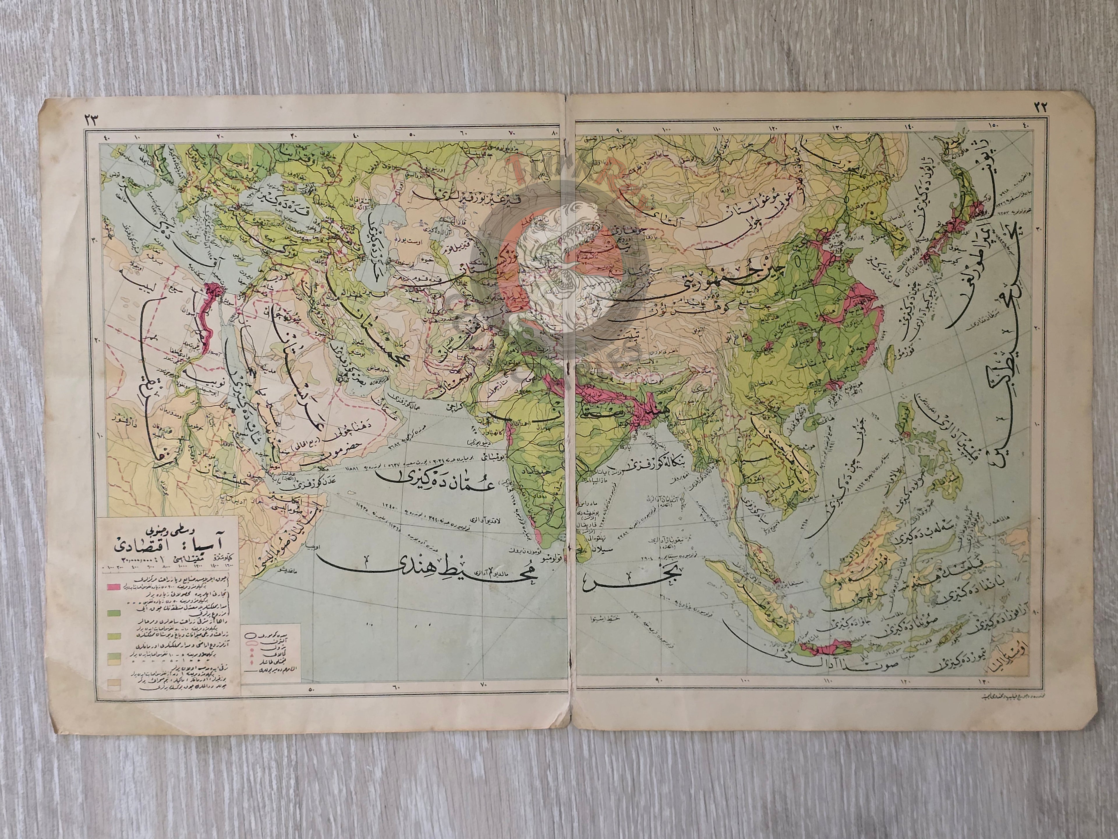
Description:
A double-sided Ottoman Turkish map, with Asia on one side and Africa on the other, measuring 45.3 × 27.7 cm, from Faik Sabri Duran’s “Orta Atlas” (Middle Atlas), published in Istanbul, 1928 by Kanaat Kütüphanesi.
Although printed during the Republican period, the atlas was still published in Arabic script (Ottoman alphabet), as it preceded the Alphabet Reform of November 1, 1928, which officially replaced Ottoman Turkish script with the Latin alphabet. This makes the atlas historically significant as one of the last Turkish educational publications in Ottoman script.
The Asia map is titled “Vasati (Middle) ve Cenubi (Southern) Asya İktisadi Haritası” and shows Asia, the Arabian Peninsula, part of Europe, and North Africa, with an emphasis on economic geography.
The Africa map is titled “Tabiî ve Siyasi Harita” (Physical and Political Map), presenting the African continent in full.
Together, they reflect the scope of geographic education in early Republican Turkey, bridging Ottoman scholarly traditions with modern cartographic standards.
The author, Faik Sabri Duran (1882–1943), was a pioneering Turkish geographer, writer, and educator. Educated at the Sorbonne (1912), he later introduced modern geography instruction at Istanbul Darülfünun. Decorated with ten medals by Sultan Abdülhamid II for his achievements, Duran became synonymous with geography education in Turkey. His atlases and textbooks, including the Orta Atlas, were widely used in schools and remain landmarks in the history of Turkish cartography.
Key Features:
-
Title/Subject: Asia (economic map) and Africa (physical & political map)
-
Publication Date: 1928 (pre-Alphabet Reform)
-
Atlas: Orta Atlas (Middle Atlas)
-
Author/Editor: Faik Sabri Duran (1882–1943)
-
Publisher: Kanaat Kütüphanesi, Istanbul
-
Language: Ottoman Turkish (Arabic script)
-
Dimensions: 45.3 × 27.7 cm
-
Coverage (Asia Map): Vasati ve Cenubi Asya İktisadi Haritası – Asia, Arabian Peninsula, part of Europe, North Africa. Saudi Arabia, Iran, Palestine, Israel, Iraq, Jordan etc.
-
Coverage (Africa Map): Tabiî ve Siyasi Harita – Entire African continent, Egypt, Congo, South Africa etc.
-
Significance: A transitional educational map, produced in the early Turkish Republic but printed in Ottoman script, marking the final stage of Ottoman-era cartographic tradition before the Latin alphabet reform.