


Asia Political & Europe Thematic Map 1928 Ottoman Atlas Faik Sabri Saudi Arabia Middle East Palestine
Ottoman Turkish Political Map of Asia and Thematic Maps of Europe & Asia – from Orta Atlas by Faik Sabri Duran (1928)
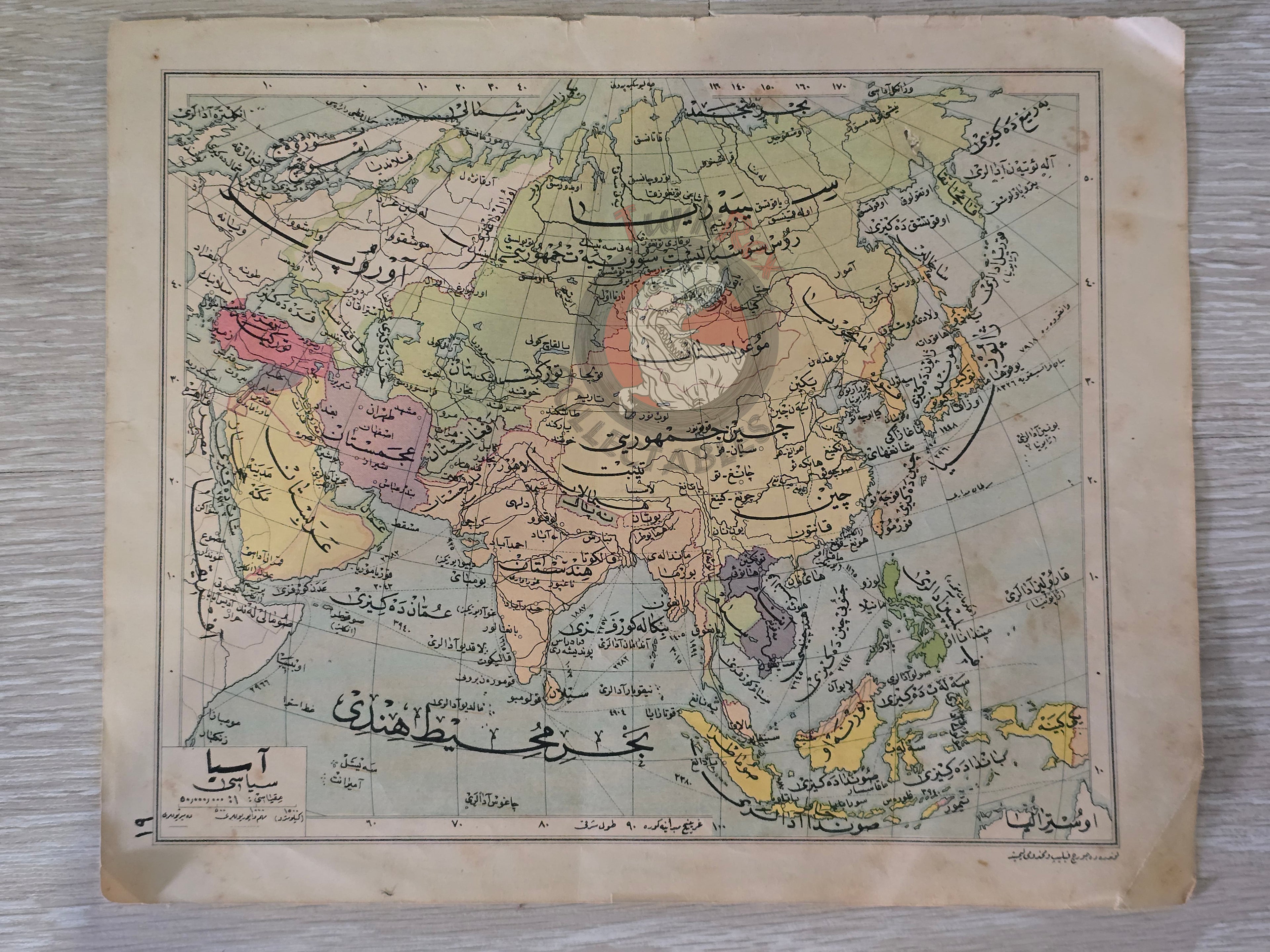
Description:
A double-sided Ottoman Turkish map, measuring 27.6 × 22.6 cm, from Faik Sabri Duran’s “Orta Atlas” (Middle Atlas), published in Istanbul, 1928 by Kanaat Kütüphanesi.
Although printed in the early Republican period, the atlas was still issued in Arabic script (Ottoman alphabet), as it preceded the Alphabet Reform of November 1, 1928, which replaced Ottoman script with the Latin alphabet. This makes the work historically significant as one of the last major educational atlases published in Ottoman script.
On one side, the map presents the Political Map of Asia (Asya Siyasi Haritası), covering the entire Asian continent, the Arabian Peninsula, as well as parts of Europe and North Africa.
On the other side, there are four separate thematic maps of Europe and Asia:
-
Temperature Map of Europe and Asia in Kanun-i Sani Month
-
Temperature Map of Europe and Asia
-
Summer Rainfall, Atmospheric Pressure, and Wind Map of Europe and Asia
-
Winter Rainfall, Atmospheric Pressure, and Wind Map of Europe and Asia
Together, these maps illustrate both political divisions and physical-climatic conditions, reflecting the growing emphasis on modern scientific geography in Turkish education during the 1920s.
The author, Faik Sabri Duran (1882–1943), was a pioneering Turkish geographer, writer, and educator. He studied at the Sorbonne (1912) and later introduced modern geography instruction at Istanbul Darülfünun. Decorated with ten medals by Sultan Abdülhamid II, Duran became synonymous with geography education in Turkey. His atlases and textbooks, including the Orta Atlas, were widely used in schools and are considered landmarks in the history of Turkish cartography.
Key Features:
-
Title/Subject: Asia Political Map; Europe & Asia thematic maps (temperature, rainfall, pressure, winds)
-
Publication Date: 1928 (pre-Alphabet Reform)
-
Atlas: Orta Atlas (Middle Atlas)
-
Author/Editor: Faik Sabri Duran (1882–1943)
-
Publisher: Kanaat Kütüphanesi, Istanbul
-
Language: Ottoman Turkish (Arabic script)
-
Dimensions: 27.6 × 22.6 cm
-
Coverage (Asia Political Map): Entire Asia, Arabian Peninsula, parts of Europe and North Africa
-
Coverage (Thematic Maps): Temperature distribution, summer & winter rainfall, atmospheric pressure, and wind patterns in Europe and Asia
-
Significance: A rare double-sided Ottoman script atlas map combining political and climatic data, published just before the Alphabet Reform, making it a transitional artifact of Turkish educational and cartographic history.