


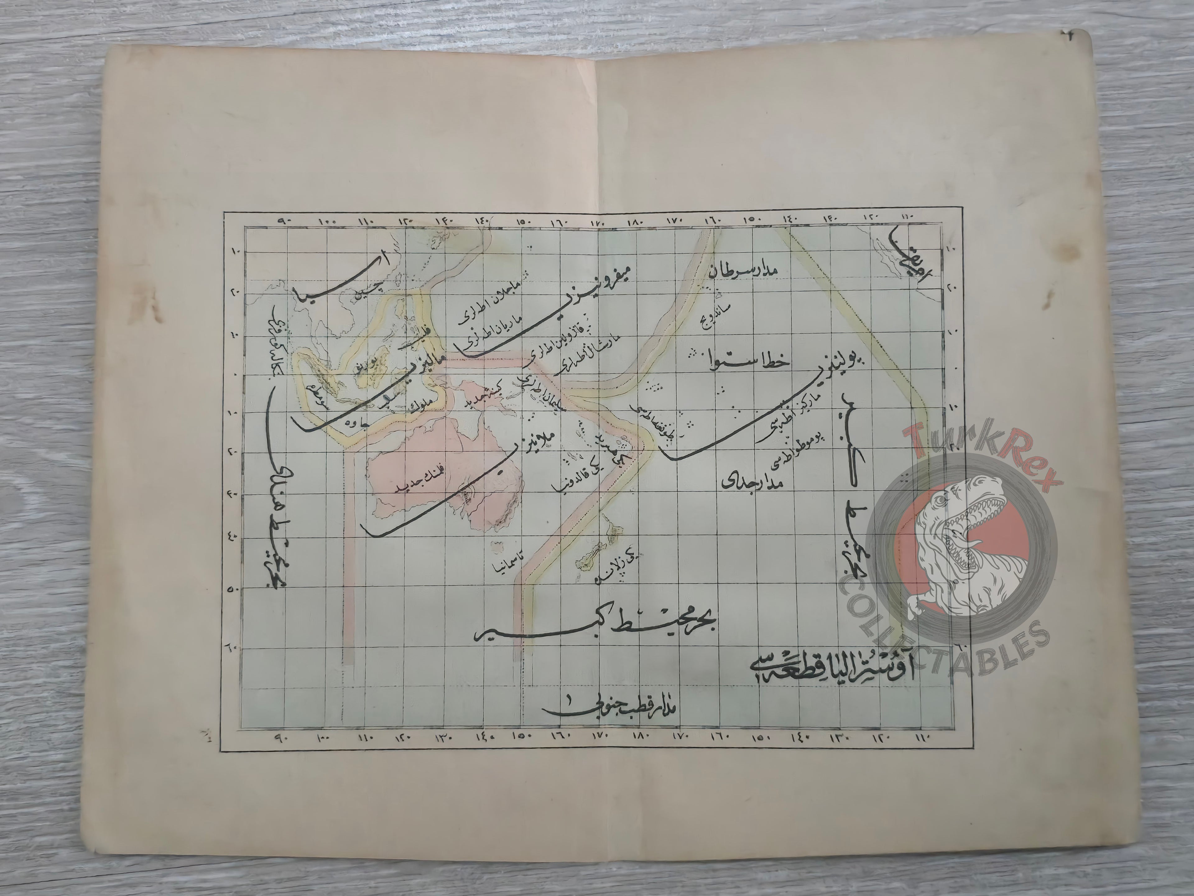


Australia Oceania 1876 Ottoman Atlas Map Ottoman Empire Indonesia New Zealand
Ottoman Map of Australia & Oceania, 1293 AH (1876)
Description:
This rare Ottoman-era map, dated 1293 AH (1876), illustrates Australia and Oceania and comes from Muhtasar Coğrafya Risalesi written by Selim Sabit. Intended for use in sıbyan mektepleri (Ottoman primary schools), the map serves as a remarkable example of educational cartography in the late 19th century Ottoman Empire. Rendered entirely in Ottoman Turkish script, it captures the geographic understanding of the period and reflects the Empire’s dedication to modernizing education through printed materials. It is both a valuable historical document and a fascinating piece for collectors of antique maps and Ottoman educational history.
Key Features:
-
Date: 1293 AH (1876)
-
Author: Selim Sabit
-
Source: Muhtasar Coğrafya Risalesi
-
Purpose: Prepared for sıbyan mektepleri (Ottoman primary schools)
-
Language: Ottoman Turkish
-
Depicts: Australia & Oceania region
-
Dimensions: 23.2 x 18.2 cm
-
Rare example of Ottoman educational cartography