


Austria Hungary Empire 1907 Ottoman Atlas Map Ottoman Empire Mehmed Eşref
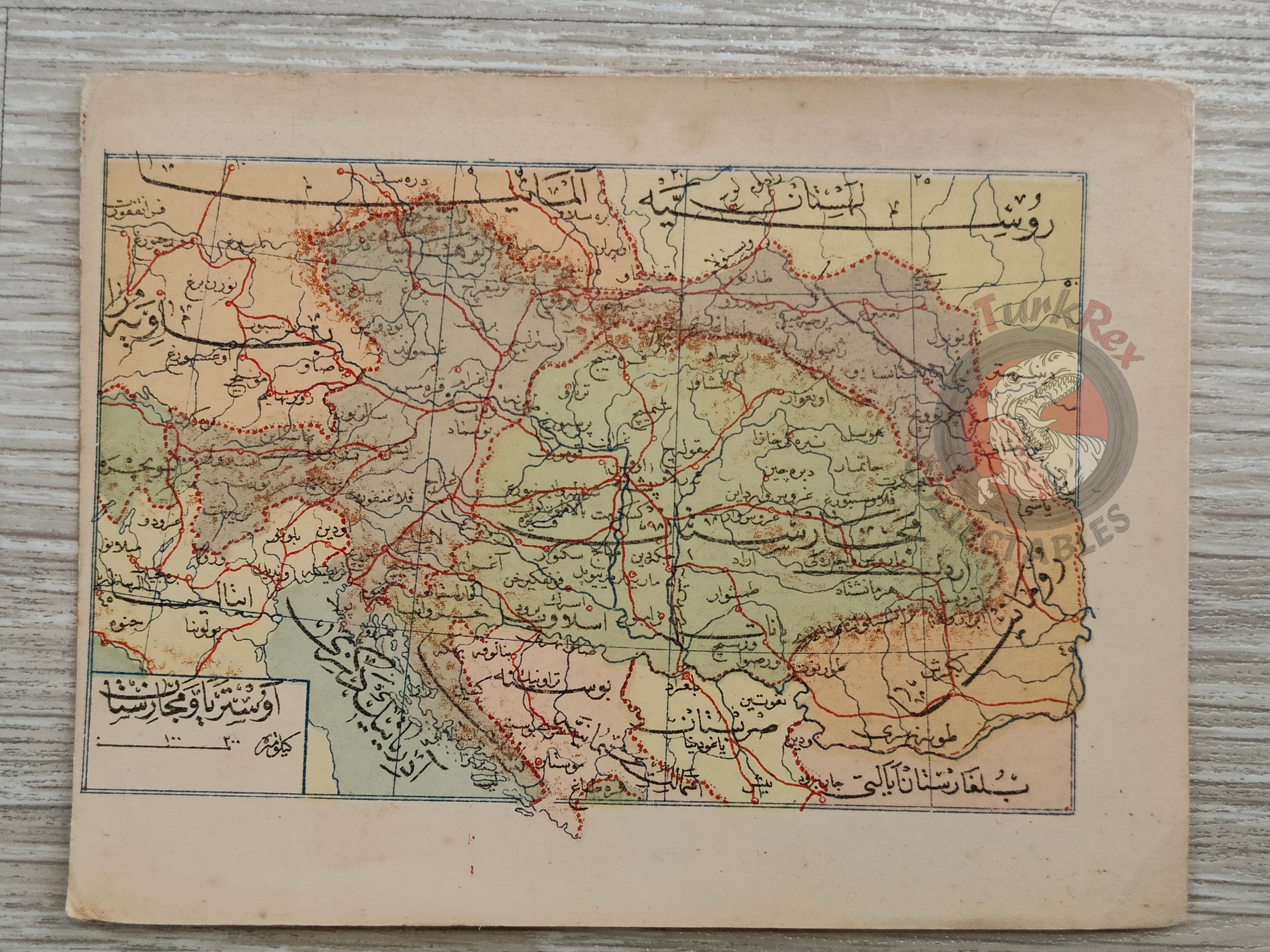
Austria-Hungary Map 1907, from Umum-i Vilayet-i Şahane’yi Havi Küçük Atlas by Mehmed Eşref
Description:
This is an Ottoman Turkish map of Austria-Hungary published in 1907. It was published in the Umum-i Vilayet-i Şahane’yi Havi Küçük Atlas, authored by Mehmed Eşref. This rare atlas included a 32-page brochure in Ottoman script and 128 maps (some composed of two parts), printed on thick paper and loosely inserted after the text. Many of the maps of certain areas worldwide are the first and possibly only Ottoman maps of those regions. The work was designed as an educational and reference atlas, offering detailed geographical knowledge to Ottoman readers at the dawn of the 20th century.
Compact in size, this map reflects the geopolitical understanding of the Austro-Hungarian Empire within the Ottoman world, a significant era when empires were interacting and competing on the European stage. Its preservation provides valuable insight into Ottoman cartography, geography education, and the perception of foreign powers in the late imperial period.
Key Features:
-
Title: Austria-Hungary Map
-
Source: Umum-i Vilayet-i Şahane’yi Havi Küçük Atlas
-
Author: Mehmed Eşref
-
Publication Year: 1907
-
Language: Ottoman Turkish
-
Dimensions: 14.1 × 10.9 cm
-
Historical Context: Represents the Austro-Hungarian Empire as seen from an Ottoman perspective
-
Educational Significance: Part of an atlas aimed at geographical instruction in the Ottoman Empire