


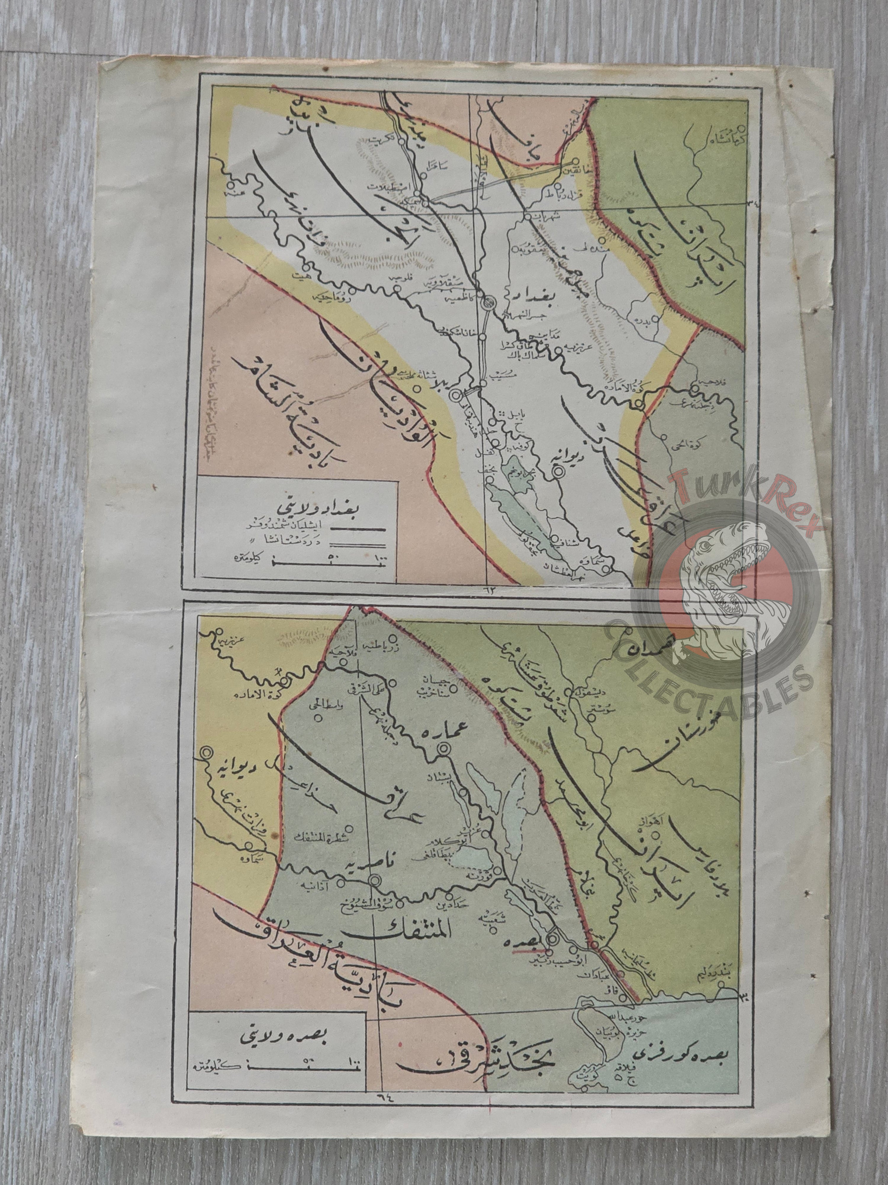


Baghdad and Basra Vilayet 1916 Ottoman Map Iraq Kuwait Iran Middle East Saudi Arabia
Baghdad and Basra Vilayet Map 1332 Rumi (1916), from Coğrafya-i Osmani by Safvet Geylangil
Description:
This is an Ottoman Turkish map of the Baghdad and Basra Vilayets, published in 1332 Rumi (1916), taken from Safvet Geylangil’s Coğrafya-i Osmani. The map was part of a comprehensive geographical work intended to educate Ottoman readers about the provinces and administrative divisions of the empire.
Featuring clear delineation of territorial boundaries and key cities, this map offers a valuable perspective on Ottoman cartography and regional understanding during the late imperial period, just prior to the end of World War I. It serves both as a historical document and as an educational tool illustrating the Ottoman approach to geography.
Key Features:
-
Title: Baghdad and Basra Vilayet Map
-
Source: Coğrafya-i Osmani
-
Author: Safvet Geylangil
-
Publication Year: 1332 Rumi (1916)
-
Language: Ottoman Turkish
-
Dimensions: 22 × 15.4 cm
-
Historical Context: Ottoman understanding of the Baghdad and Basra provinces during World War I era
-
Educational Significance: Part of a textbook intended for geography instruction in the late Ottoman Empire