


Bahr-i Ahmer Red Sea and Basra Region Ottoman Distance Chart Middle East Qatar Egypt Kuwait
Bahr-i Ahmer and Basra Region Distance Chart Late 19th Century Ottoman Turkish
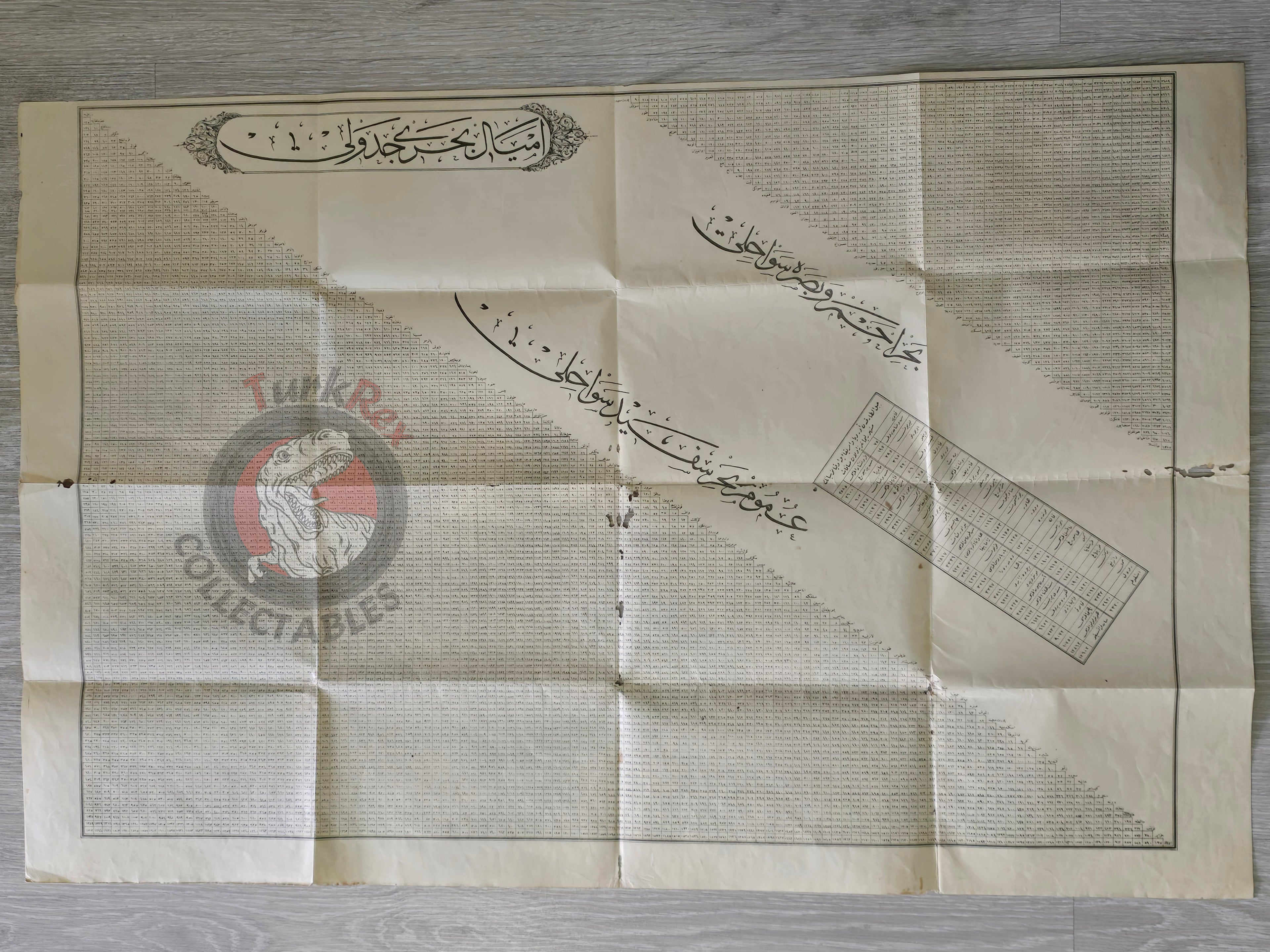
Description:
This is a large Ottoman Turkish distance chart of the Bahr-i Ahmer (Red Sea) and Basra region, likely dating from the late 19th century, though the exact year is not specified. The chart provides a highly detailed table of distances between cities within the region, reflecting the Ottoman Empire’s practical interest in navigation, trade, and administration.
In the central section, the chart also lists distances from Jebel Tarik (Gibraltar) to major European and American ports, such as Lisbon (290 km) and Boston (3084 km), offering a global perspective on maritime connections of the period. This combination of local and international distance data makes the chart both a practical tool and a historical document illustrating Ottoman cartographic precision.
Key Features:
-
Title: Bahr-i Ahmer and Basra Region Distance Chart
-
Language: Ottoman Turkish
-
Estimated Date: Late 19th century
-
Dimensions: 60 × 90 cm
-
Content:
-
Detailed distance table between cities in the Red Sea and Basra regions
-
Distances from Jebel Tarik to major global ports
-
-
Condition: Small tears present
-
Historical Significance: Reflects Ottoman geographic knowledge and maritime interest, useful for scholars studying trade, navigation, and regional administration