


Beirut Vilayet Lebanon Ottoman Postcard Map Middle East Ibrahim Hilmi Military Israel
Beyrut Vilayeti Haritası - Postcard, circa 1910
Description:
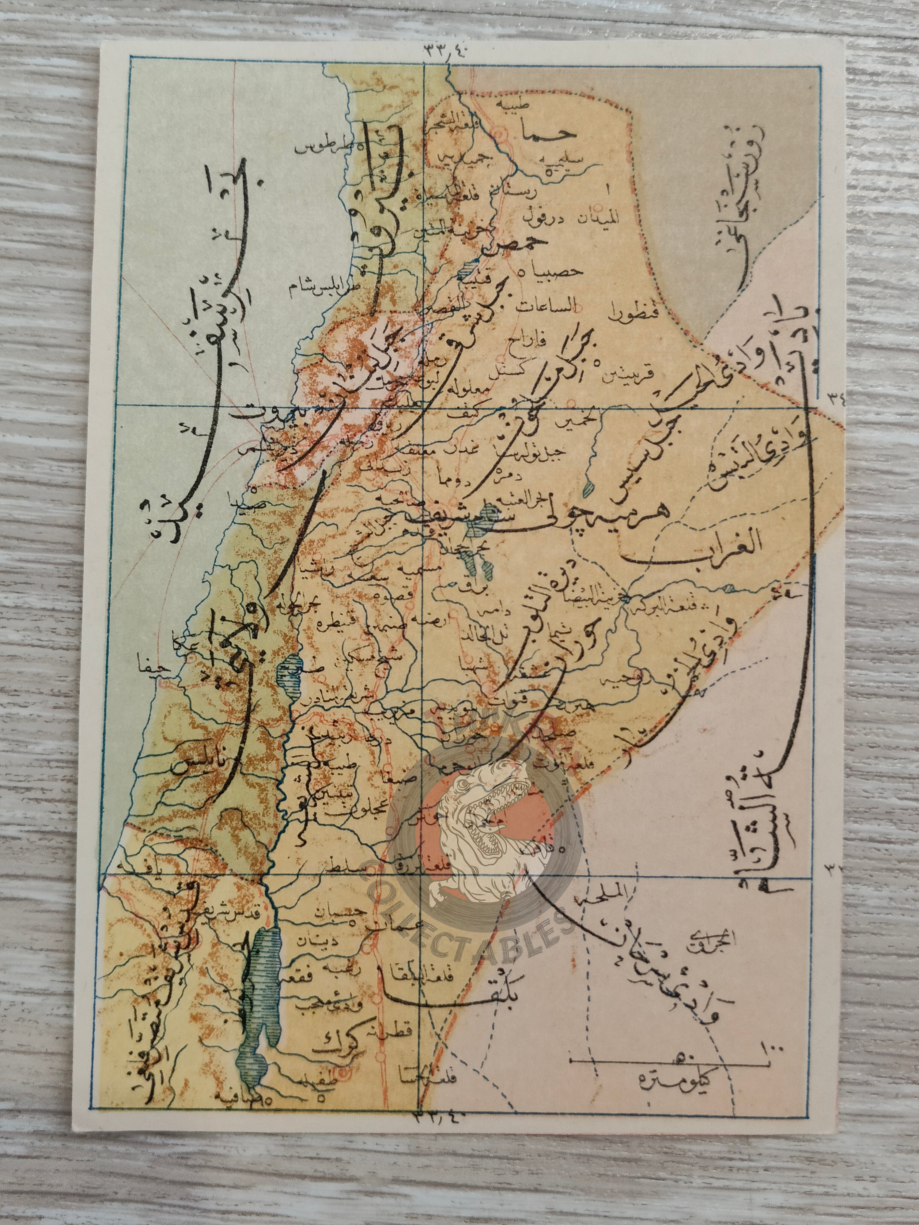
This is a rare Ottoman-era postcard map depicting the Vilayet of Beirut, dating to around 1910. Measuring 13 x 9 cm, it was published in Istanbul by Tüccarzade İbrahim Hilmi’s Military Press (Kitaphane-yi Askeri) as part of a historical postcard series.
İbrahim Hilmi was a notable Ottoman publisher and intellectual who contributed significantly to the popularization of geography, history, and educational materials in the late 19th and early 20th centuries. His press produced a wide range of works, from atlases and maps to political writings, often with the aim of spreading knowledge to a broad readership.
This postcard is an excellent example of how the Ottoman public engaged with geographical knowledge at the time, making it a fascinating piece of both cartographic and publishing history.
Key Features:
-
Title: Beyrut Vilayeti (Vilayet of Beirut)
-
Format: Cartographic postcard
-
Publisher: Tüccarzade İbrahim Hilmi, Kitaphane-yi Askeri (Military Press, Istanbul)
-
Date: circa 1910
-
Size: 13 x 9 cm
-
Language: Ottoman Turkish
-
Historical Context: Produced during a period when postcards were both a communication medium and a tool for spreading knowledge.
-
Collectibility: Valuable for collectors of Ottoman cartography, postcards, and publishing history