


Central and South Africa 1894 Ottoman Atlas Map Empire Congo Madagascar
Ottoman Turkish Map of Central and South Africa – from Yeni Coğrafya Atlasi (1894)
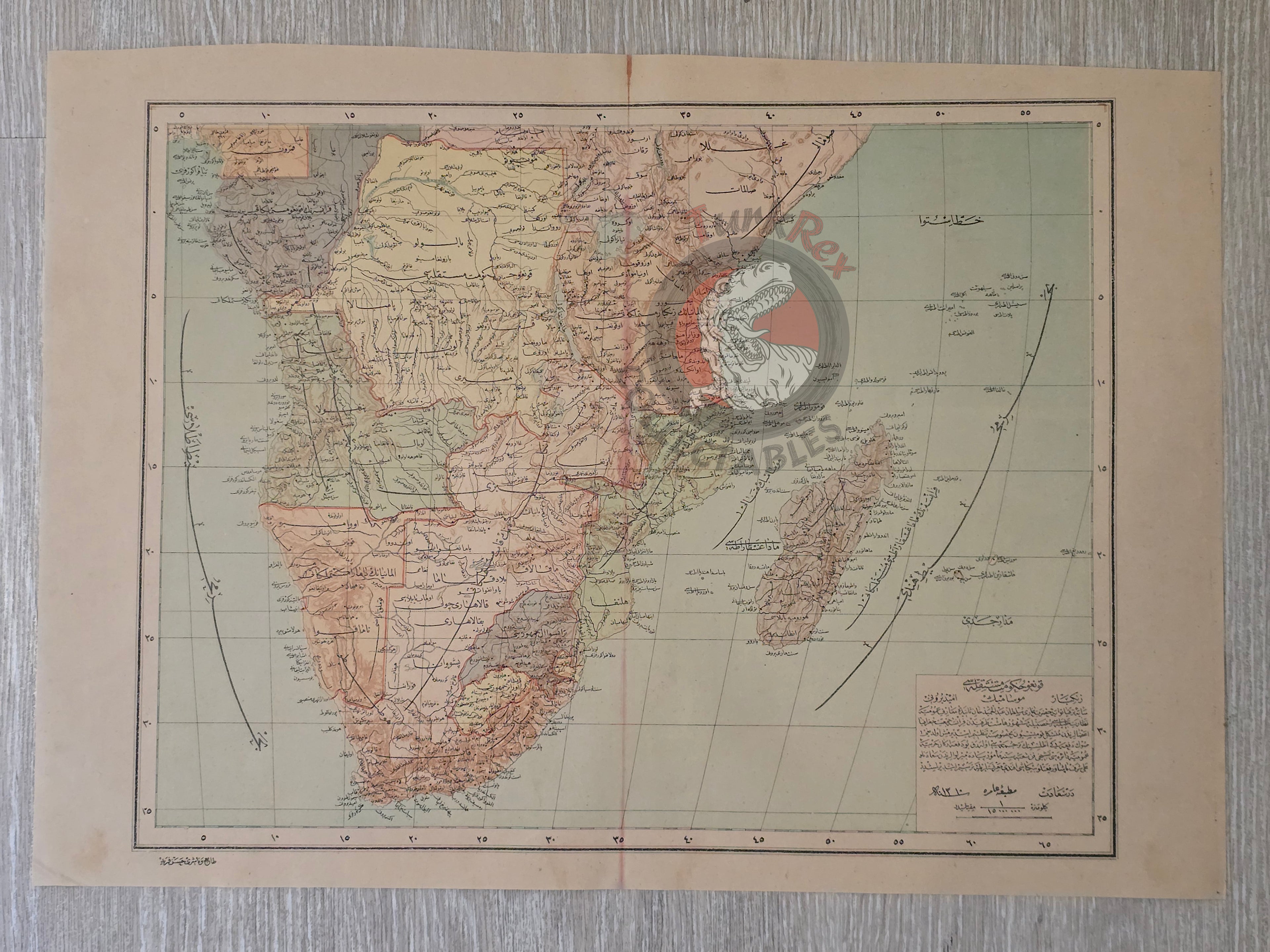
Description:
A large Ottoman Turkish map of Central and South Africa, measuring 51.1 × 36.1 cm, published in 1310 AH (1894 CE). The map is part of the “Yeni Coğrafya Atlasi” (New Geographical Atlas), edited by Ali Şeref Paşa and Hafız Ali Eşref, printed by Hasan Ferid at the Matbaa-i Âmire in Istanbul.
This sheet depicts regions including the Congo, Zanzibar, Mozambique, and southern Africa, created during the height of the Scramble for Africa following the Berlin Conference of 1884–1885. It reflects the late 19th-century Ottoman perspective on imperial rivalries and colonial claims in Africa.
Today, the area shown on the map corresponds to South Africa, Mozambique, Namibia, Zimbabwe, Tanzania, Democratic Republic of Congo, Angola, and Madagascar.
The Yeni Coğrafya Atlasi was a landmark late Ottoman publication, comprising 42 double-page lithographed color maps published between 1893–1898 (1309–1314 AH). It marked the Empire’s commitment to modern scientific cartography and global geographic awareness.
Ali Şeref Paşa, one of the editors, was a soldier trained as a cartographer in Paris, later serving as chief cartographer at Matbaa-i Âmire, the successor to İbrahim Müteferrika’s pioneering press founded in 1727. His European training shaped the accuracy and modern style of this atlas, making it a unique blend of Ottoman and European cartographic traditions.
Key Features:
-
Title/Subject: Central & South Africa
-
Publication Date: 1310 AH (1894 CE)
-
Atlas: Yeni Coğrafya Atlasi (New Geographical Atlas)
-
Editors: Ali Şeref Paşa & Hafız Ali Eşref
-
Printer: Hasan Ferid
-
Publisher: Matbaa-i Âmire, Istanbul
-
Dimensions: 51.1 × 36.1 cm
-
Content: Covers Congo, Zanzibar, Mozambique, and southern Africa
-
Modern Equivalents: South Africa, Mozambique, Namibia, Zimbabwe, Tanzania, DRC, Angola, Madagascar
-
Technique: Lithographed color map
-
Significance: A rare Ottoman atlas map documenting Africa during the Scramble for Africa, reflecting both imperial geopolitics and modernized Ottoman cartography