


China Ottoman Atlas Map Empire Asia
Ottoman Map - China (Çin Haritası), ca. Late Ottoman Period
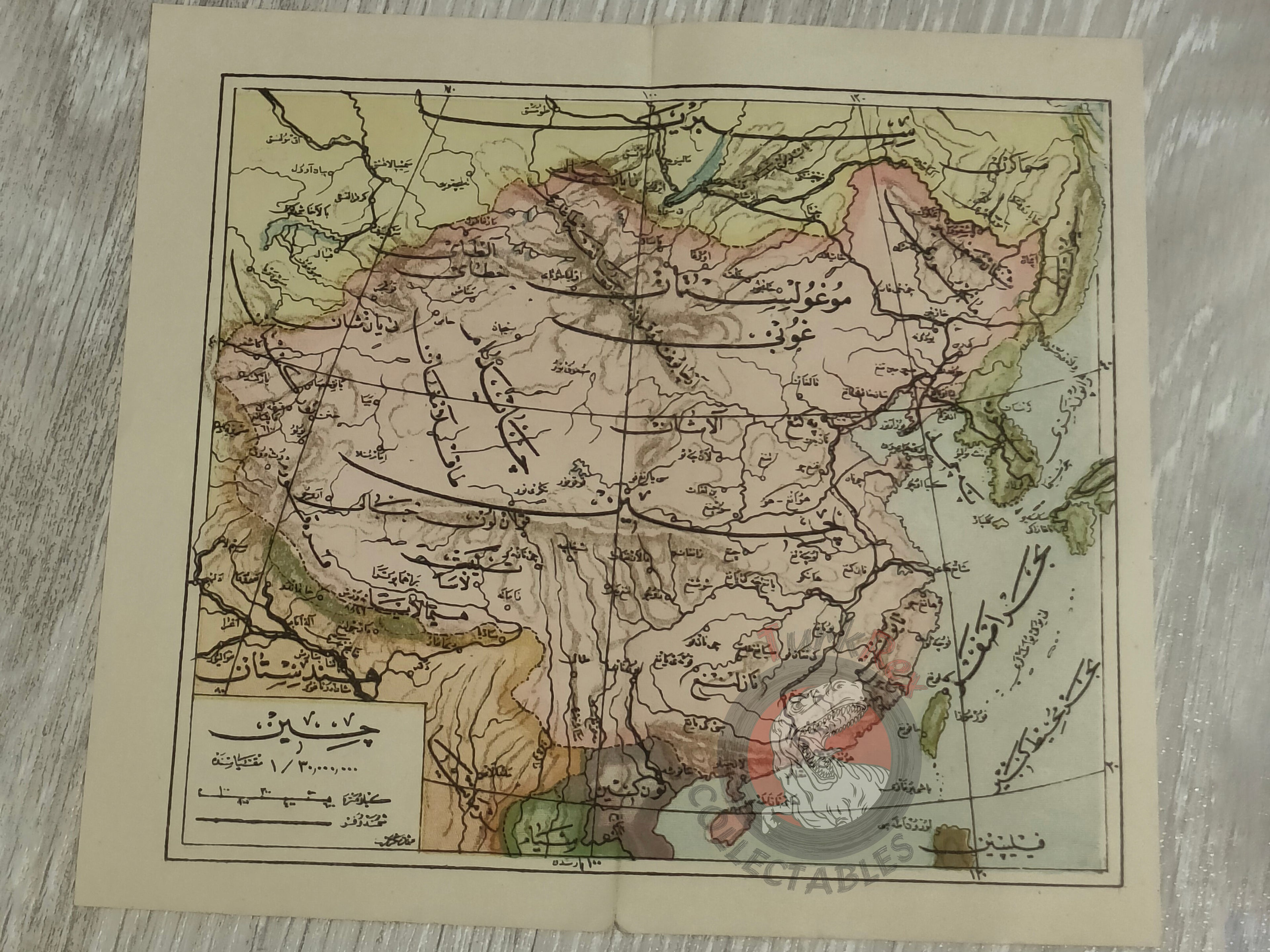
Description:
An Ottoman Turkish map of China, measuring 19.6 × 17.7 cm. The map is printed in Ottoman script (Arabic letters) and likely originates from an Ottoman-era atlas produced in the late 19th or early 20th century.
Although the exact publication date is not specified on the map, its style and printing suggest it was used for educational and geographic purposes during the final decades of the Ottoman Empire. Such maps were often included in school atlases to provide knowledge of distant regions like East Asia.
This piece represents not only geographic interest but also the Ottoman intellectual curiosity about the Far East, particularly China, at a time when global connections and world geography were gaining importance in education and statecraft.
Key Features:
-
Region: China
-
Size: 19.6 × 17.7 cm
-
Language: Ottoman Turkish (Arabic script)
-
Source: Likely from an Ottoman atlas (educational/geographic work)
-
Historical Context: Produced during the late Ottoman period (19th–early 20th century)
-
Condition: Good, with light fold marks consistent with atlas use