


Deployment of Bulgaria Serbia and Greece Ottoman Military Map Balkans pre WW1 Empire
Ottoman Military Map - Deployment of Bulgaria, Serbia, and Greece (c. Early 20th Century, pre-WWI)
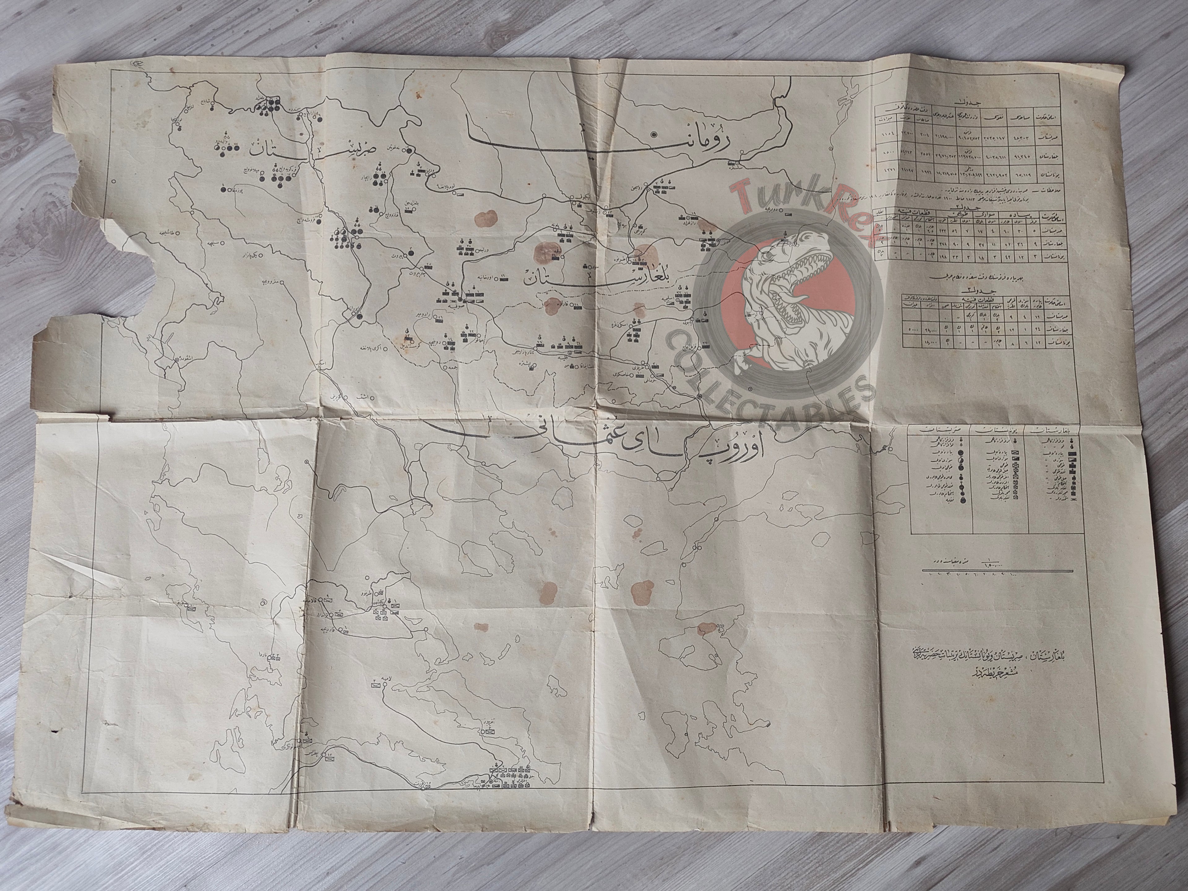
Description:
A large-format Ottoman Turkish military map, measuring 81.4 × 57 cm, titled “Bulgaristan, Sırbistan ve Yunanistan’ın Tertibat Haritası” (“Deployment Map of Bulgaria, Serbia, and Greece”).
This highly detailed educational military chart illustrates the troop deployments and organizational structures of the three Balkan states prior to the First World War. The map identifies infantry, cavalry, artillery regiments, and other military units, providing a rare visual record of regional military strength.
In the annotation section, notes state:
-
“The Greek corps, according to earlier regulations, consisted of 1,813 officers and 1,600 soldiers.”
-
“The above-mentioned forces are based on the 1904 regulations.”
These details confirm that the map was most likely prepared in the early 20th century, probably for use in Ottoman military schools as a teaching aid in the years preceding WWI.
Along the sides, accompanying tables present detailed statistics on the military forces of Bulgaria, Serbia, and Greece separately, giving breakdowns of their respective units.
Key Features:
-
Region: Bulgaria, Serbia, Greece (Balkan states)
-
Date/Context: Based on 1904 regulations, likely pre-WWI (early 20th century)
-
Format: Large military school wall chart
-
Dimensions: 81.4 × 57 cm
-
Content:
-
Troop deployments of infantry, cavalry, and artillery
-
Unit organization and regiment structures
-
Side tables with comparative details of each state’s military forces
-
Notations on Greek forces and 1904 regulatory basis
-
-
Condition: Tear in the upper left corner
-
Significance: An exceptionally rare Ottoman military map, offering detailed insight into Balkan armies on the eve of WWI. A superb resource for military historians and collectors of Ottoman war history.