


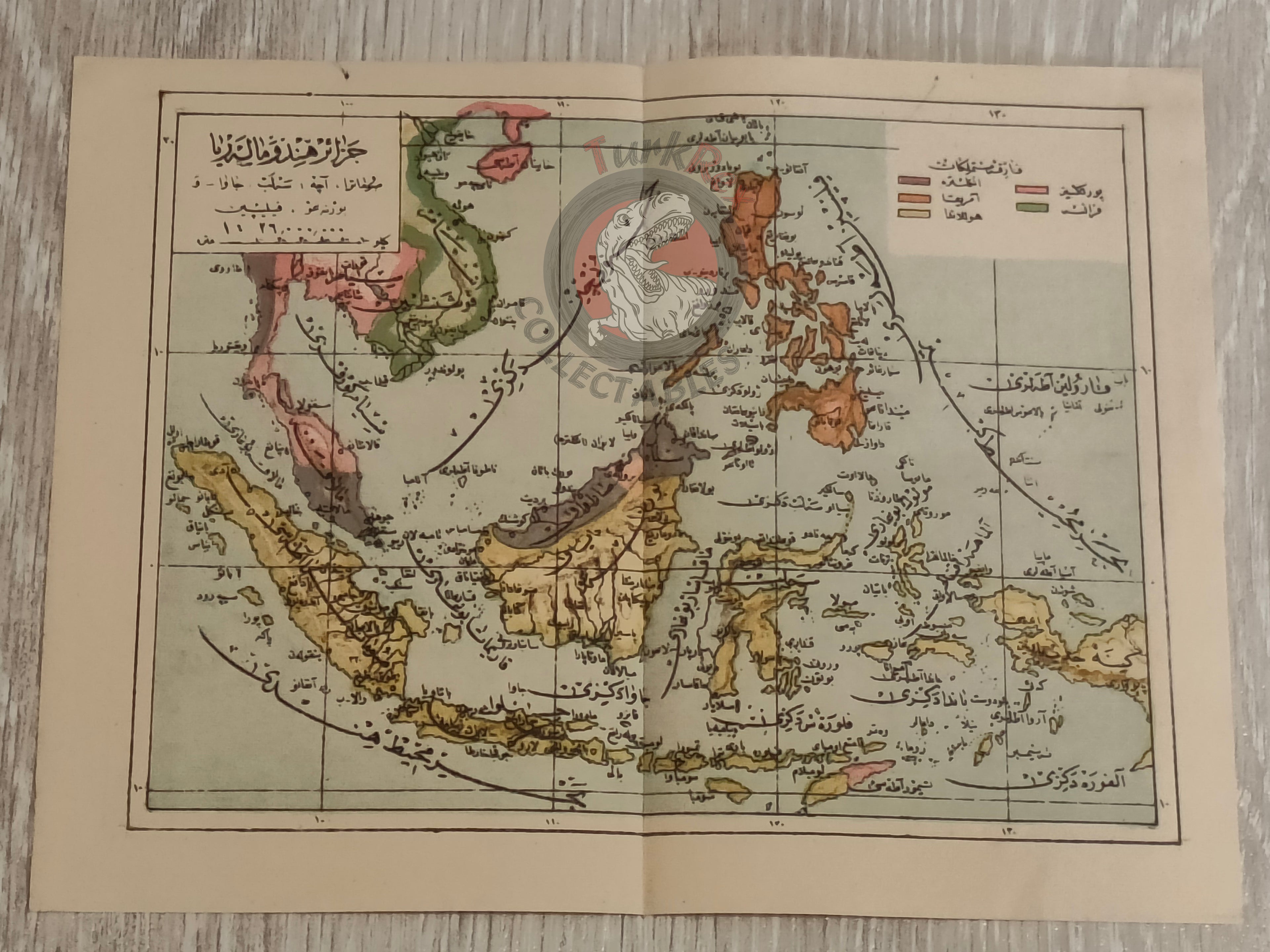


East Indies 1910s Ottoman Atlas Map Empire Indonesia Singapore Philippines
Ottoman Map of the East Indies Indonesia, Singapore, Malaysia, Philippines (c. 1910s)
Description:
A rare Ottoman Turkish map depicting the East Indies, covering Indonesia, Singapore, Malaysia, and the Philippines. Measuring 22 × 17 cm, this map likely originates from an atlas published in the 1910s, though the exact source remains unknown.
This finely detailed map offers a fascinating glimpse into how the Ottoman Empire visualized Southeast Asia in the early 20th century. Its geographic depictions reflect the cartographic conventions of the era and provide historical insight into Ottoman mapping practices beyond the empire’s borders.
A perfect addition for map collectors, historians, and enthusiasts of Ottoman cartography, this map exemplifies both the educational and geographic interests of the period.
Key Features:
- Region: East Indies (Indonesia, Singapore, Malaysia, Philippines)
- Dimensions: 22 × 17 cm
- Date: Likely 1910s
- Origin: Ottoman Turkish map; exact name of the atlas is unknown
- Condition: Preserved with typical minor signs of age
- Significance: Rare example of early 20th-century Ottoman cartography depicting Southeast Asia