


Eastern Anatolia & European Mountains Ottoman Empire Atlas Map Ibrahim Hilmi Iran Russia Palestine Lebanon
Ottoman Map - Eastern Anatolia & European Mountains, 1905
Description:
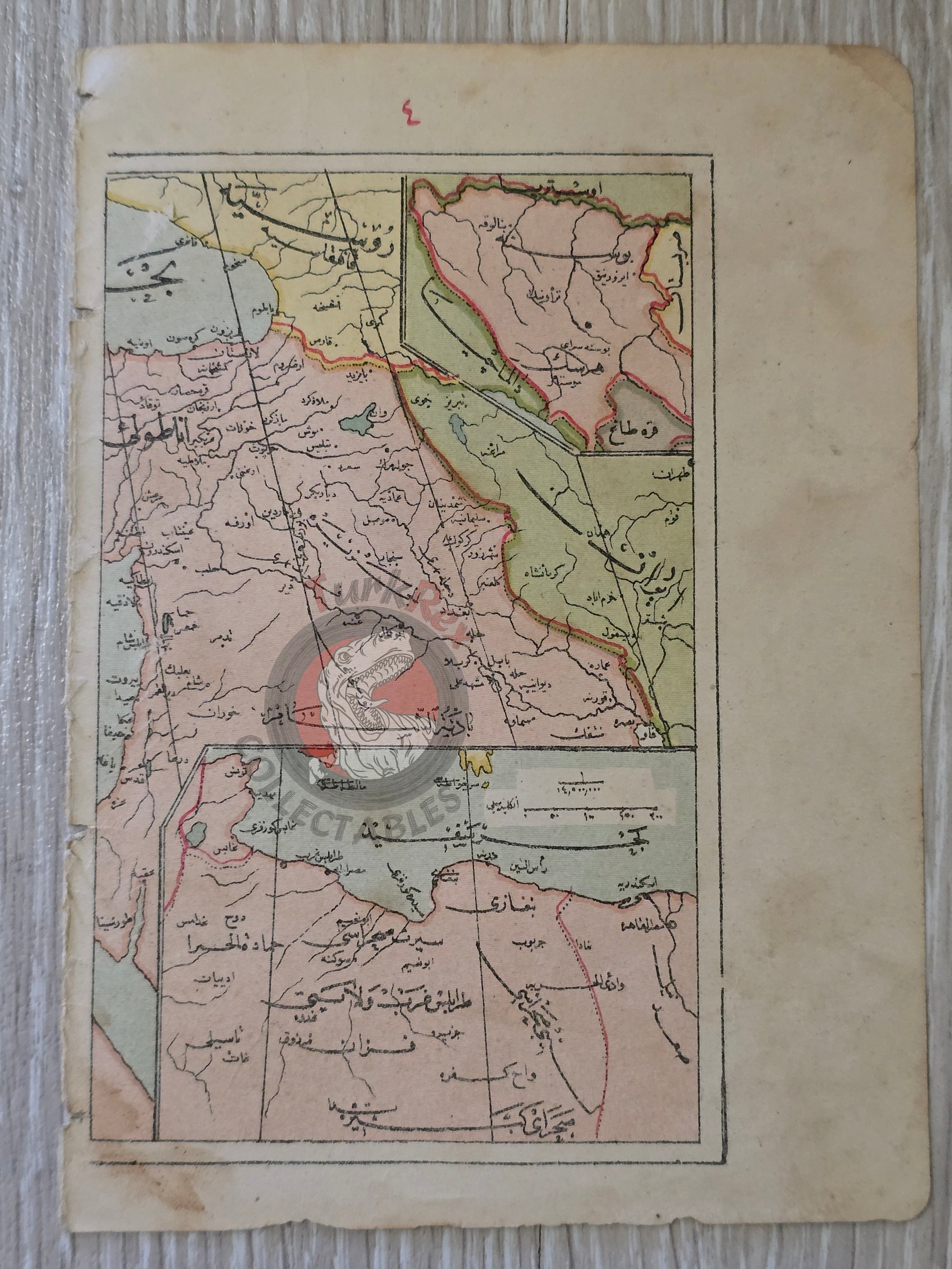
This original Ottoman map sheet, dated 1323 (1905), comes from the Memalik-i Osmâniyye Celp Atlası authored by Tüccarzade İbrahim Hilmi and published by Kitabhane-i İslâm ve Askerî in Istanbul.
The map is printed on a single sheet, double-sided, and reflects the late Ottoman approach to geography and education. One side illustrates Eastern Anatolia, including Ottoman territories, as well as neighboring Russia and Iran, while also extending southwards to depict Lebanon, Syria, and Palestine. The reverse side contains a detailed elevation chart of mountains in Ottoman Europe, including notable ranges such as the Rhodope (Rodop) Mountains and Mount Olympus (Olimpos), with their relative altitudes.
Its modest size of 16 × 11.5 cm makes it a portable yet richly detailed reference, reflecting the pedagogical and cartographic style of the late Ottoman Empire.
Key Features:
-
Date: 1323 (1905)
-
Source: Memalik-i Osmâniyye Celp Atlası
-
Author: Tüccarzade İbrahim Hilmi
-
Publisher: Kitabhane-i İslâm ve Askerî, Istanbul
-
Format: Single sheet, double-sided print
-
Side 1: Map of Eastern Anatolia, showing Ottoman territories, Russia, Iran; extends south to Lebanon, Syria, Palestine
-
Side 2: Elevation chart of Ottoman Europe’s mountains (e.g., Rhodope, Mount Olympus)
-
Dimensions: 16 × 11.5 cm
-
Language: Ottoman Turkish
-
Condition: Age-consistent wear; printed map on both sides
-
Historical Context: Rare example of early 20th-century Ottoman cartography, combining regional geography with topographical education.