


Egypt 1908 Ottoman Atlas Map Arabian Peninsula Saudi Arabia Mehmed Eşref
Ottoman Map – Egypt, Red Sea & Arabian Peninsula, 1908
Description:
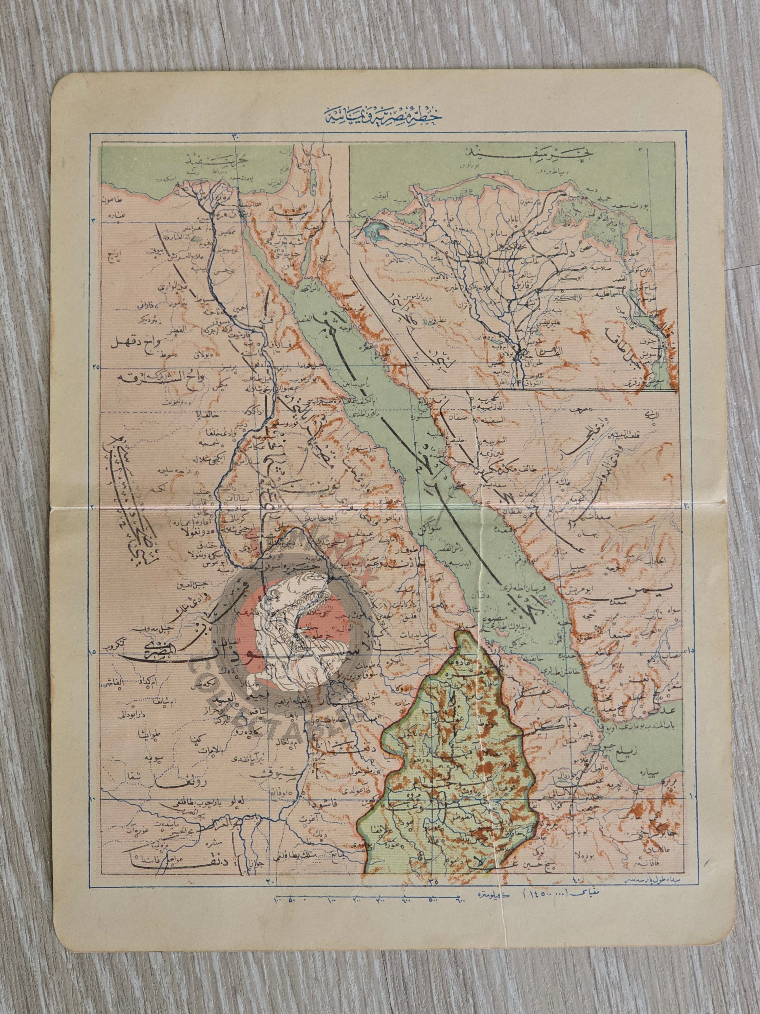
This original Ottoman map, dated 1324 (1908), illustrates Egypt, the Red Sea, and parts of the Arabian Peninsula (modern-day Saudi Arabia). It was published in Istanbul as part of the atlas Mükemmel ve Mufassal Coğrafya-yı Umumi, authored by Mehmed Eşref, one of the most prominent Ottoman geographers of the early 20th century.
The atlas was designed as a comprehensive geographical reference work, combining detailed regional maps with global coverage, reflecting both Ottoman educational needs and the Empire’s engagement with modern cartography.
With its relatively large format (23.2 × 18 cm) compared to pocket atlases of the era, this map offers greater geographical clarity and detail.
Key Features:
-
Date: 1324 (1908)
-
Source: Mükemmel ve Mufassal Coğrafya-yı Umumi
-
Author: Mehmed Eşref
-
Region Depicted: Egypt, Red Sea, and Arabian Peninsula (including parts of modern-day Saudi Arabia)
-
Publisher: Istanbul
-
Dimensions: 23.2 × 18 cm
-
Language: Ottoman Turkish
-
Format: Printed map,
-
Condition: Age-consistent wear; clear print
-
Historical Context: A rare example of Ottoman cartography from the early 20th century, documenting both African and Middle Eastern territories at a time of strategic importance for the Ottoman state.