


Ethiopia Abyssinia 1907 Ottoman Atlas Map Mehmed Eşref Red Sea Eritrea
Ottoman Map of Ethiopia - From Umum-i Vilayet-i Şahane’yi Havi Küçük Atlas (1907)
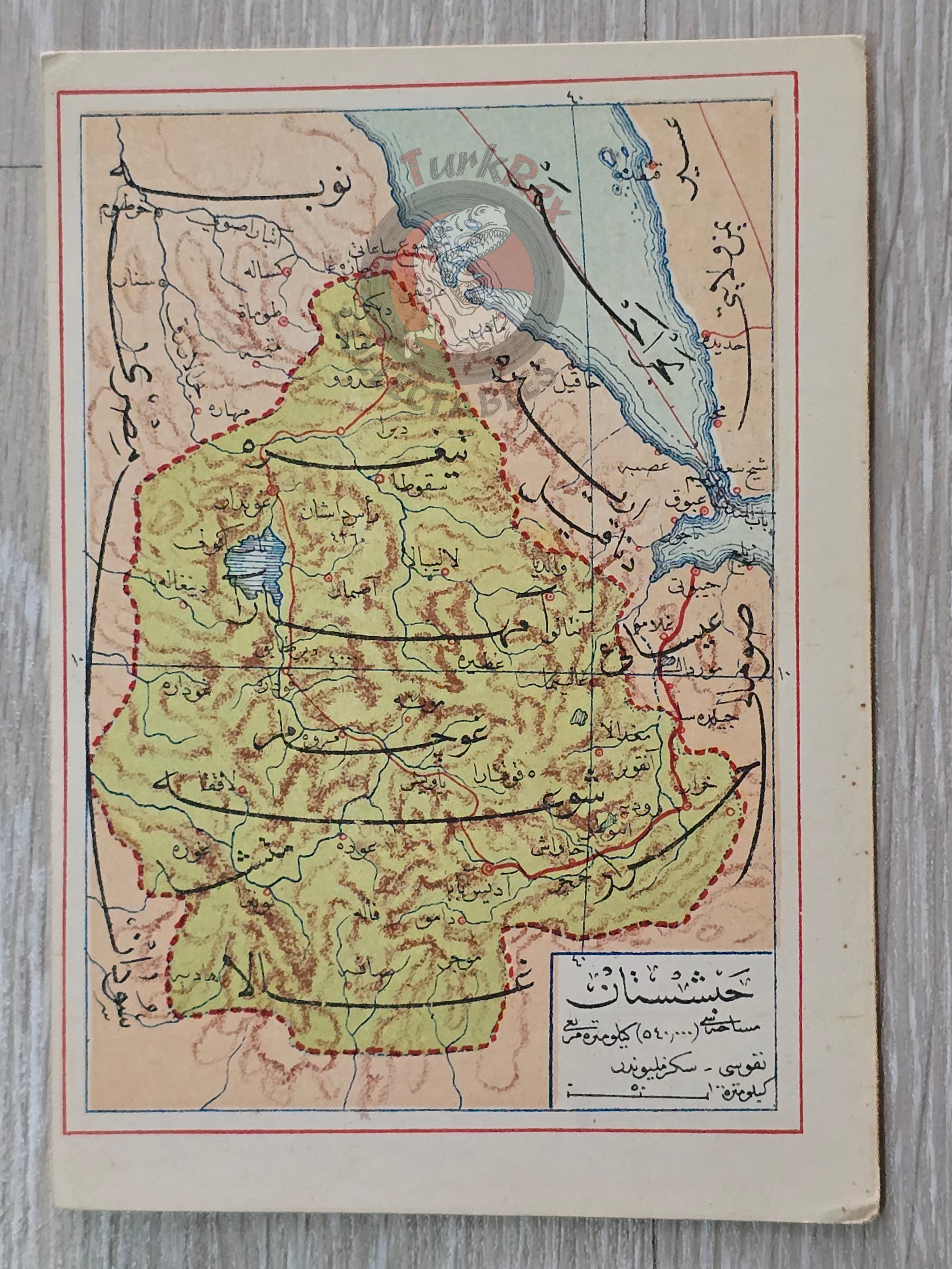
Description:
This rare Ottoman map depicts Ethiopia and includes the Red Sea coastline, offering a unique early 20th-century perspective on the region. It measures 14.5 × 10.3 cm and was published in 1907 as part of the Umum-i Vilayet-i Şahane’yi Havi Küçük Atlas, authored by Mehmed Eşref.
The atlas itself is a remarkable historical work, containing a 32-page Ottoman-script brochure accompanied by 128 maps (some composed of two parts), all printed on thick paper and loosely inserted after the text. Many of the maps within the atlas represent the first and possibly only Ottoman cartographic records of certain regions worldwide. This map of Ethiopia is particularly significant for historians and collectors, as it illustrates Ottoman-era knowledge and representation of East Africa.
Key Features:
-
Date: 1907
-
Region Depicted: Ethiopia, including the Red Sea
-
Dimensions: 14.5 × 10.3 cm
-
Source: Umum-i Vilayet-i Şahane’yi Havi Küçük Atlas by Mehmed Eşref
-
Atlas Details: 32-page Ottoman-script brochure, 128 maps (some two-part), thick paper inserts
-
Historical Significance: Likely among the earliest Ottoman maps of Ethiopia and surrounding regions
-
Paper/Condition: Original thick paper
-
Language: Ottoman Turkish
-
Cultural Significance: A rare example of Ottoman cartography, demonstrating the empire’s geographical knowledge and publishing practices in the early 20th century