


Europe Balkan States Ottoman Empire Expansion 1928 Ottoman Atlas Map Faik Sabri Middle East
Ottoman Turkish Double-Sided Map of Central & Southern Europe / Balkan States & Ottoman Empire Expansion - from Orta Atlas by Faik Sabri Duran (1928)
Description:
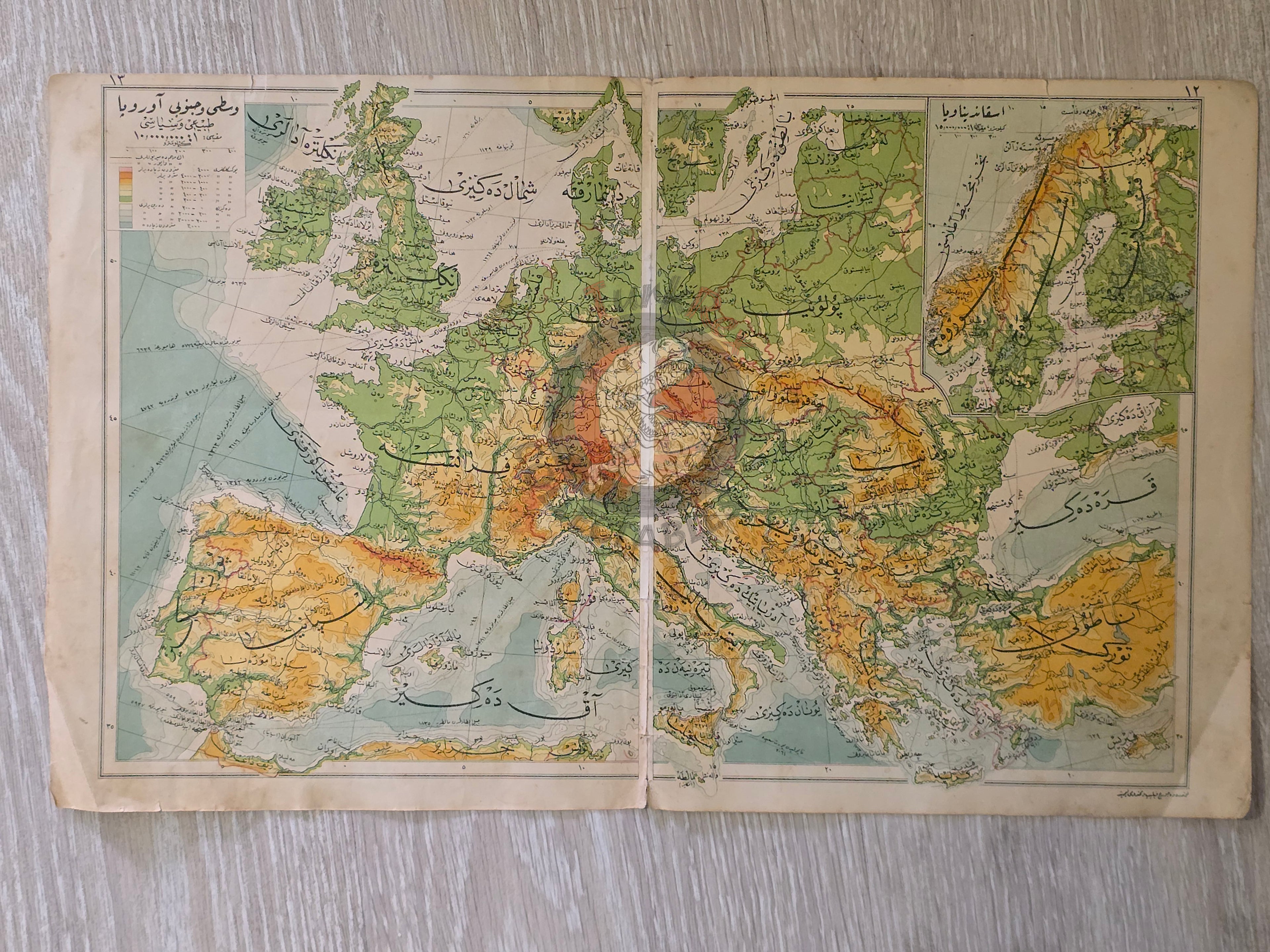
A double-sided Ottoman Turkish map, measuring 45.4 × 27.7 cm, from Faik Sabri Duran’s “Orta Atlas” (Middle Atlas), published in Istanbul, 1928 by Kanaat Kütüphanesi.
Although printed during the Republican period, the atlas was published in the Arabic-based Ottoman script, as it preceded the Alphabet Reform of November 1, 1928, when the Latin alphabet was officially introduced. This makes the atlas historically important as one of the final educational works in Ottoman script.
On one side, the map depicts the Physical and Political Map of Central and Southern Europe (Orta ve Cenubi Avrupa Tabii ve Siyasi Haritası).
On the other side, there are two separate maps:
-
The Balkan States (Physical and Political Map) (Balkan Hükümetleri Tabii ve Siyasi Haritası) - includes Greece, Bulgaria, Romania, Bosnia, Montenegro, Albania, and a detailed inset map of Crete (Girit Adası).
-
The Ottoman Empire during its Rise (Osmanlı İmparatorluğu Yükselme Devri) - showing the Middle East and European territories of the Empire, with the historical expansion of Ottoman lands illustrated in different colors, highlighting the phases of territorial growth.
The author, Faik Sabri Duran (1882–1943), was a leading Turkish geographer, writer, and educator. After completing his studies at the Sorbonne (1908–1912), he returned to Istanbul to teach at the Darülfünun, pioneering modern geography education. Decorated with ten medals by Sultan Abdülhamid II, Duran authored numerous atlases, geography, travel, and natural science books, with the Orta Atlas being one of his most influential works.
Key Features:
-
Title/Subject: Central & Southern Europe / Balkan States / Ottoman Empire (Expansion Period)
-
Publication Date: 1928 (pre-Alphabet Reform)
-
Atlas: Orta Atlas (Middle Atlas)
-
Author/Editor: Faik Sabri Duran (1882–1943)
-
Publisher: Kanaat Kütüphanesi, Istanbul
-
Language: Ottoman Turkish (Arabic script)
-
Dimensions: 45.4 × 27.7 cm
-
Coverage:
-
Central & Southern Europe (Physical & Political)
-
Balkan States with inset of Crete
-
Ottoman Empire during its rise, with territorial expansion phases illustrated
-
-
Significance: A rare double-sided Ottoman-script atlas map, issued shortly before the Alphabet Reform, combining both geographical and historical cartography.