


Germany Denmark Ottoman Script Map Military Empire Europe Poland
Large Ottoman Map of Germany (Harita-ı Umumi) – Likely Military Educational Use (ca. Late Ottoman Period)
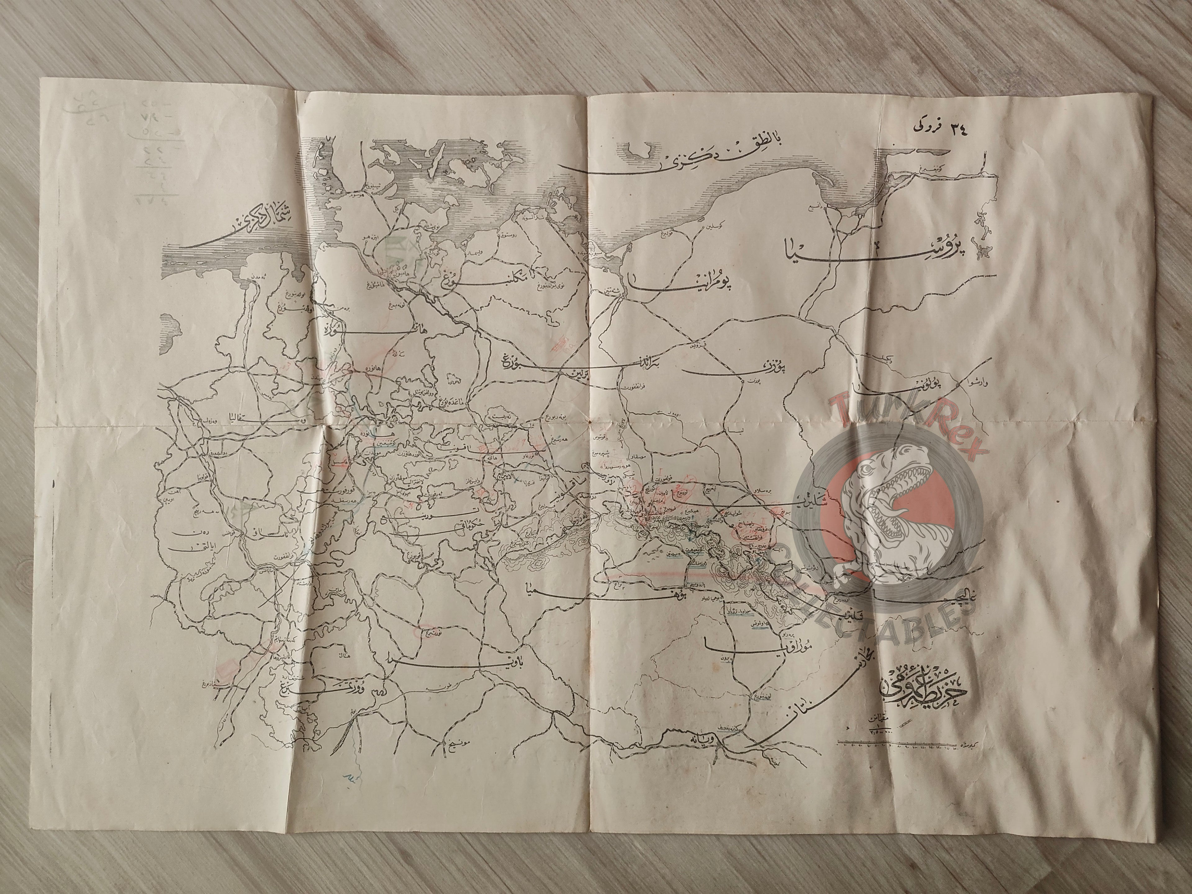
Description:
A large-format Ottoman Turkish map of Germany, titled Harita-ı Umumi, measuring 57.1 × 49.5 cm. Executed in a detailed, schematic kroki-style in black and white, the map clearly marks regions such as Bavaria and Poland, providing a precise geographical framework.
The map’s scale, style, and function strongly suggest that it was intended as a military educational tool, most likely used in Ottoman officer schools during the late 19th or early 20th century. This is further supported by the presence of handwritten Ottoman annotations on the sheet, indicating it was actively studied and worked on in a classroom or staff-college context.
Although the exact publication and year remain uncertain, the map resembles the type of large folding maps and sketches prepared by the Ottoman Military Press (Matbaa-i Askerî) for instructional use, particularly in the decades around the Franco-Prussian War (1870–71) and World War I.
Its condition is moderate, with one side showing light damp staining, but the sheet retains its legibility and historic character.
Key Features:
-
Date: ca. late Ottoman period (likely late 19th–early 20th century)
-
Title: Harita-ı Umumi (General Map)
-
Region Depicted: Germany and surrounding areas (including Bavaria, Poland, etc.)
-
Dimensions: 57.1 × 49.5 cm
-
Style: Black-and-white detailed schematic map (kroki style)
-
Annotations: Handwritten Ottoman notes, reinforcing its use as a military teaching aid
-
Historical Context: Likely produced for officer education, reflecting the Ottoman military’s adoption of European-style cartography and staff training methods
-
Condition: Moderate, with some damp staining on one side