


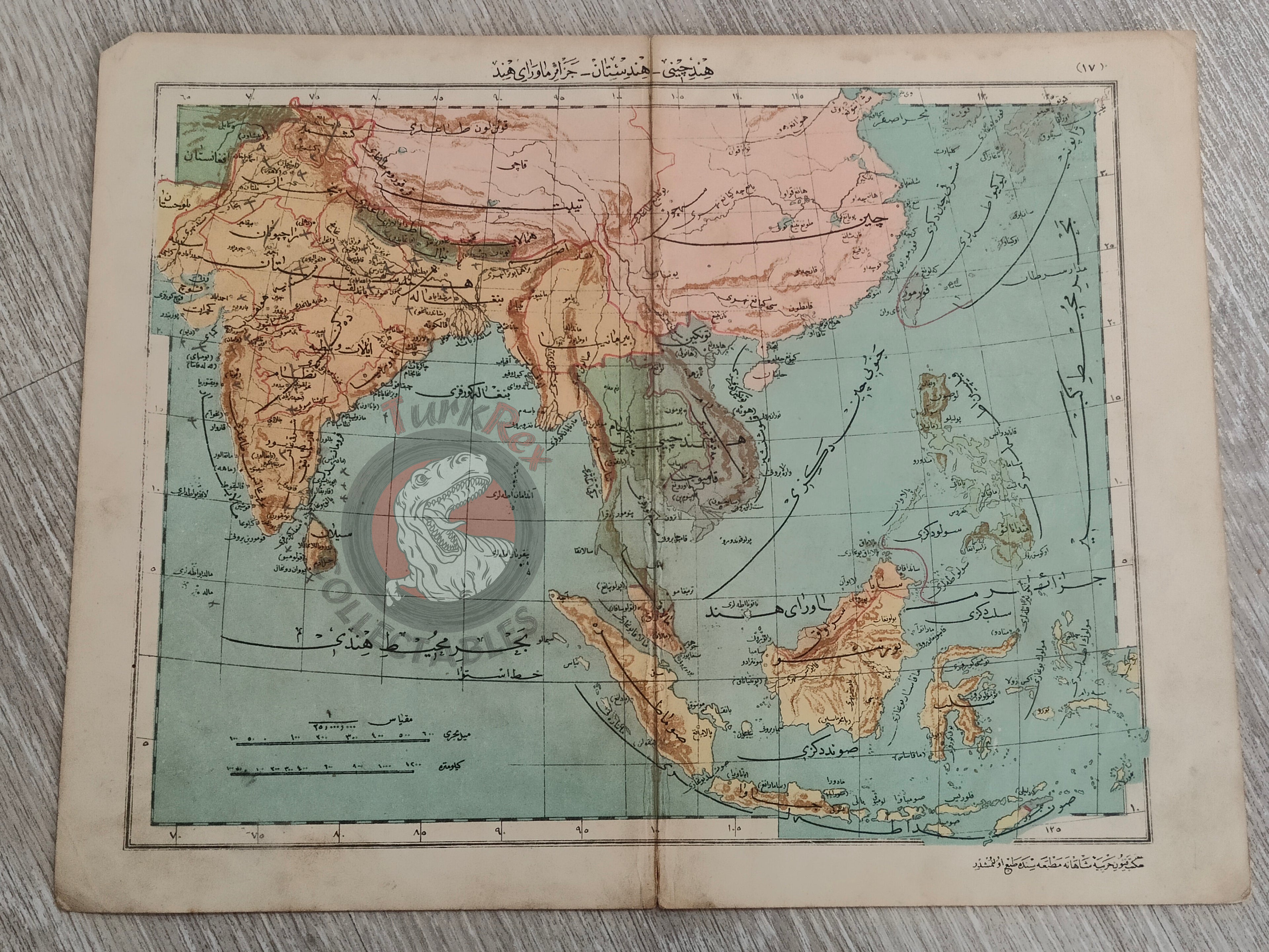


India China 1905 Ottoman Atlas Map Ottoman Empire Military School Indonesia Cambodia East Indies
Title: Ottoman Map of India – Hind-i Çini – Hindistan – Cezair-i Mavera-yı Hind (From Mekâtib-i Rüşdiye-i Askeriye-i Şahane Umumi Coğrafya Atlası, 1905)
Description:
An original Ottoman Turkish map titled “Hind-i Çini – Hindistan – Cezair-i Mavera-yı Hind”, depicting India, China and East Indies published in 1323 AH (1905 CE) as part of Mekâtib-i Rüşdiye-i Askeriye-i Şahane Üçüncü Seneleri Şakirdanına Mahsus Umumi Coğrafya Atlası (“General Geography Atlas for the Third-Year Students of the Imperial Military Secondary Schools”), authored by Muhammed Remzi and printed in Istanbul by the Mekteb-i Fünun-ı Harbiye-i Şahanesi Matbaası.
Measuring 31.7 × 24.6 cm, this map was designed for Ottoman military school students, providing detailed geographic information for educational purposes. It reflects the Ottoman Empire’s focus on integrating geography into the curriculum for military training during the early 20th century.
Key Features:
- Date: 1323 AH (1905 CE)
- Title/Region: Hind-i Çini – Hindistan – Cezair-i Mavera-yı Hind (India)
- Source: Mekâtib-i Rüşdiye-i Askeriye-i Şahane Umumi Coğrafya Atlası
- Author: Muhammed Remzi
- Publisher: Mekteb-i Fünun-ı Harbiye-i Şahanesi Matbaası, Istanbul
- Dimensions: 31.7 × 24.6 cm
- Audience: Third-year students of Ottoman imperial military secondary schools
- Historical Context: Used for military education
- Cultural Significance: Rare example of an Ottoman military school atlas map, illustrating India in the early 20th century