


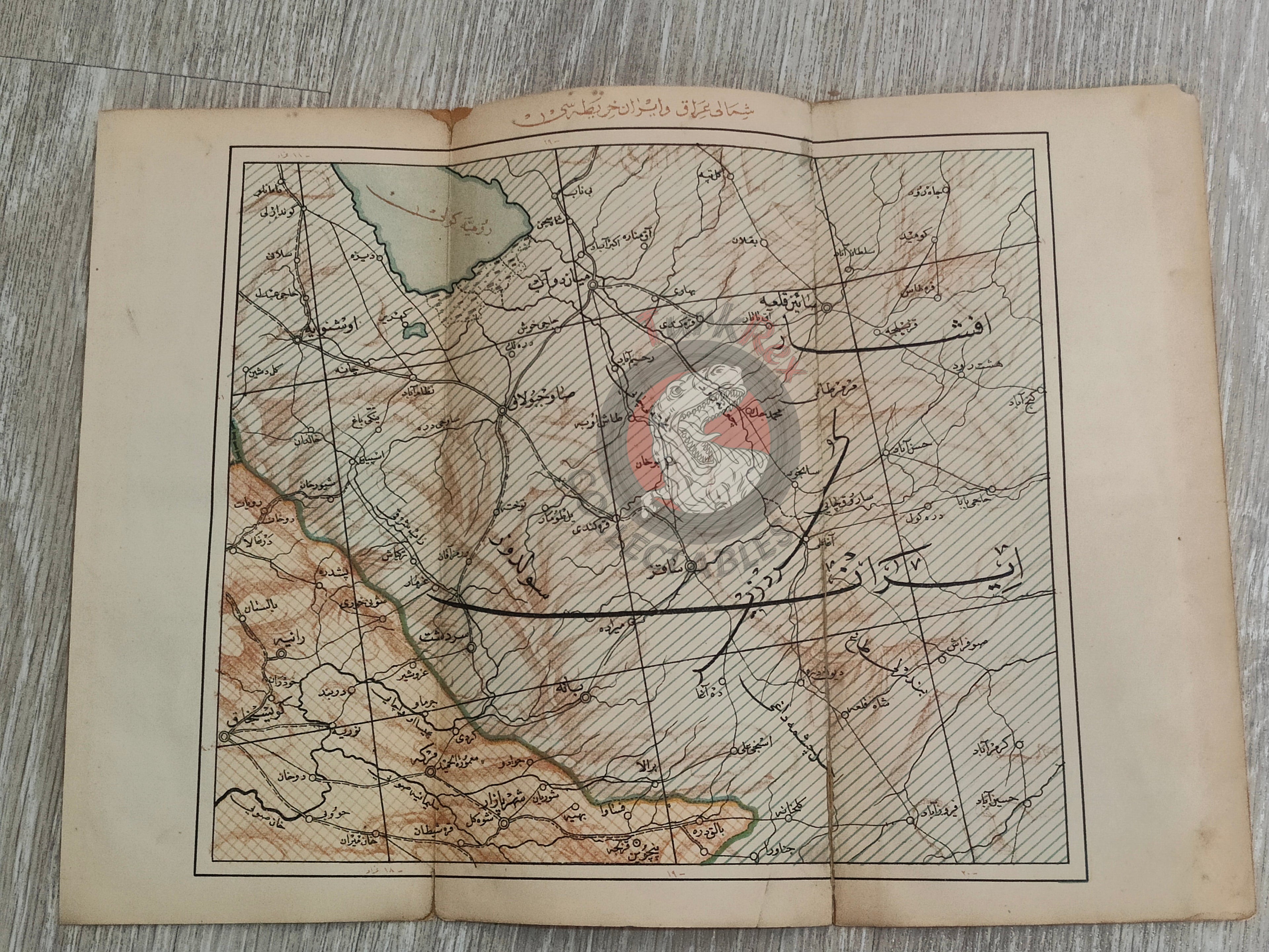


Iran Iraq Urmia 1928 Ottoman Script Atlas Map West Azerbaijan Province Middle East
Ottoman Map of Iran (West Azerbaijan Province) and North Iraq - From Mükemmel ve Mufassal Türkiye Cumhuriyeti Atlası (1928)
Description:
An Ottoman Turkish map titled “Şimali Irak and İran Map”, depicting Iranian territories, including the Lake Urmia region, published in 1928 as part of Mükemmel ve Mufassal Türkiye Cumhuriyeti Atlası, authored by Mehmed Rüşdü. The atlas is from Turkish Republic era but was printed before the Turkish Alphabet Reform. This document represents the short transitional period between the founding of the Republic (1923) and the Alphabet Reform of 1928, after which the Latin alphabet replaced Ottoman Turkish script. (Arabic letters)
Measuring 33.1 × 23.7 cm, the map reflects the geographic understanding of Iran and Iraq in the late Ottoman and early Republican period. It provides a rare example of pre-Alphabet Reform cartography from Turkey.
Key Features:
-
Title/Region: Şimali Irak and Iran Map
-
Date: 1928
-
Source: Mükemmel ve Mufassal Türkiye Cumhuriyeti Atlası
-
Author: Mehmed Rüşdü
-
Dimensions: 33.1 × 23.7 cm
-
Historical Significance: Printed before the Turkish Alphabet Reform; reflects pre-1928 Ottoman/Turkish cartography
-
Cultural Significance: Rare example of maps in Ottoman Turkish script in the early Republican era