


Iraq Iran border Basra 1921 Ottoman Script Military Map Middle East Kuwait
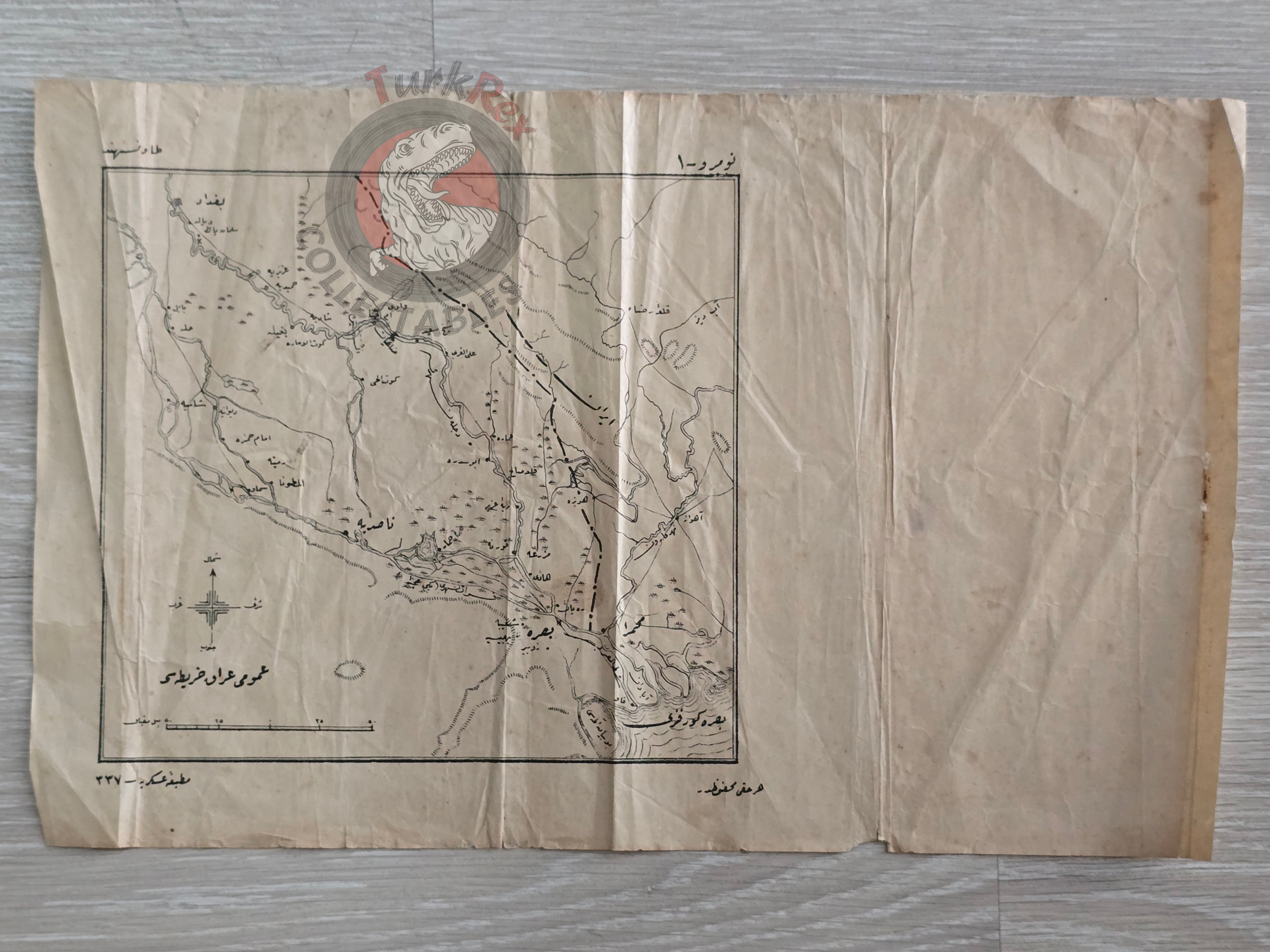
Ottoman Map of Iraq – Irak Umumi Haritası (1337 AH / 1921)
Description:
An Ottoman Turkish map titled “Irak Umumi Haritası”, published by Matbaa-i Askeri in 1337 AH (1921 CE). This map depicts the Basra region and surrounding territories of Iraq and Iran, outlining their borders at the time. It was originally used in Ottoman/Turkish military schools, reflecting its practical and educational purpose.
The map is particularly notable as it also covers the territory that today forms the State of Kuwait, offering valuable historical context for the shifting borders of the Middle East in the early 20th century.
Key Features:
-
Title/Region: Irak Umumi Haritası – Basra, Iraq, Iran, and Kuwait region
-
Date: 1337 AH (1921 CE)
-
Publisher: Matbaa-i Askeri (Military Press)
-
Use: Produced for use in Ottoman/Turkish military education
-
Historical Significance: Shows Iraq-Iran borderlands before the establishment of modern Kuwait