


Istanbul 1915 Ottoman WW1 Military Map Empire Constantinople Capital
Ottoman Military Map – Istanbul (Kağıthane, Beşiktaş & Ortaköy), General Staff (Erkan-ı Harbiye), 1912
Description:
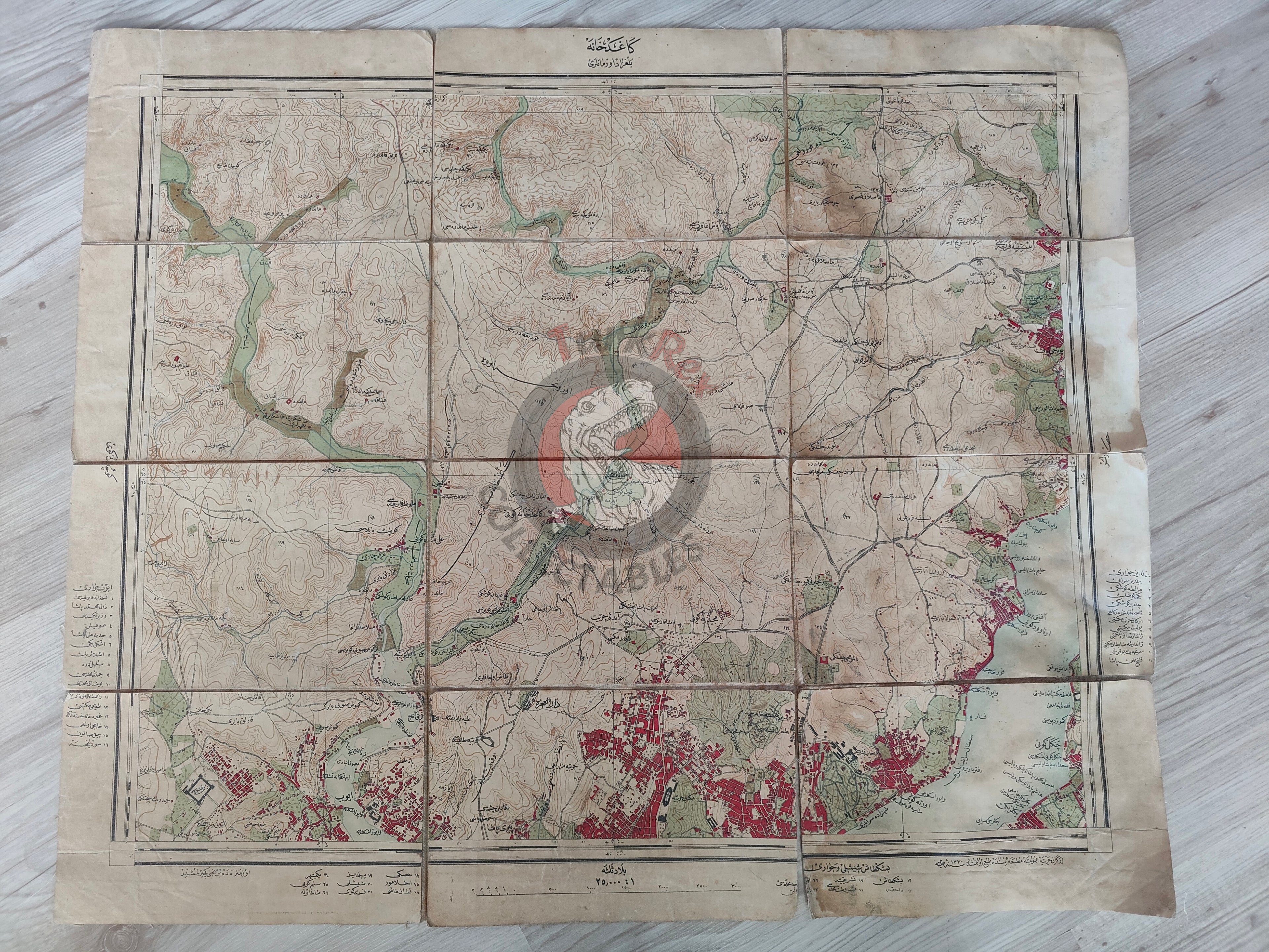
An original Ottoman military map prepared by the General Staff (Erkan-ı Harbiye), dated 1330 AH (1912 AD), measuring 58 × 48.5 cm. The map covers the Kağıthane area of Istanbul, with sections of Beşiktaş and Ortaköy also visible.
Produced on the eve of the First World War, this map belongs to the series of detailed topographic surveys created by the Ottoman military for use in strategic planning and training. The Erkan-ı Harbiye maps typically highlight terrain features, settlements, waterways, and communication routes, all essential for both defensive and offensive operations.
Historical Context:
The Erkan-ı Harbiye originated as a military academy founded by Sultan Mahmud II in 1835 to train modern officers. By the early 20th century, it had evolved into the Ottoman Empire’s central military planning body, producing a wide array of maps for operational and educational use.
This Istanbul-focused sheet illustrates the strategic importance of the capital and its approaches, especially as the empire faced growing military challenges in the Balkan Wars (1912–1913) and later World War I. It is also a rare survival, since most surviving Ottoman military maps focus on frontiers and campaign zones, while domestic Istanbul-area maps were often destroyed, heavily used, or lost.
Key Features:
-
Type: Ottoman military map (Erkan-ı Harbiye haritası)
-
Date: 1330 AH (1912 AD)
-
Size: 58 × 48.5 cm
-
Region: Istanbul – Kağıthane, with Beşiktaş and Ortaköy visible
-
Purpose: Military topographic survey for training and strategic planning
-
Context: Produced on the eve of the Balkan Wars and WWI, when Ottoman cartography reached its most intense period
-
Historical Significance: Rare General Staff map of Istanbul’s European side, illustrating terrain, settlements, and key locations near the capital