


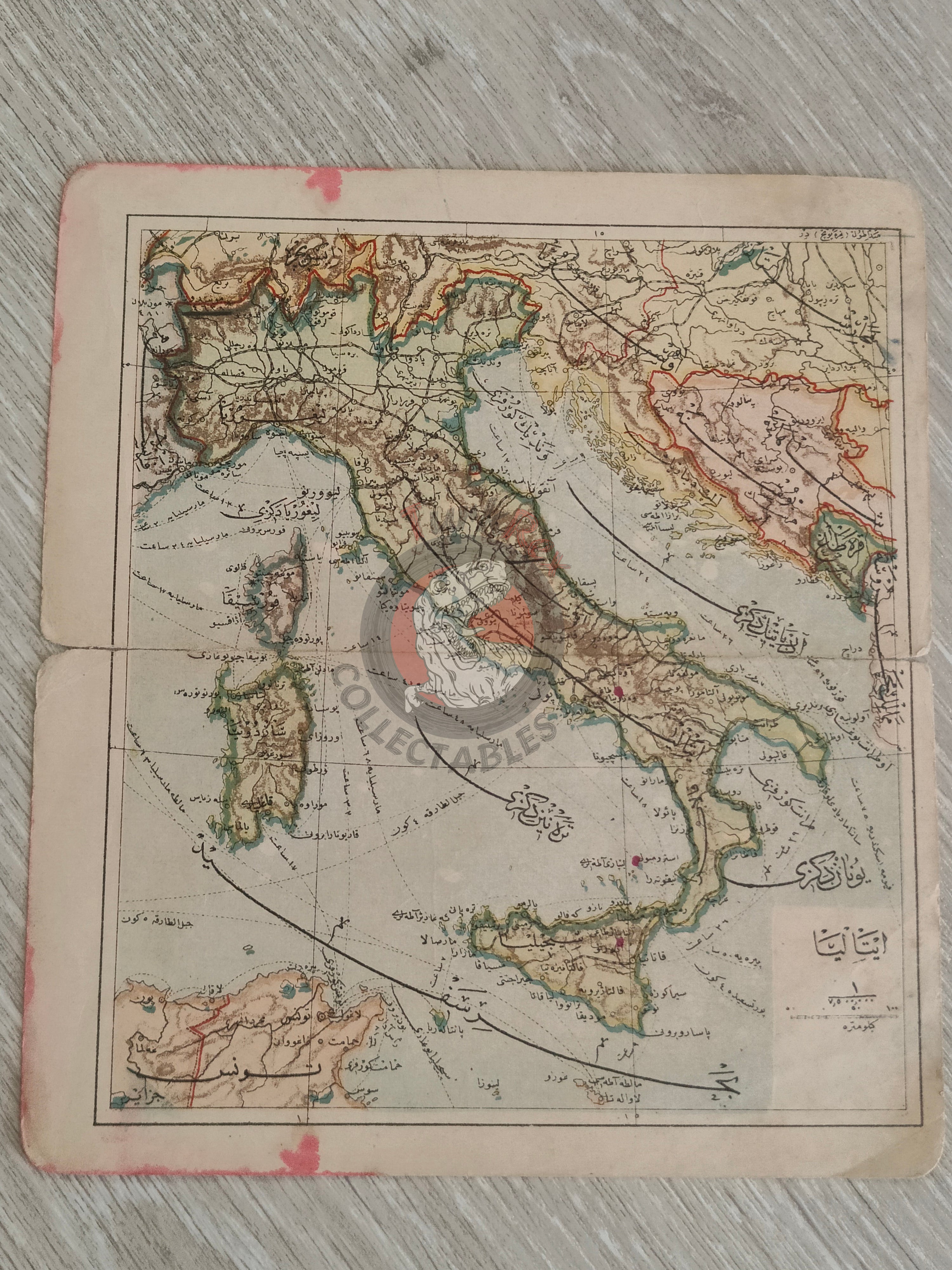


Italy 1906 Ottoman Atlas Map Empire Europe Sardegna Bosnia Crotia Montenegro
Ottoman Map of Italy – From Umumi Cep Atlası by Tüccarzade İbrahim Hilmi (1324 AH / 1906 CE)
Description:
An Ottoman Turkish map of Italy, published in 1324 AH (1906 CE) as part of Tüccarzade İbrahim Hilmi’s Umumi Cep Atlası. Printed in Istanbul, this map measures 19.4 × 17.2 cm and reflects the cartographic knowledge and style of early 20th-century Ottoman atlases.
Tüccarzade İbrahim Hilmi was one of the most prolific Ottoman publishers of the late 19th and early 20th centuries, producing accessible atlases and educational works that introduced modern cartography to a broad audience. The Umumi Cep Atlası was designed as a compact reference, making its surviving maps relatively rare today.
It serves as a valuable historical record for collectors and researchers interested in Ottoman-era geography and educational materials.
Key Features:
- Region: Italy
- Date: 1324 AH / 1906 CE
- Source: Umumü Cep Atlası by Tüccarzade İbrahim Hilmi
- Dimensions: 19.4 × 17.2 cm
- Significance: Early 20th-century Ottoman atlas map, illustrating Italy for educational or reference purposes