


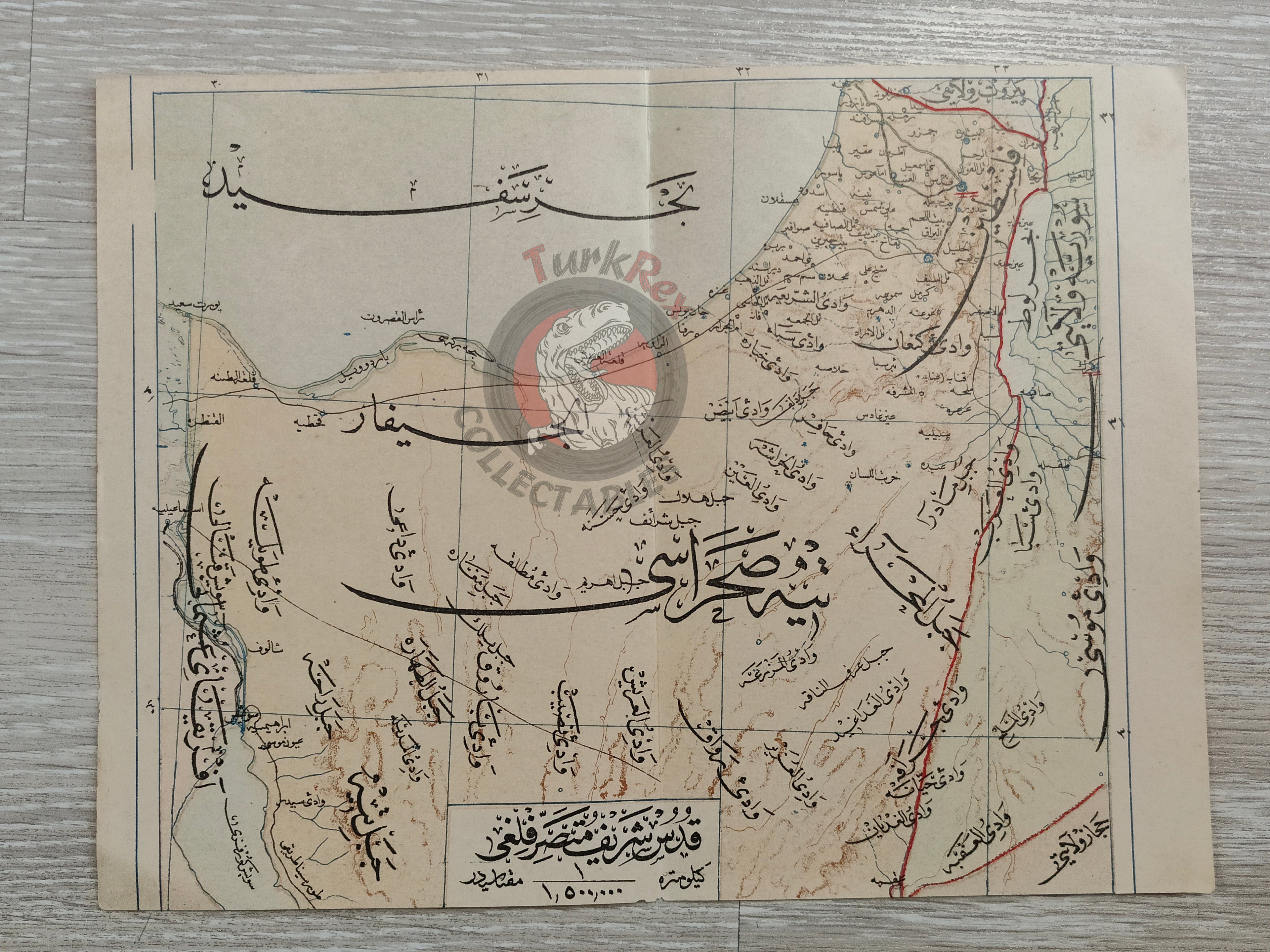


Jerusalem 1907 Ottoman Atlas Map Middle East Israel Palestine Mehmed Eşref
Ottoman Map – District of Jerusalem (Kudüs-ü Şerif Mutasarrıflığı)
Description:
A detailed Ottoman Turkish map of the District of Jerusalem (Kudüs-ü Şerif Mutasarrıflığı), covering Jerusalem, Bethlehem, Al-Khalil (Hebron), Yaffa (Jaffa), Gaza, and Beersheba. Published in 1325 (1907) as part of the Memâlik-i Mahrûse-i Şâhâneye Mahsûs Mükemmel ve Mufassal Atlas, authored by Mehmed Eşref and printed in Istanbul by Tefeyyüz Kütüphanesi.
This map illustrates the historical boundaries of the district, which today corresponds to areas within Israel and the Palestinian territories, offering a unique perspective on the Ottoman administrative geography of the region.
Key Features:
-
Region: District of Jerusalem (Jerusalem, Bethlehem, Al-Khalil, Yaffa, Gaza, Beersheba)
-
Date: 1325 (1907)
-
Publisher: Tefeyyüz Kütüphanesi, Istanbul
-
Author: Mehmed Eşref
-
Dimensions: 25.9 × 19.5 cm
-
Significance: Shows Ottoman-era administrative boundaries of Jerusalem district, providing historical insight into early 20th-century cartography in the region