


Kapıdağ Peninsula Ottoman Empire Map Marmara Balıkesir early 20th century
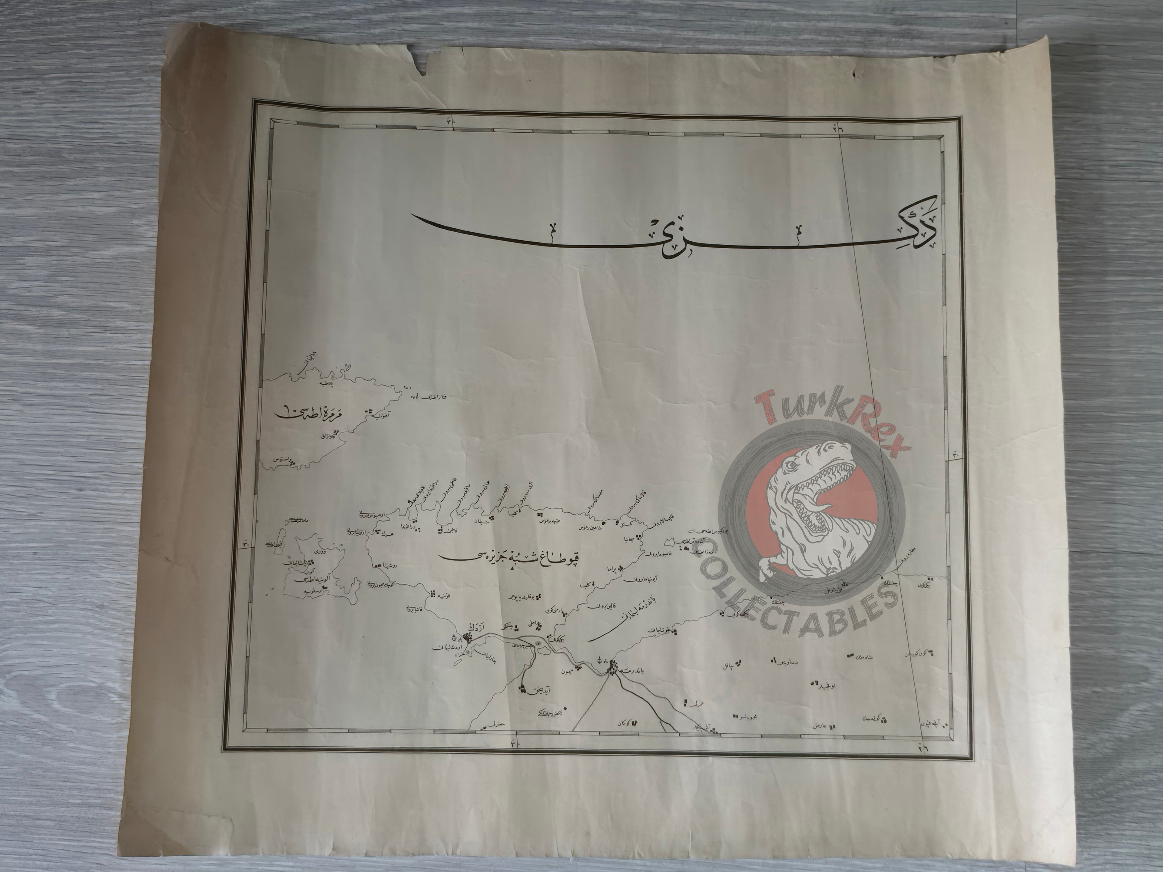
Ottoman Map of the Kapıdağ Peninsula (Early 20th Century)
Description:
A large Ottoman Turkish map of the Kapıdağ Peninsula (Kapıdağ Yarımadası), located in Balıkesir Province, northwestern Anatolia. Measuring 45.6 × 40.5 cm, this map likely dates to the early 20th century, though its exact publication date is not specified.
The Kapıdağ Peninsula is a tied island extending into the Sea of Marmara, forming the Gulf of Bandırma on the east and the Gulf of Erdek on the west. In antiquity, it was known as Arctonnesus, later called the Peninsula of Cyzicus after its principal city. According to legend, the land connection to the mainland was created either by an earthquake or by Alexander the Great.
This map captures both the geographic and historical importance of Kapıdağ, a region that has played a role in ancient Greek, Byzantine, and Ottoman history.
Key Features:
- Region: Kapıdağ Peninsula, Balıkesir Province, Sea of Marmara
- Date: Early 20th century (undated)
- Dimensions: 45.6 × 40.5 cm
- Content: Topography of the peninsula, coastal features of Bandırma and Erdek Gulfs
- Historical Note: Ancient Greek Arctonnesus, later Cyzicus; tied island connected to Anatolia in antiquity
- Significance: Rare Ottoman map illustrating an area of both geographic and classical historical importance