


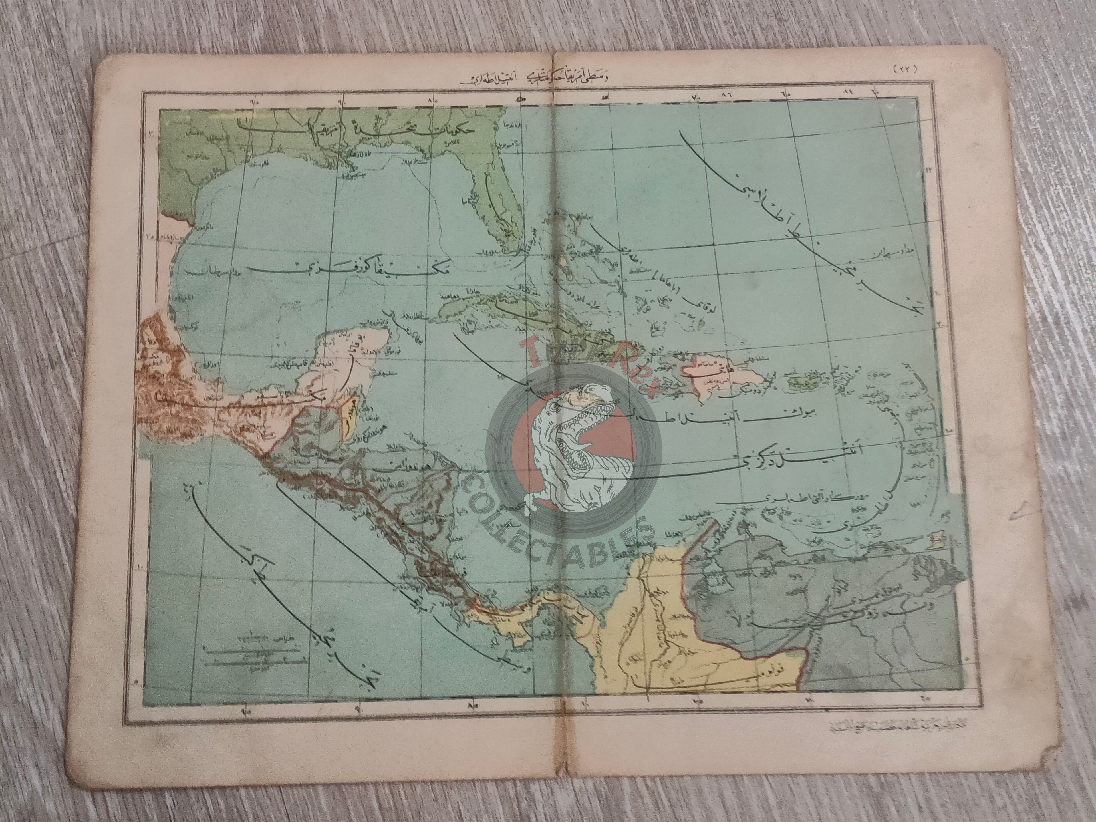


Mexico 1905 Ottoman Atlas Map Ottoman Empire Central America Cuba Guatemala
Ottoman Map of Mexico and Central America – From Mekâtib-i Rüşdiye-i Askeriye-i Şahane Umumi Coğrafya Atlası (1323 AH / 1905 CE)
Description:
An Ottoman Turkish map depicting Mexico along with parts of Cuba, Guatemala, and Honduras, published in 1323 AH (1905 CE) in Muhammed Remzi’s Mekâtib-i Rüşdiye-i Askeriye-i Şahane Üçüncü Seneleri Şakirdanına Mahsus Umumi Coğrafya Atlası. Printed in Istanbul by the Mekteb-i Fünun-i Harbiye-i Şahanesi Matbaası, this atlas was specifically prepared for use in Ottoman military schools as an educational resource.
Measuring 31.7 × 24.6 cm, the map illustrates the Ottoman Empire’s interest in global geography and its effort to provide students with a broad understanding of world regions beyond its borders.
Key Features:
- Region: Mexico, with Cuba, Guatemala, and Honduras also depicted
- Date: 1323 AH / 1905 CE
- Source: Mekâtib-i Rüşdiye-i Askeriye-i Şahane Umumi Coğrafya Atlası by Muhammed Remzi
- Target Audience: Students of the Imperial Military Rüşdiye Schools
- Publisher: Mekteb-i Fünun-i Harbiye-i Şahanesi Matbaası, Istanbul
- Dimensions: 31.7 × 24.6 cm
- Significance: Educational Ottoman military school atlas map, reflecting global geographic awareness in the early 20th century