


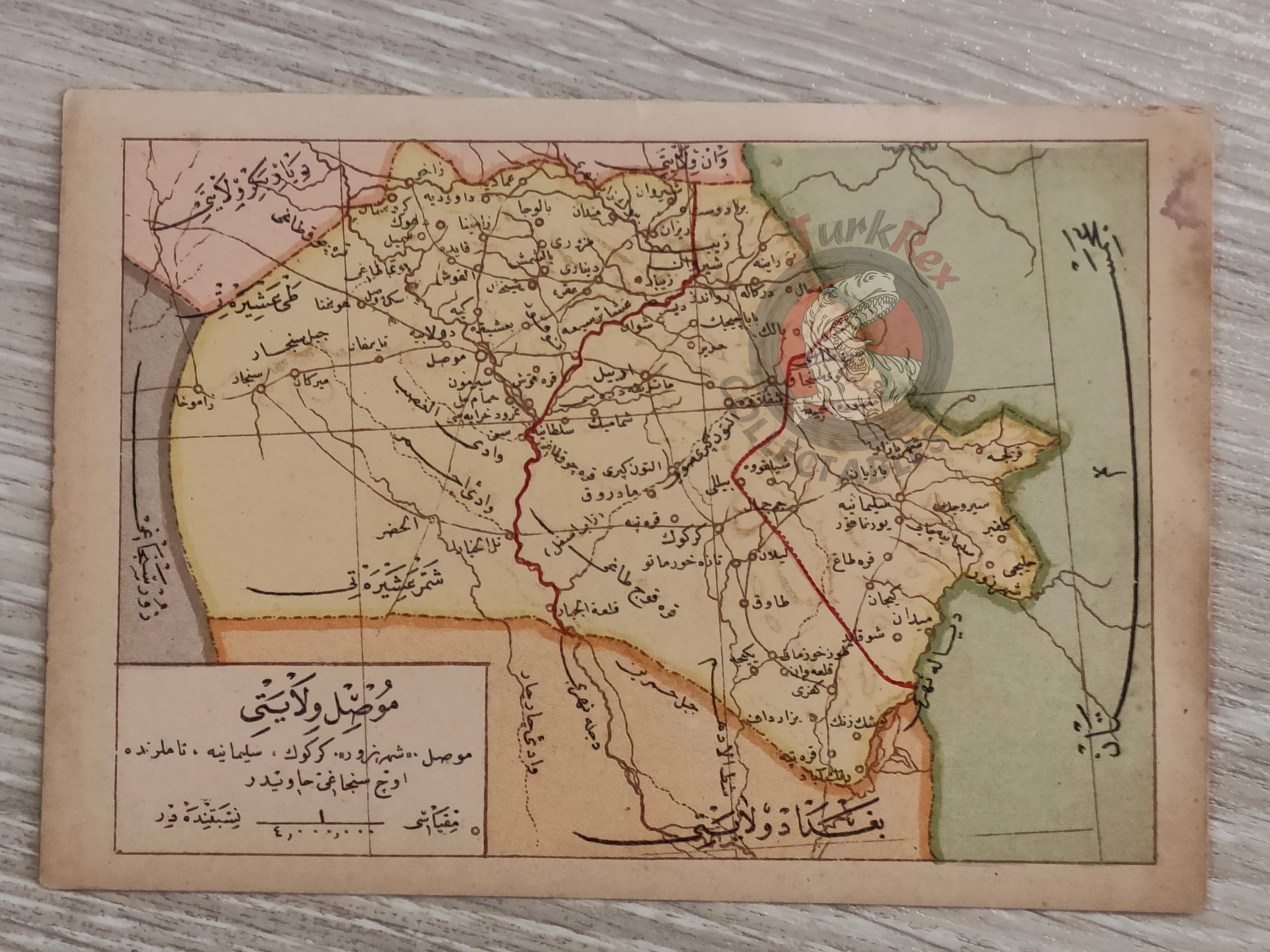


Mosul Vilayet Ottoman Postcard Map Middle East Ibrahim Hilmi Military Iraq
Ottoman Turkish Postcard Map – Mosul (Musul) Vilayet
Description:
An Ottoman Turkish postcard map of Mosul Vilayet. Measuring 14.5 × 10 cm, the postcard was published in Istanbul by Tüccarzade İbrahim Hilmi’s Military Press (Kitaphane-yi Askeri) as part of a historical postcard series. Tüccarzade İbrahim Hilmi was a prominent Ottoman publisher and intellectual, instrumental in popularizing geography, history, and educational materials in the late 19th and early 20th centuries. His press produced a wide range of atlases, maps, and political writings, making knowledge accessible to a broad audience.
The Mosul Vilayet was a first-level administrative division (vilayet) of the Ottoman Empire, It was created from the northern sanjacks of the Baghdad Vilayet in 1878.
This postcard provides a rare example of early 20th-century Ottoman cartography, highlighting the Mosul region. It offers valuable insight into how the Ottoman public engaged with geographical knowledge and serves as an important piece for collectors and historians interested in Ottoman maps and educational publishing.
Key Features:
-
Title/Subject: Mosul Vilayet, Iraq
-
Format: Postcard map
-
Dimensions: 14.5 × 10 cm
-
Publisher: Tüccarzade İbrahim Hilmi, Kitaphane-yi Askeri, Istanbul