


Skip to product information


Netherlands 1906 Ottoman Atlas Map Ottoman Empire Europe Belgium Germany Luxembourg
$140.00
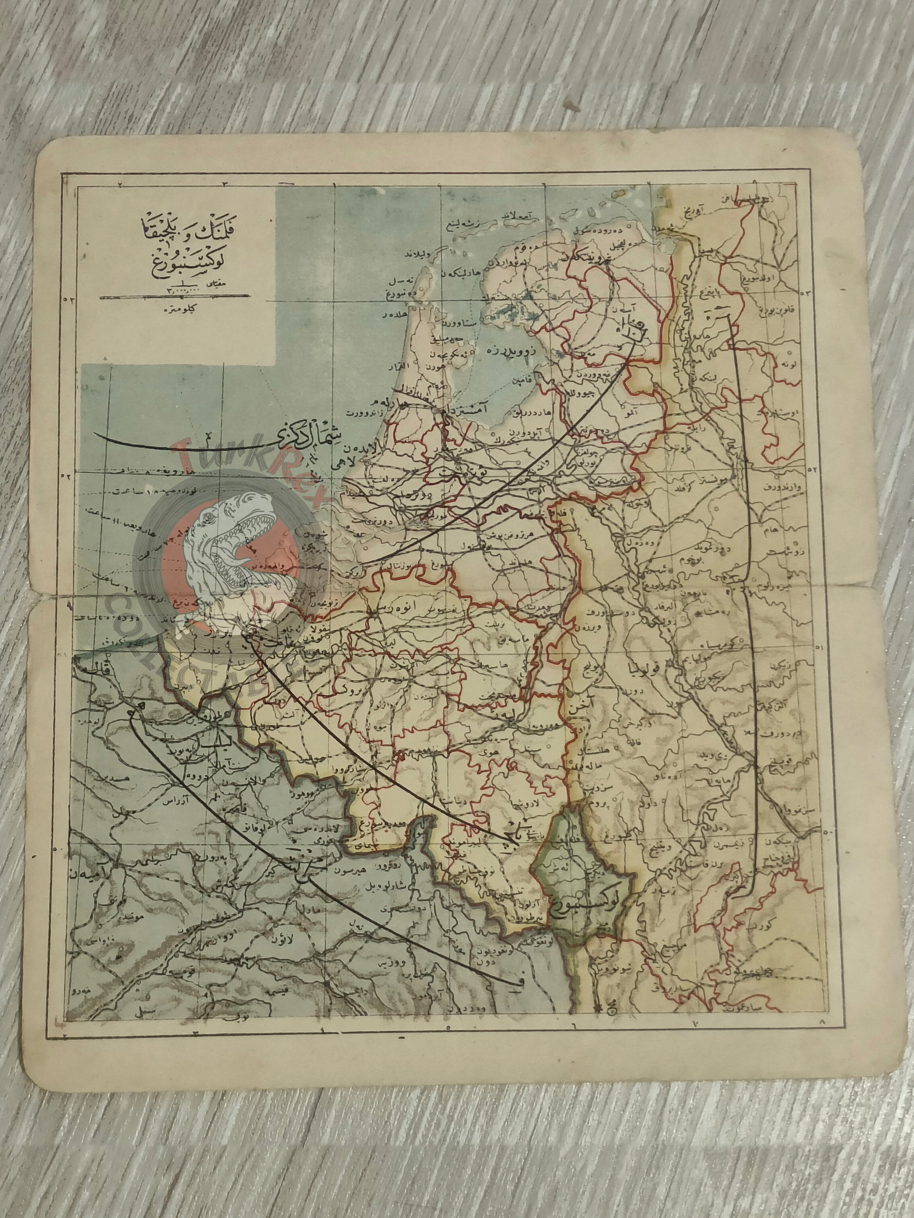
Ottoman Map of the Netherlands – From Umumi Cep Atlası by Tüccarzade İbrahim Hilmi (1324 AH / 1906 CE)
Description:
An Ottoman Turkish map of the Netherlands, published in 1324 AH (1906 CE) in Tüccarzade İbrahim Hilmi’s Umumi Cep Atlası. Measuring 19.3 × 17.2 cm, this compact atlas map was printed in Istanbul and designed to provide accessible geographic knowledge to a wide Ottoman readership.
In addition to the Netherlands, the map also depicts Belgium, as well as parts of France, Germany, and Luxembourg, reflecting the interconnected geography of northwestern Europe in the early 20th century.
Key Features:
- Region: Netherlands, with Belgium, parts of France, Germany, and Luxembourg
- Date: 1324 AH / 1906 CE
- Source: Umumi Cep Atlası by Tüccarzade İbrahim Hilmi
- Publisher: Istanbul, Ottoman Empire
- Dimensions: 19.3 × 17.2 cm
- Significance: Early 20th-century Ottoman atlas map designed for educational and popular use, showing northwestern Europe