


Skip to product information


North Africa 1906 Ottoman Atlas Map Empire Algeria Egypt Morocco Palestine Israel Libya
$150.00
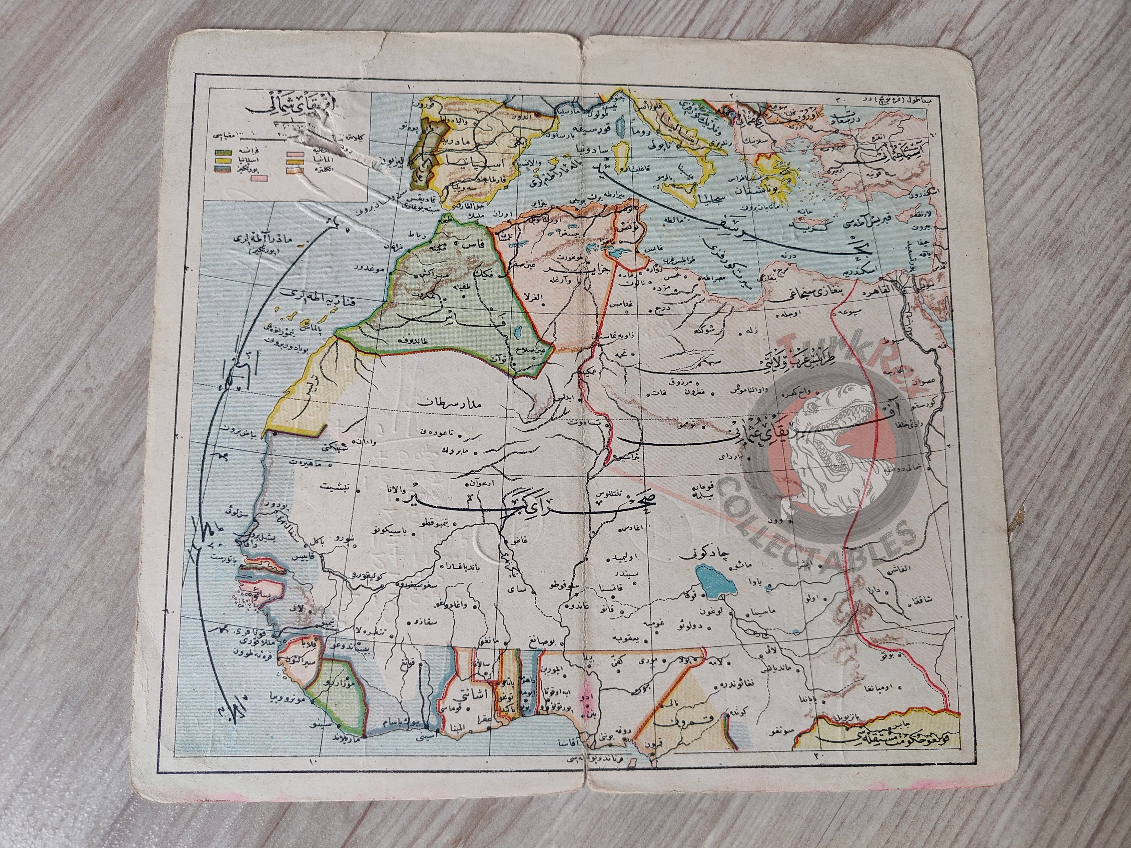
Ottoman Map of Afrika-i Osmani – From Umumi Cep Atlası by Tüccarzade İbrahim Hilmi (1324 AH / 1906 CE)
Description:
An Ottoman Turkish map titled “Afrika-i Osmani” (Ottoman Africa), published in 1324 AH (1906 CE) as part of Tüccarzade İbrahim Hilmi’s Umumi Cep Atlası. Printed in Istanbul, the map depicts the Ottoman and North African territories, including Algeria, Morocco, Palestine, Libya, and Egypt.
Measuring 19.1 × 17.2 cm, this atlas map reflects the Ottoman interest in North Africa during the early 20th century and illustrates both directly controlled and historically associated lands of the empire.
Key Features:
- Region: North Africa – including Algeria, Morocco, Palestine, Libya, and Egypt
- Date: 1324 AH / 1906 CE
- Source: Umumi Cep Atlası by Tüccarzade İbrahim Hilmi
- Publisher: Istanbul, Ottoman Empire
- Dimensions: 19.1 × 17.2 cm
- Condition: Handwritten notes are present on the reverse side of the map
- Significance: Pocket-sized atlas map by one of the most prolific Ottoman publishers, illustrating the empire’s geographic perspective on Africa