


Skip to product information


North Africa 1908 Ottoman Atlas Map Empire Libya Tunisia Morocco Algeria Tripoli
$140.00
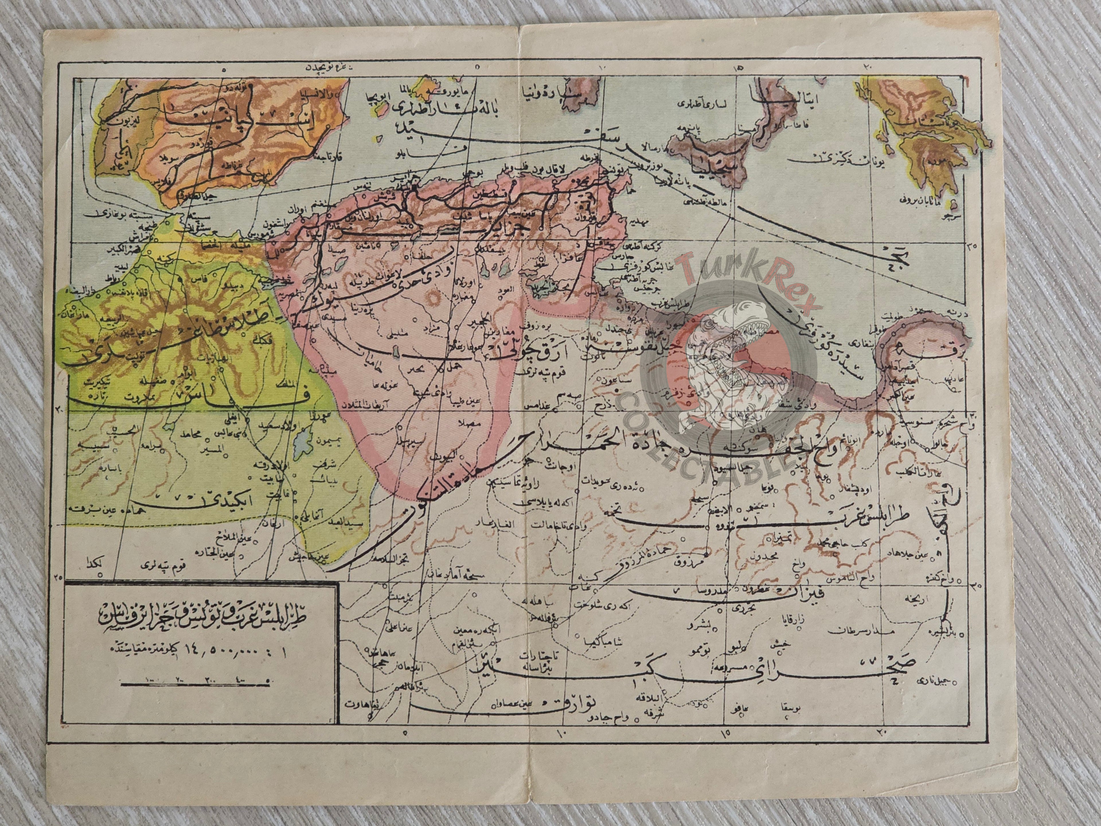
Trablusgarb ve Tunus ve Fas ve Cezayir Haritası – From Mükemmel ve Mufassal Coğrafya-yı Umumi Atlası by Mehmed Eşref (1324 AH / 1908 CE)
Description:
An Ottoman Turkish map titled “Trablusgarb ve Tunus ve Fas ve Cezayir Haritası”, published in 1324 AH (1908 CE) in Mehmed Eşref’s Mükemmel ve Mufassal Coğrafya-yı Umumi Atlası. Printed in Istanbul, the map provides a detailed representation of North Africa, showing Libya (Trablusgarb), Tunisia, Morocco, and Algeria.
Measuring 21.7 × 17.6 cm, this atlas map reflects the Ottoman cartographic and educational approach of the early 20th century, produced during a period of heightened European colonial activity in North Africa.
Key Features:
- Title on Map: Trablusgarb ve Tunus ve Fas ve Cezayir Haritası
- Region: North Africa – Libya, Tunisia, Morocco, and Algeria
- Date: 1324 AH / 1908 CE
- Source: Mükemmel ve Mufassal Coğrafya-yı Umumi Atlası by Mehmed Eşref
- Publisher: Istanbul, Ottoman Empire
- Dimensions: 21.7 × 17.6 cm
- Significance: Early 20th-century Ottoman atlas map highlighting the Maghreb at a time of major geopolitical changes