


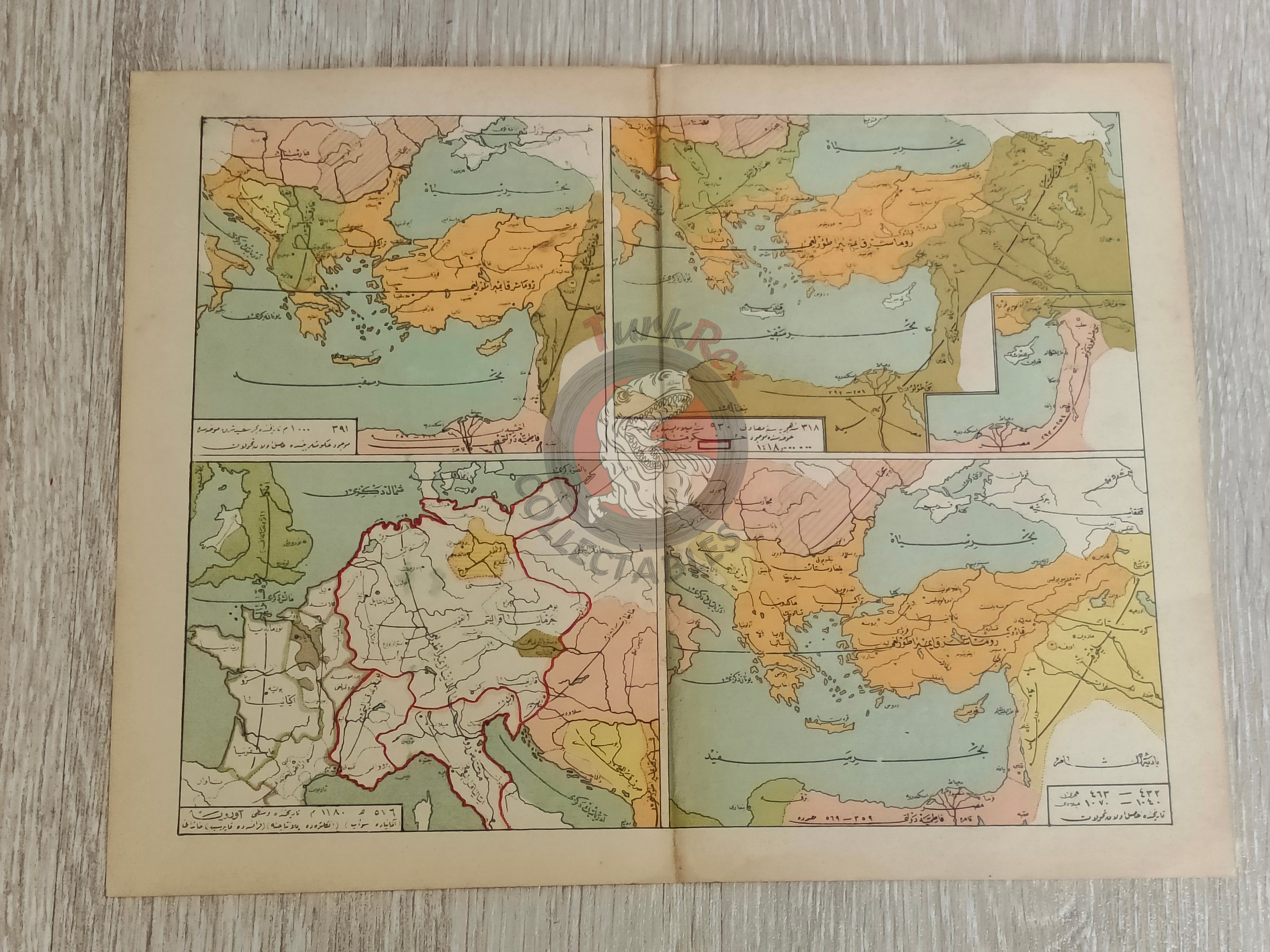


Ottoman 1913 Historical Map of the Balkans, Roman Empire, and Western Europe Middle East
Ottoman Historical Map of the Balkans, Roman Empire, and Western Europe (930–1180 CE) - From Tarih-i Umumi ve Osmani by Mehmed Eşref (1329 AH / 1913 CE)
Description:
A four-color lithographed double-page map depicting the Balkan states, the Roman Empire, and parts of Western Europe during the period 930-1180 CE. Published in 1329 AH (1913 CE) by the Mekteb-i Harbiye Matbaası (Ottoman Military Academy Press) in Mehmed Eşref’s Tarih-i Umumi ve Osmani, a richly illustrated historical atlas printed in Istanbul.
The map measures 32.7 × 25.7 cm and is one of 138 maps contained within 32 double-page plates included in the volume. This atlas aimed to provide Ottoman students with both world and Ottoman historical geography, combining visual learning with historical narrative.
Key Features:
- Region: Balkan states, Roman Empire, and part of Western Europe
- Date Represented: 930-1180 CE
- Publication Date: 1329 AH / 1913 CE
- Source: Tarih-i Umumi ve Osmani by Mehmed Eşref
- Publisher: Istanbul, Ottoman Empire
- Format: 4-color lithographed double-page map
- Dimensions: 32.7 × 25.7 cm
- Atlas Content: One of 138 maps in 32 double-page plates
- Significance: A vivid Ottoman historical atlas map, illustrating Europe and the Balkans during the medieval period for educational use