


Ottoman Empire 1916 Map Anatolia Middle East Hejaz Railway Arabian Peninsula Palestine
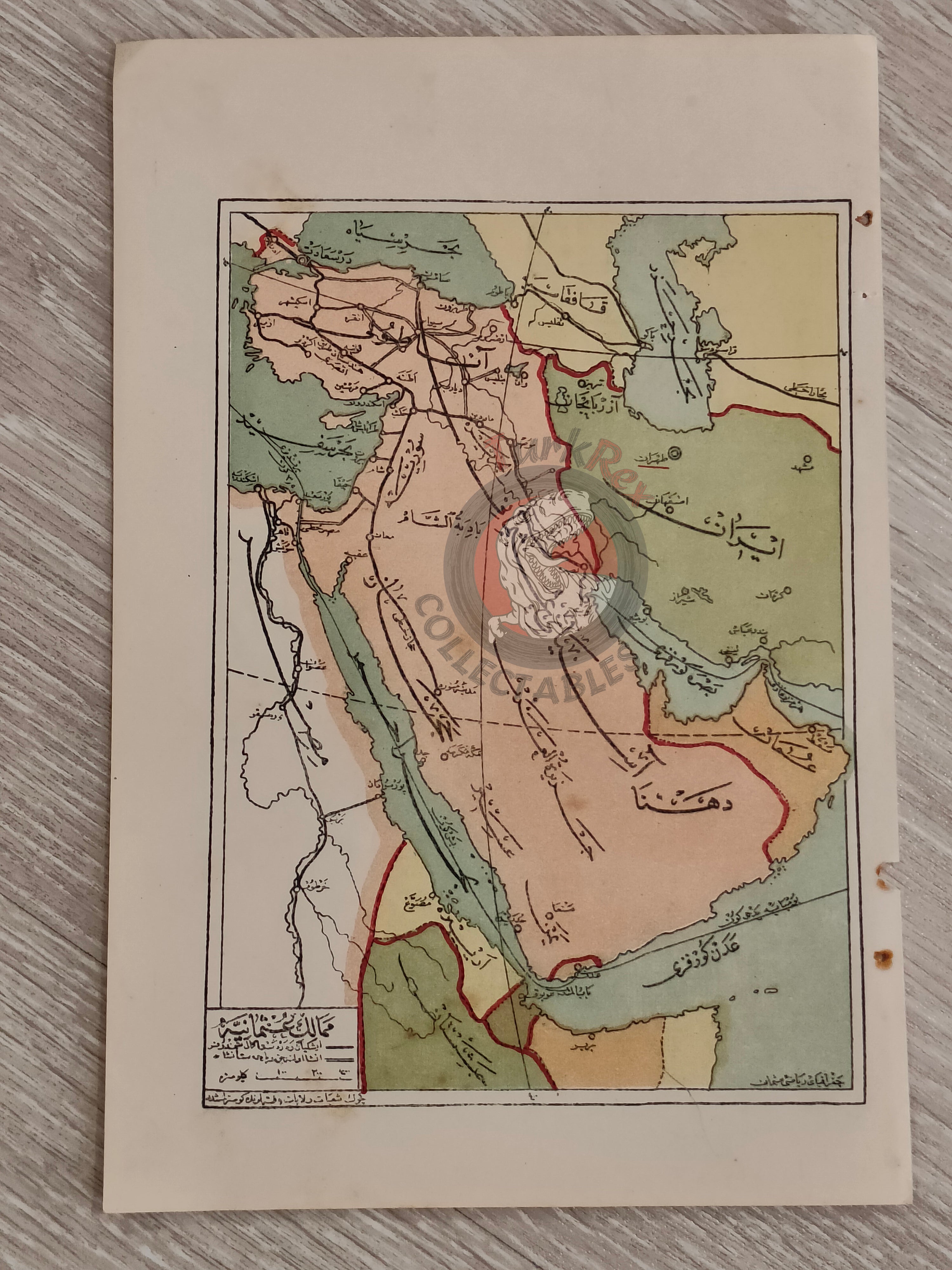
Ottoman Map of the Ottoman Empire - From Coğrafya-yı Osmani by Safvet (1332 AH / 1916 CE)
Description:
An Ottoman Turkish school map of the Ottoman Empire, published in 1332 AH (1916 CE) in Safvet’s Coğrafya-yı Osmani. This work was prepared as a geography textbook for the first class of advanced primary schools (Mekâtib-i İbtidâiye Devre-i Âliye), reflecting the educational reforms of the late Ottoman period.
The map, measuring 24.1 × 16.1 cm, delineates the boundaries of the Ottoman Empire, with the entire Arabian Peninsula clearly shown. Notably, the Hejaz Railway is marked, underscoring its importance as a strategic and symbolic project of the era. The map also depicts portions of Iranian territory, alongside Ottoman provinces corresponding to present-day Iraq, Syria, Lebanon, Israel/Palestine, Egypt, and Saudi Arabia.
Designed for classroom use, this map illustrates how geography was taught to Ottoman students during the First World War, combining both territorial knowledge and key infrastructural projects.
Key Features:
-
Region: Ottoman Empire, including the Arabian Peninsula
-
Date: 1332 AH / 1916 CE
-
Source: Coğrafya-yı Osmani by Safvet
-
Purpose: Textbook for Ottoman advanced primary schools (Mekâtib-i İbtidâiye Devre-i Âliye)
-
Publisher: Istanbul, Ottoman Empire
-
Dimensions: 24.1 × 16.1 cm
-
Content Highlights: Ottoman boundaries, Hejaz Railway, parts of Iran, and provinces across the Middle East and North Africa
-
Significance: A rare educational map from the late Ottoman period, produced during WWI, showing both imperial borders and modernizing infrastructure