


Ottoman Empire Map 1916 Administrative Divisions Middle East Palestine Jerusalem Israel Hejaz Railway
Ottoman Turkish Map – Administrative Divisions of the Ottoman Middle East (from Küçüklere Coğrafya Dersleri, 1916)
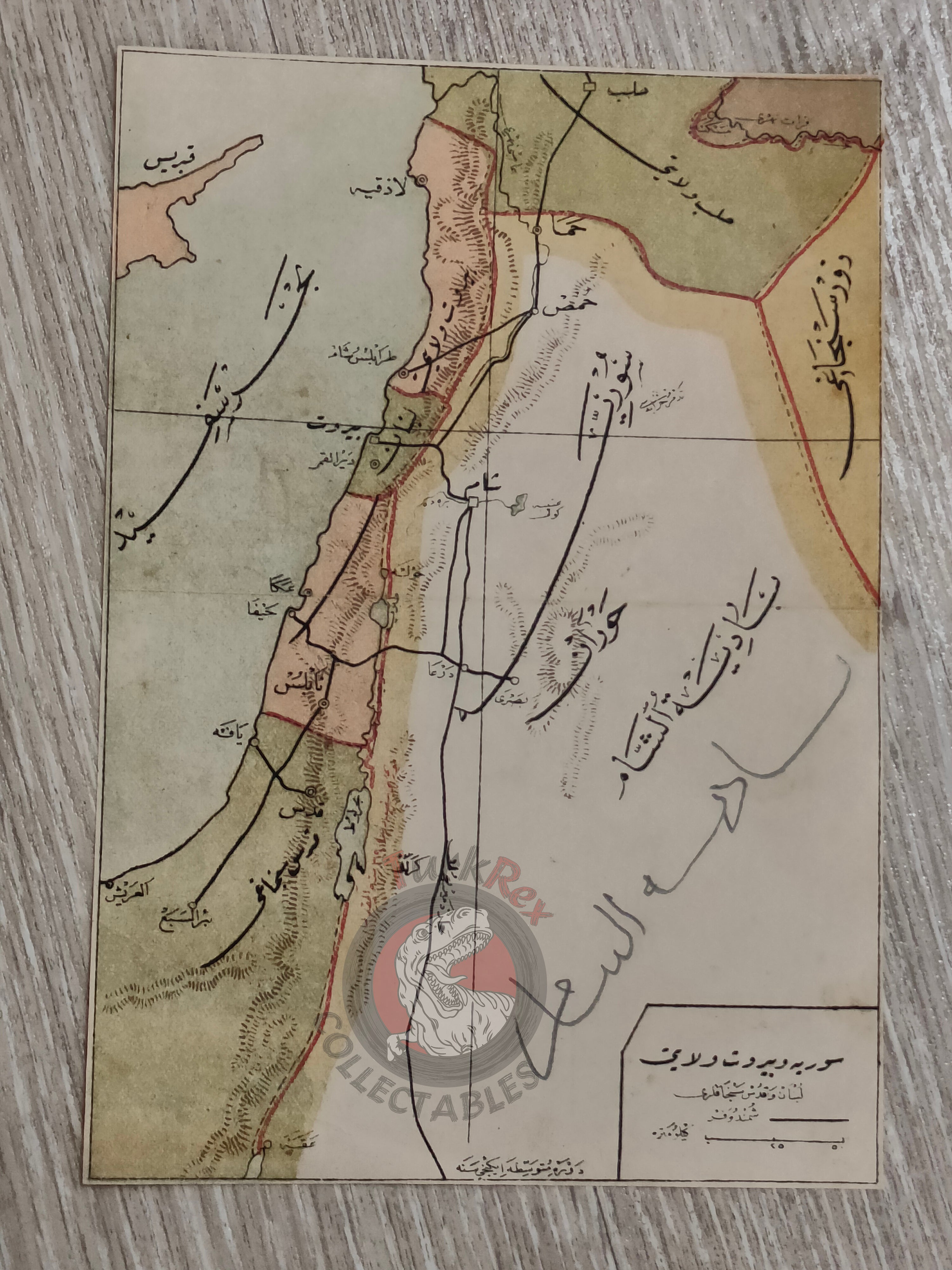
Description:
An Ottoman Turkish school atlas map showing the administrative divisions of the Ottoman Empire in the Middle East, taken from Küçüklere Coğrafya Dersleri (Geography Lessons for Children), written by Safvet Geylangil and published in 1339 AH (1916 CE) by the Matbaa-i Amire (Imperial Printing Press, Istanbul).
The map measures 18.2 × 12.7 cm and was designed for use in elementary-level schools (Mekatib-i İbtidaiye, devre-i mutavassıta, 1st grade), reflecting the educational approach of the late Ottoman Empire.
The map illustrates key Ottoman provincial divisions such as the Syria Vilayet, Jerusalem Sanjak, Lebanon, Aleppo Vilayet, and Zor Sanjak, all integral parts of the empire’s Middle Eastern administration. The Hejaz Railway route is also marked, emphasizing the strategic and infrastructural significance of this line in connecting the empire’s Arab provinces with the capital.
In modern terms, these lands later became the foundation for several states, including Lebanon, Syria, Jordan, Palestine, and Israel.
Key Features:
-
Title: Ottoman Empire – Middle East Administrative Map
-
Author: Safvet Geylangil
-
Source: Küçüklere Coğrafya Dersleri, Mekatib-i İbtidaiye devre-i mutavassıta 1. sınıfa mahsus
-
Publisher: Matbaa-i Amire, Istanbul
-
Date: 1339 AH / 1916 CE
-
Dimensions: 18.2 × 12.7 cm
-
Content: Middle Eastern Ottoman provinces, including Syria Vilayet, Jerusalem Sanjak, Lebanon, Aleppo Vilayet, Zor Sanjak
-
Special Feature: Hejaz Railway route marked
-
Condition: On the reverse side, Ottoman Turkish handwritten notes are present, adding unique historical and collectible value
-
Significance: A rare example of an educational Ottoman school map, combining administrative geography with infrastructural details during the final years of the empire