


Ottoman Empire Physical Map 1914 Palestine Iraq Israel Egypt Middle East
Ottoman Empire Physical Map – Mükemmel ve Mufassal Coğrafya-yı Umumi Atlası (1914)
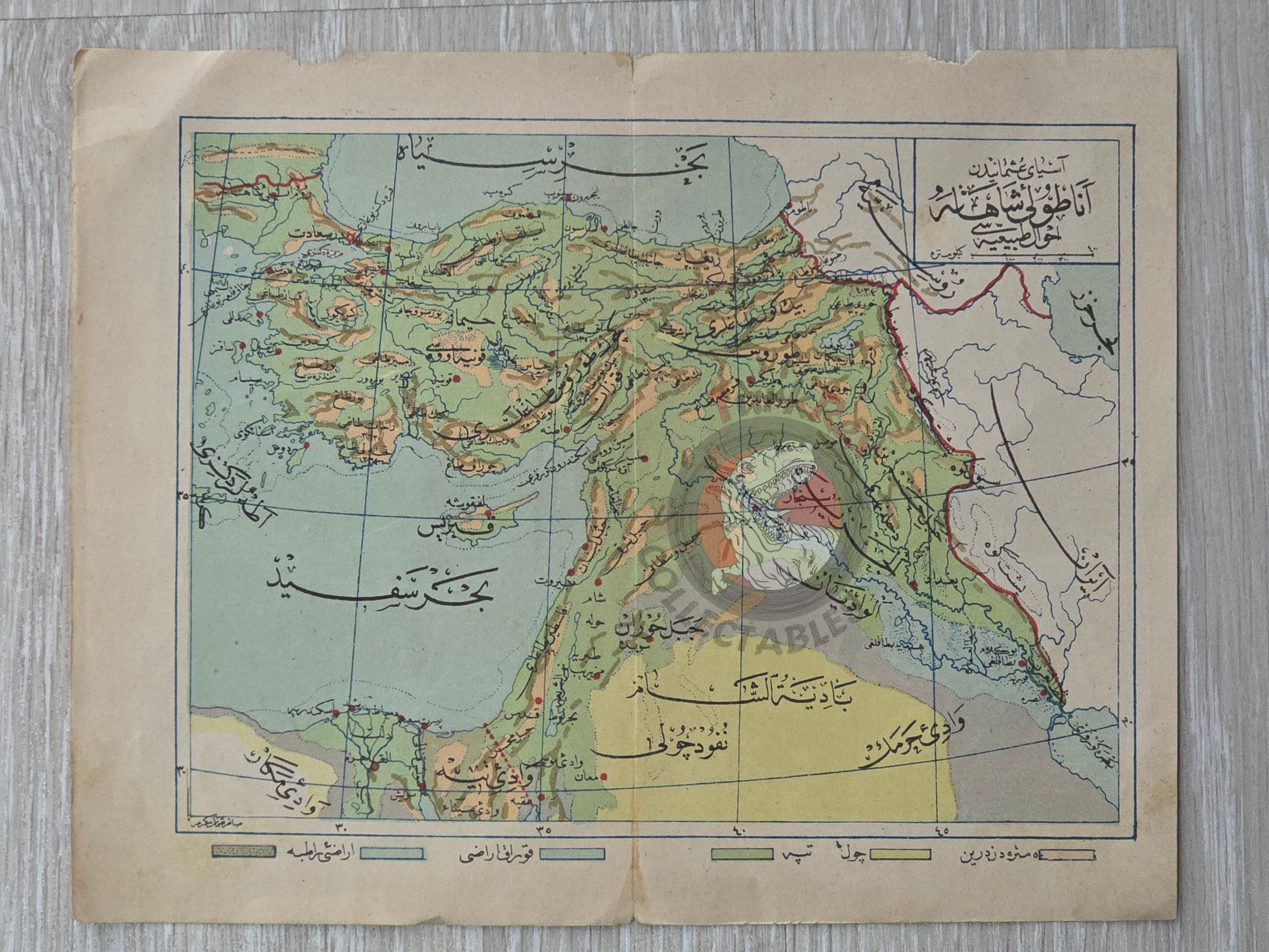
Description:
This Ottoman Turkish physical map illustrates the territories of the Ottoman Empire, highlighting mountains, rivers, and their names. The legend at the bottom provides information on deserts, hills, arid areas, wet areas, and depths over five meters.
The map comes from Mehmed Eşref’s Mükemmel ve Mufassal Coğrafya-yı Umumi Atlası, published in 1330 Hijri (1914) by Artin Asaduryan & Co., an Ottoman Armenian publishing house.
Measuring 22.3 × 17.6 cm, the map shows regions that today encompass multiple modern states, including Palestine, Iraq, Lebanon, Israel, Syria, Jordan, and Egypt. The mountains in the Palestine region are specifically labeled as the “Palestine Mountains.”
Key Features:
-
Depicted Regions: Entire Ottoman Empire territories
-
Physical Features: Mountains, rivers, deserts, hills, arid and wet areas, depths over five meters
-
Publication: Mehmed Eşref, Mükemmel ve Mufassal Coğrafya-yı Umumi Atlası, 1914
-
Publisher: Artin Asaduryan & Co., Istanbul (Ottoman Armenian publishing house)
-
Dimensions: 22.3 × 17.6 cm
-
Significance: A detailed historical atlas map showing topography and terrain of the Ottoman Empire, offering insight into the geography of regions that are now multiple independent nations.