


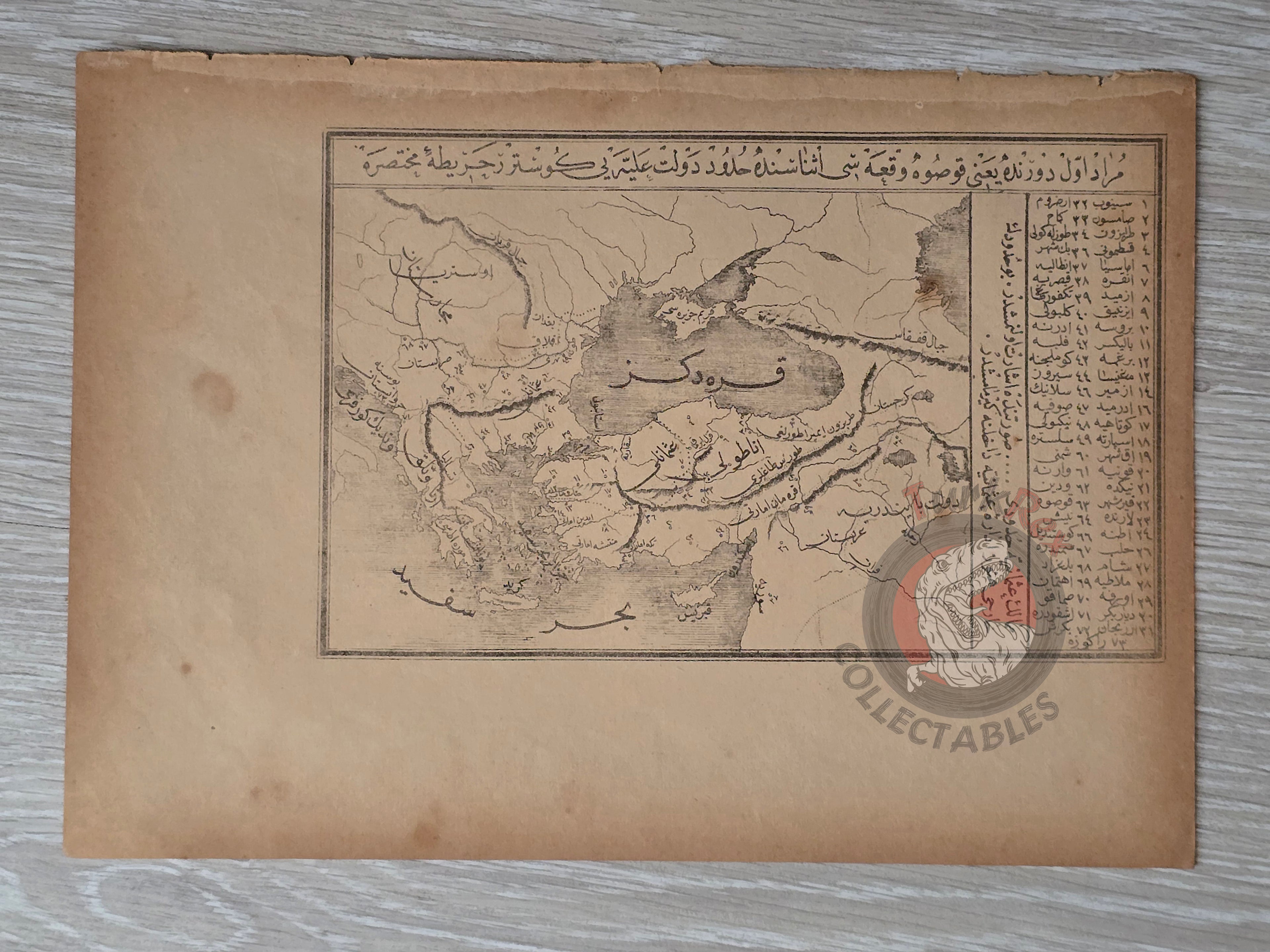


Ottoman Map of the Empire during the Reign of Murad I 1888 Europe Asia Middle East
Ottoman Map of the Empire during the Reign of Murad I - From Mufassal Tarih-i Kanun-ı Cedid by Ahmed Midhat (1305 AH / 1888 CE)
Description:
An Ottoman Turkish historical map depicting the territorial extent of the Ottoman Empire under Sultan Murad I (r. 1362–1389), specifically during the Battle of Kosovo (1389). The map illustrates the empire’s European and Asian lands at the time, highlighting its early expansion into the Balkans.
Published in 1305 AH (1888 CE) in Ahmed Midhat’s Mufassal Tarih-i Kanun-ı Cedid, the map was printed in Istanbul by the Tercüman-ı Hakikat Press. Measuring 27 × 19.4 cm, it was part of a richly illustrated history book intended for a broad Ottoman readership, combining narrative history with visual cartography to make the empire’s past more accessible.
Key Features:
-
Period Depicted: Reign of Sultan Murad I (Kosovo Campaign, 1389)
-
Region: Ottoman territories in Europe and Asia
-
Date of Publication: 1305 AH / 1888 CE
-
Source: Mufassal Tarih-i Kanun-ı Cedid by Ahmed Midhat
-
Publisher: Tercüman-ı Hakikat Matbaası, Istanbul
-
Dimensions: 27 × 19.4 cm
-
Format: Historical atlas map within a narrative history book
-
Significance: Rare Ottoman historical map combining text and cartography, reflecting both educational and popular interest in Ottoman expansion during the late 19th century