


Ottoman Maps of Italy 1915 WW1 Military Press Fortifications amd Ports Empire
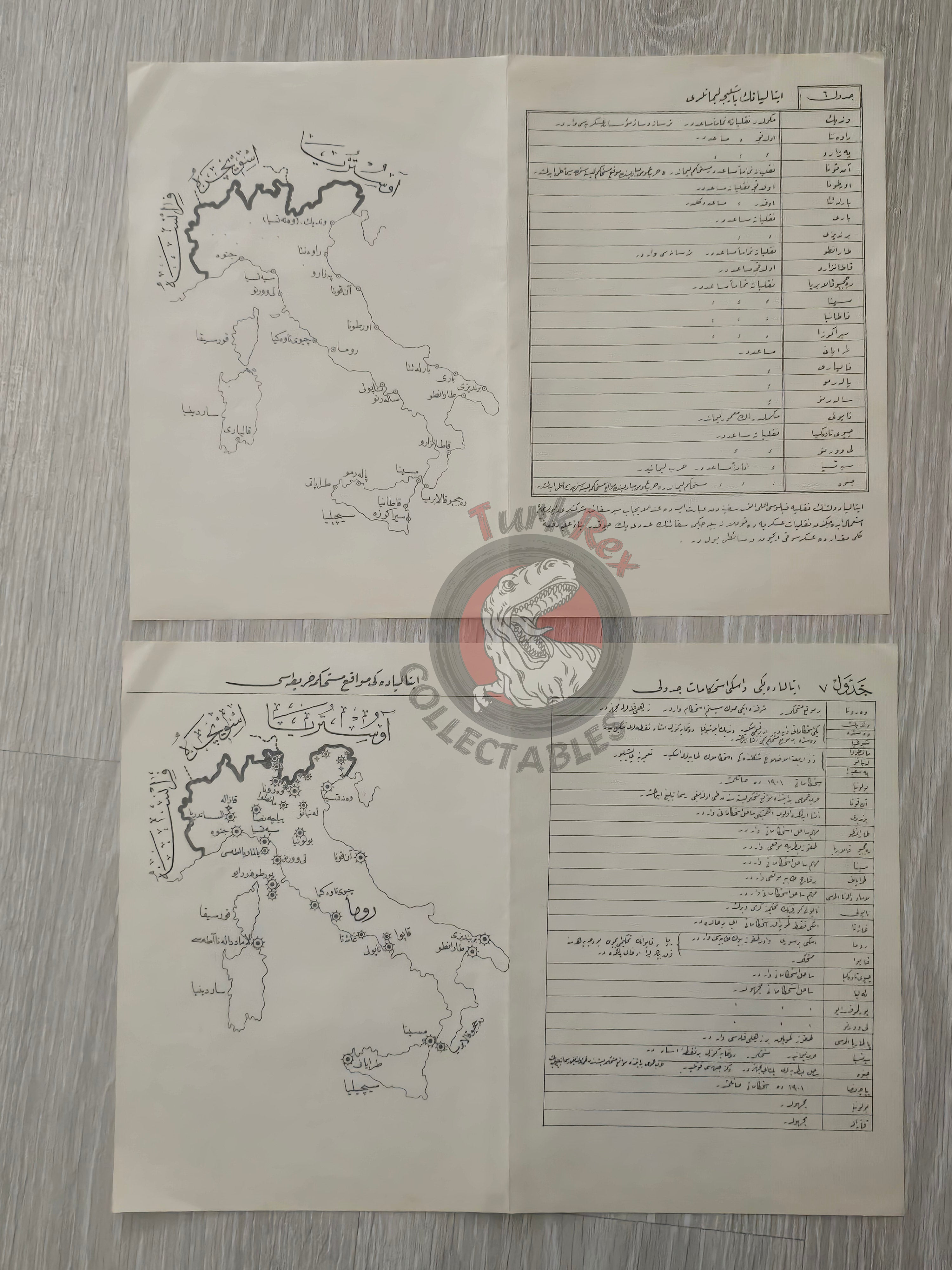
Ottoman Maps of Italy – Yeni ve Eski İstihkamat Cedveli & İtalya’nın Başlıca Limanları (1331 AH / 1915)
Description:
A pair of Ottoman Turkish maps depicting Italy, one titled “Yeni ve Eski İstihkamat Cedveli” (New and Old Fortifications) and the other “İtalya’nın Başlıca Limanları” (Major Ports of Italy), both published in 1331 AH (1915 CE) as part of a military reference book İtalya Ordusu.
Produced by Matbaa-i Askeriye, these maps were intended for military training during World War I, serving as educational tools for Ottoman army officers.
Each map measures 33.9 × 24.3 cm and provides detailed geographic and strategic information, including fortifications, ports, and key regional features, reflecting the military knowledge and cartographic standards of the Ottoman army during the early 20th century.
Key Features:
-
Region: Italy – Fortifications & Major Ports
-
Date: 1331 AH (1915 CE)
-
Source: İtalya Ordusu (Ottoman Military Reference Book)
-
Publisher: Matbaa-i Askeriye
-
Dimensions: 33.9 × 24.3 cm each
-
Purpose: Military training and educational use for Ottoman officers during World War I
-
Significance: Rare Ottoman military maps offering strategic insights from the WWI era