


Poland Ottoman Atlas Map Empire Estonia Lithuania Eastern Europe Ukraine
Ottoman Map of Poland (Lehistan) – Early 20th Century Educational Atlas
Description:
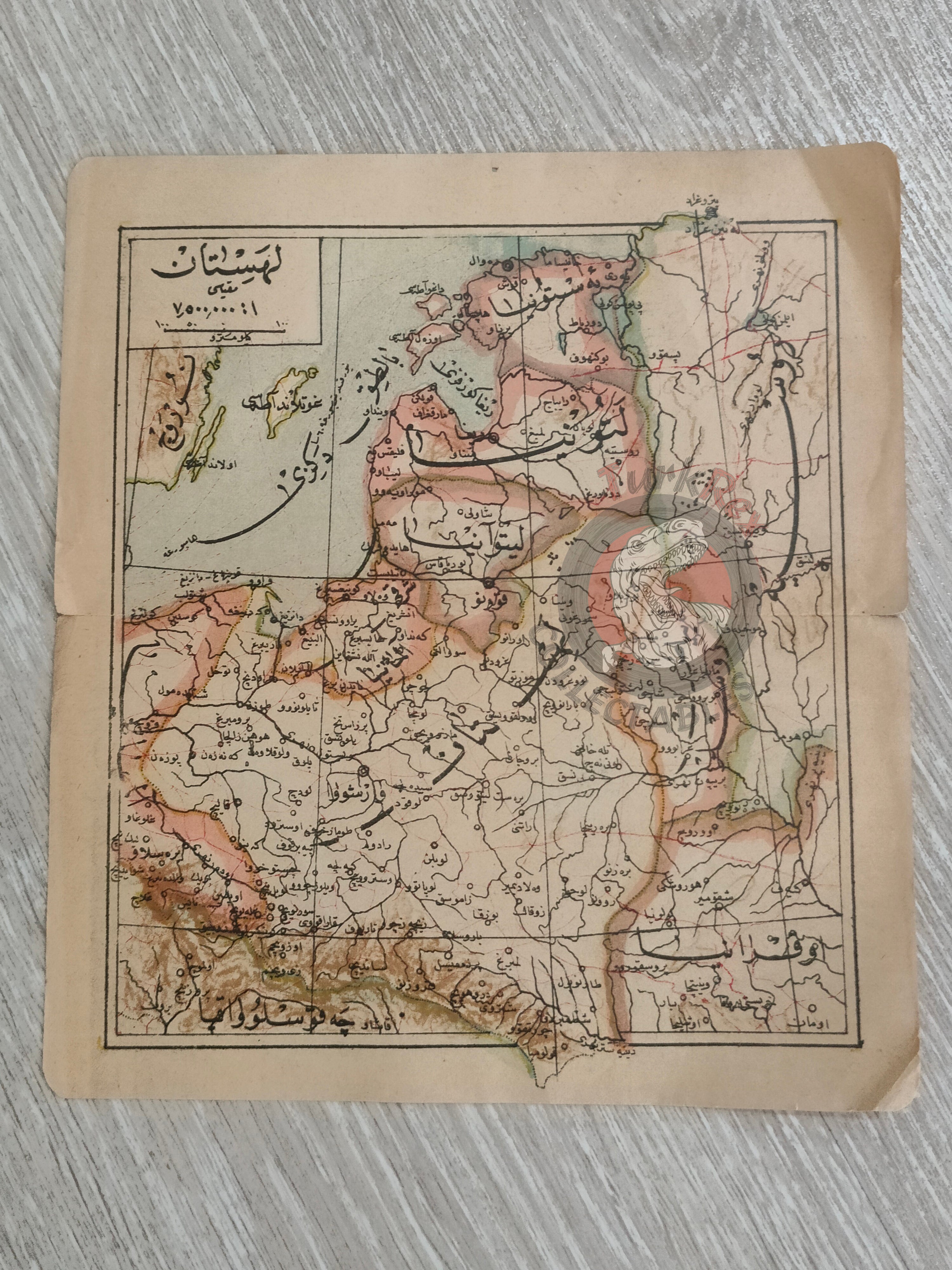
An Ottoman Turkish map of Lehistan (Poland), likely dating to the late 1910s or early 1920s, produced for use in Ottoman/Turkish educational atlases. Measuring 20 × 17.8 cm, the map depicts Poland along with surrounding regions, including Lithuania, Estonia, parts of Czechoslovakia, Russia, and Ukraine.
The map reflects the political and territorial complexities of Eastern Europe during the early 20th century, a period marked by shifting borders following World War I and the eventual re-establishment of Poland as an independent state in 1918. As an Ottoman-script educational map, it offers valuable insight into how geography was taught in the late Ottoman and early Republican transition period.
Key Features:
- Region: Poland (Lehistan), with parts of Lithuania, Estonia, Czechoslovakia, Russia, and Ukraine
- Date: ca. late 1910s – early 1920s
- Language: Ottoman Turkish (Arabic script)
- Dimensions: 20 × 17.8 cm
- Purpose: Educational atlas map used in schools
- Significance: A rare example of early 20th-century Ottoman/Turkish cartography reflecting the shifting borders of Eastern Europe