


Rumelia 1906 Ottoman Atlas Map Empire Greece Bulgaria Albenia Montenegro Serbia Balkans
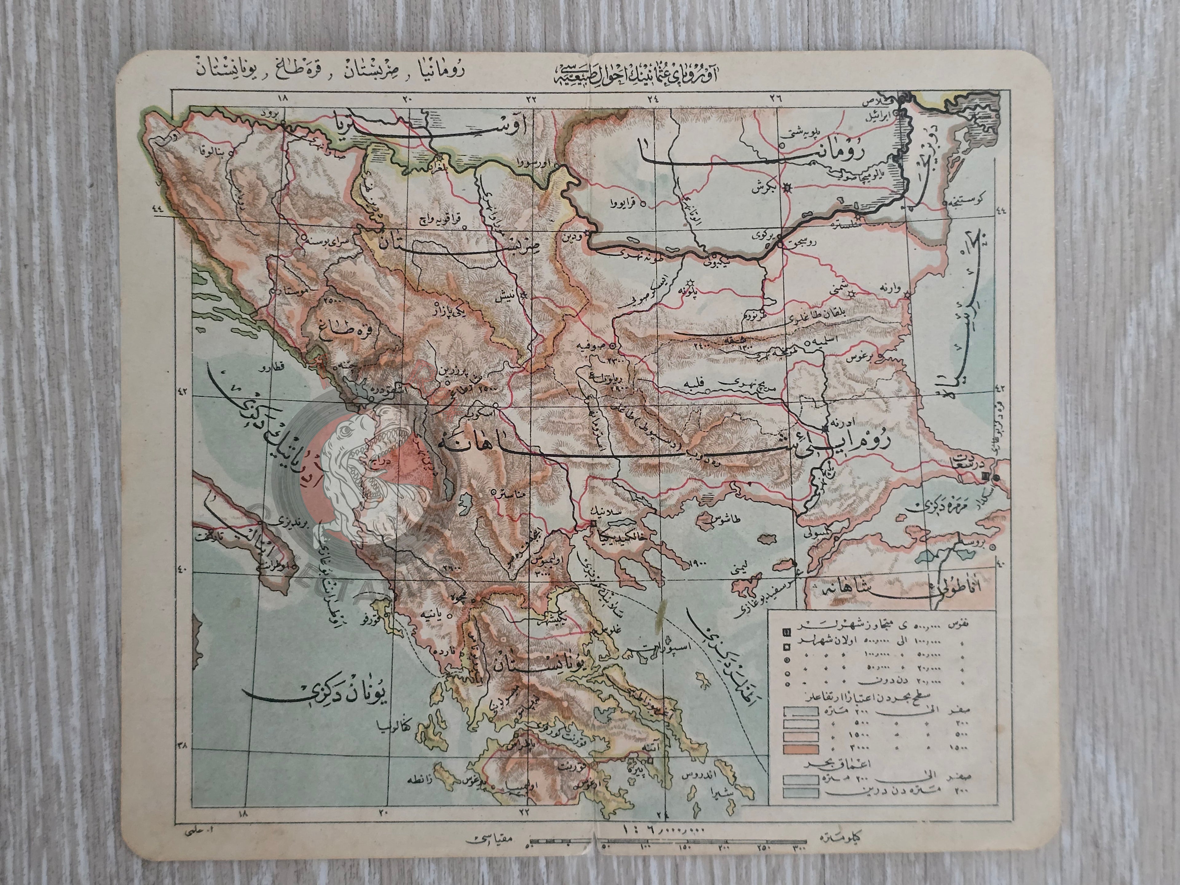
Title: Ottoman Map – Avrupa-i Osmaniyenin Ahvâl-i Tabîiyyesi (Natural Features of Ottoman Europe) – From Tüccarzade İbrahim Hilmi’s Umumi Cep Atlası (1906)
Description:
An original Ottoman Turkish map titled “Avrupa-i Osmaniyenin Ahvâl-i Tabîiyyesi: Romanya, Sırbistan, Karadağ, Bulgaristan”, published in 1324 AH (1906 CE) as part of Tüccarzade İbrahim Hilmi’s Umumi Cep Atlası (Universal Pocket Atlas). Printed in Istanbul, the map measures 20 × 17 cm and depicts the Balkans and surrounding Ottoman territories, including Greece, Bulgaria, Albania, and Serbia.
The map focuses on the natural and geographical features of Ottoman Europe, situating the empire within the changing Balkan landscape on the eve of the Balkan Wars (1912–13). Such maps were crucial for students, merchants, and officials seeking to understand both the Ottoman domains and neighboring states during a time of rapid political transformation.
Tüccarzade İbrahim Hilmi, one of the most active publishers of the late Ottoman period, created compact educational atlases that brought modern cartography into everyday Ottoman life. Surviving examples of these maps are relatively rare, as they were heavily used and circulated in pocket-sized atlases.
Key Features:
- Date: 1324 AH (1906 CE)
- Title: Avrupa-i Osmaniyenin Ahvâl-i Tabîiyyesi – Romanya, Sırbistan, Karadağ, Bulgaristan
- Source: Umumi Cep Atlası by Tüccarzade İbrahim Hilmi
- Place of Publication: Istanbul
- Dimensions: 20 × 17 cm
- Region Depicted: Balkans and surrounding areas, including Greece, Bulgaria, Albania, and the Aegean islands
- Historical Context: Shows the Ottoman perception of European territories during the years leading up to the Balkan Wars
- Cultural Significance: Rare survival from an Ottoman pocket atlas, illustrating the empire’s embrace of modern cartography for education and public use