


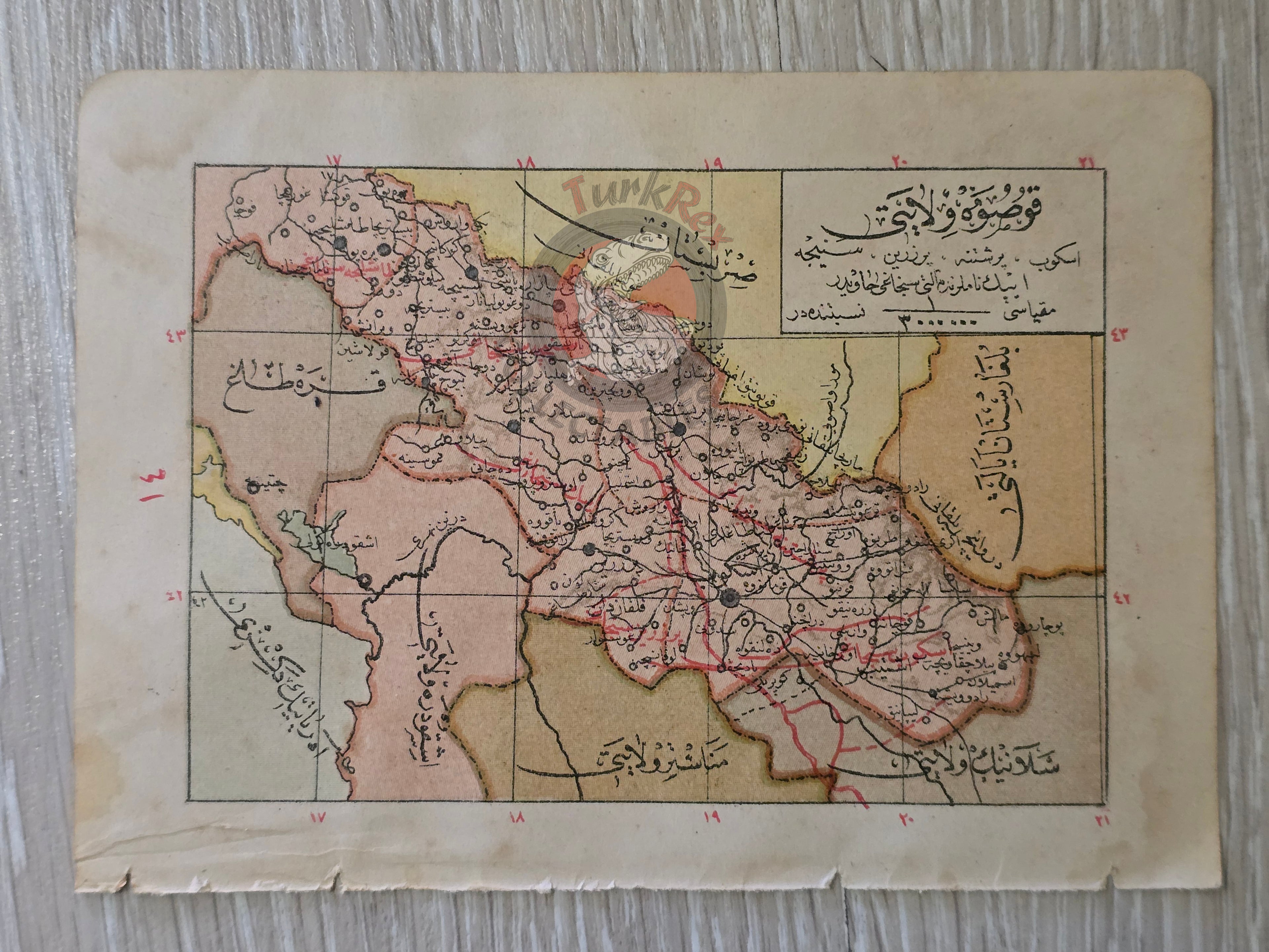


Salonica and Kosovo Vilayet 1905 Ottoman Empire Map Balkans Greece Albania Serbia
Ottoman Double Sided Map - Manastır Vilayeti & İşkodra (Scutari) Vilayeti (1323 AH / 1905 CE)
Description:
A rare double-sided Ottoman Turkish map featuring Selanik (Salonica) Vilayeti on one side and Kosova Vilayeti on the other. Published in 1323 AH (1905 CE) as part of Tüccarzade İbrahim Hilmi’s Memalik-i Osmaniye Ceyb Atlası, the map was printed in Istanbul by the Kitabhane-i Islam ve Askeri publishing house.
Measuring 16 × 11.5 cm, this compact atlas map reflects the Ottoman Empire’s effort to provide accessible geographic knowledge to a broad audience. Tüccarzade İbrahim Hilmi, one of the most prolific Ottoman publishers of the late 19th and early 20th centuries, was instrumental in popularizing modern cartography and educational materials throughout the empire.
The Vilayet Of Salonica was a first-level administrative division (vilayet) of the Ottoman Empire from 1867 to 1913. This dual-sided map is a significant historical artifact, showcasing the administrative geography of the late Ottoman Balkans.
Key Features:
-
Regions: Salonica Vilayeti (modern Greece, Thessaloniki)
& Kosova Vilayeti (modern Kosovo, Serbia
-
Date: 1323 AH / 1905 CE
-
Source: Memalik-i Osmaniye Ceyb Atlası by Tüccarzade İbrahim Hilmi
-
Publisher: Kitabhane-i Islam ve Askeri, Istanbul
-
Dimensions: 16 × 11.5 cm
-
Significance: Double-sided Ottoman atlas map illustrating the Balkan provinces of the empire in the early 20th century