


Siam and Indochina 1895 Ottoman Atlas Map Empire Thailand Myanmar Vietnam Malaysia
Ottoman Turkish Map of Siam and Indochina - from Yeni Coğrafya Atlasi (1895)
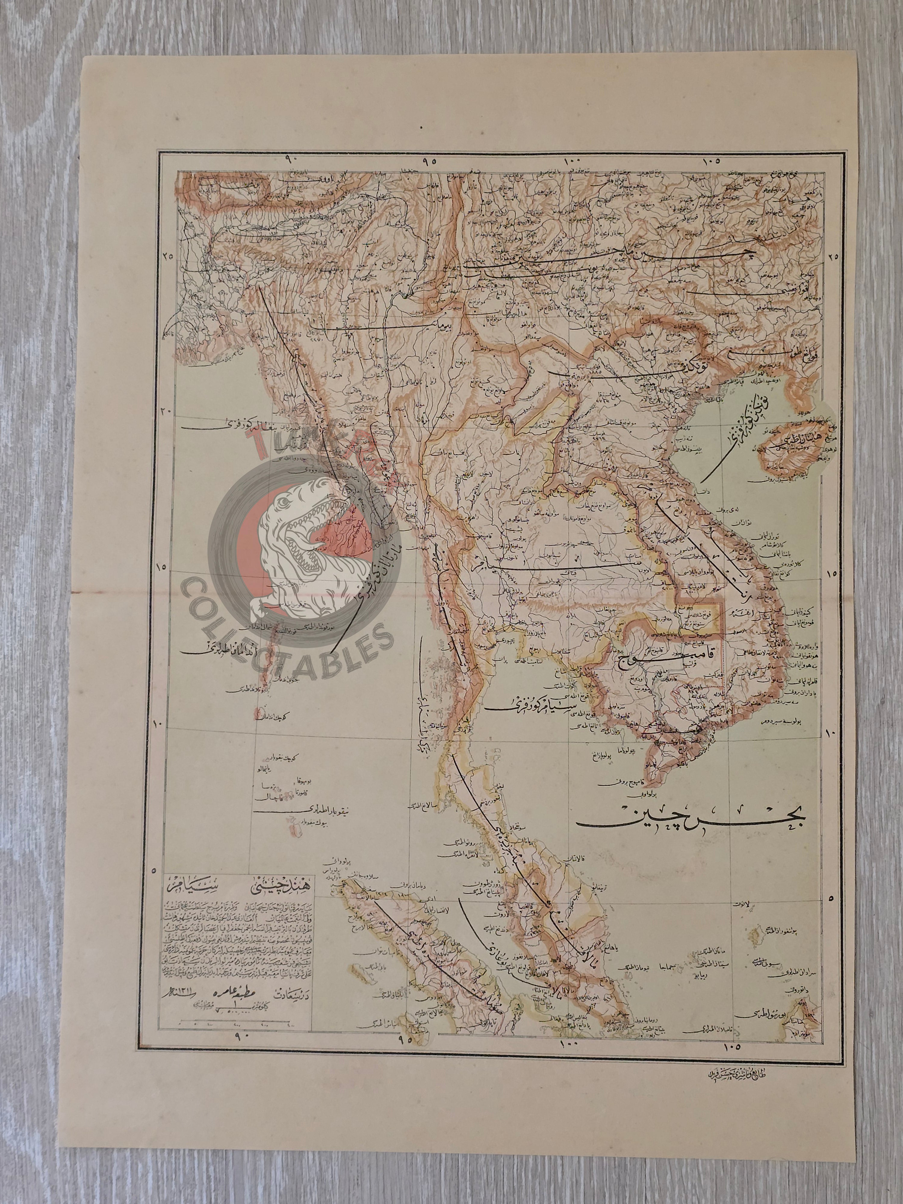
Description:
A large Ottoman Turkish map of Southeast Asia, titled Siyam ve Hind-i Çin, measuring 51 × 36 cm. Published in 1311 AH (1895 CE), the map forms part of the “Yeni Coğrafya Atlasi” (New Geographical Atlas), edited by Ali Şeref Paşa and Hafız Ali Eşref. It was printed by Hasan Ferid at the Matbaa-i Âmire in Istanbul.
The map covers the Indochina Peninsula, Siam (modern Thailand), Burma (Myanmar), Cambodia, Vietnam, and Laos, as well as the Malay Peninsula and parts of the South China Sea. It provides a rare late 19th-century Ottoman view of this strategically and commercially significant region.
The Yeni Coğrafya Atlasi was one of the most ambitious cartographic projects of the Ottoman Empire, comprising 42 double-page lithographed color maps produced between 1893–1898 (1309–1314 AH). It reflected the Empire’s broadening geographic and political horizons during a period of reform and modernization.
Ali Şeref Paşa, one of the editors, was a former soldier who trained as a cartographer in Paris before becoming chief cartographer at the Matbaa-i Âmire, successor to İbrahim Müteferrika’s pioneering press founded in 1727. His European training and experience shaped the scientific style and precision of late Ottoman cartography.
Key Features:
-
Title/Subject: Siam (Thailand) & Indochina
-
Publication Date: 1311 AH (1895 CE)
-
Atlas: Yeni Coğrafya Atlasi (New Geographical Atlas)
-
Editors: Ali Şeref Paşa & Hafız Ali Eşref
-
Printer: Hasan Ferid
-
Publisher: Matbaa-i Âmire, Istanbul
-
Dimensions: 51 × 36 cm
-
Content: Covers Siam (Thailand), Burma (Myanmar), Cambodia, Vietnam, Laos, and the Malay Peninsula
-
Technique: Lithographed color map
-
Significance: Rare Ottoman atlas map of Southeast Asia, reflecting both imperial geographic awareness and European-influenced cartographic techniques