


South America 1906 Ottoman Atlas Map Empire Antilles Tüccarzade İbrahim Hilmi
Ottoman Turkish Map - South America (Umumi Cep Atlası, 1906)
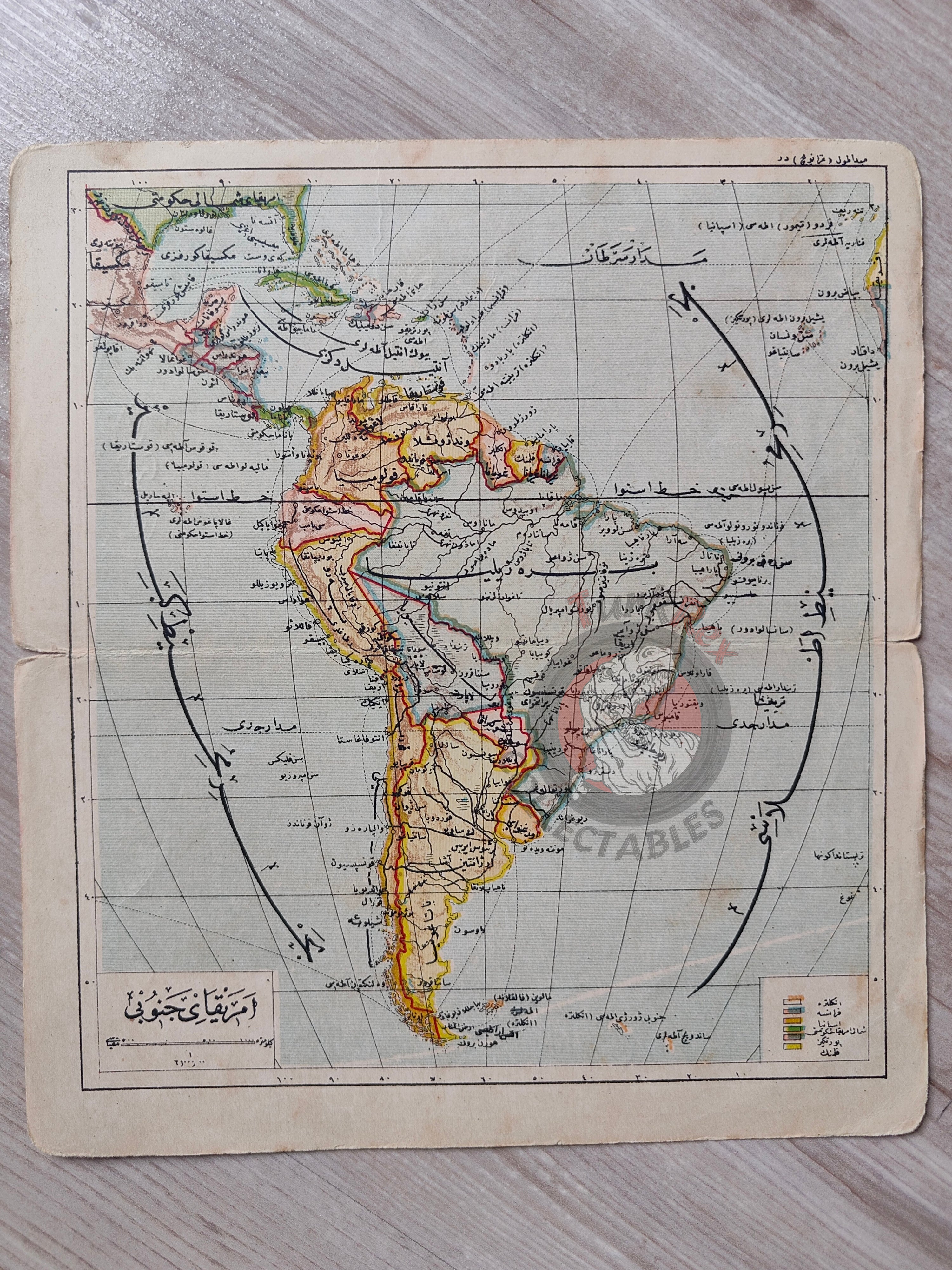
Description:
An Ottoman Turkish map of South America, published in Tüccarzade İbrahim Hilmi’s Umumi Cep Atlası, printed in 1324 AH (1906 CE).
The map measures 19.1 × 17.3 cm and depicts the geography of South America in the early 20th century. Major countries are labeled in Ottoman Turkish, including Brazil, Venezuela, Colombia, Guyana, Peru, Chile, Argentina, and Bolivia. The Antilles region is also visible, with Cuba clearly marked.
As part of the Umumi Cep Atlası, this map reflects the Ottoman effort to make world geography accessible to a broad readership, presenting faraway continents in a compact and educational format.
Key Features:
-
Title/Subject: South America
-
Author/Publisher: Tüccarzade İbrahim Hilmi
-
Source: Umumi Cep Atlası
-
Date: 1324 AH / 1906 CE
-
Dimensions: 19.1 × 17.3 cm
-
Geographic Coverage: South America and the Antilles
-
Content: Includes Brazil, Venezuela, Colombia, Guyana, Peru, Chile, Argentina, Bolivia, and Cuba
-
Significance: Rare Ottoman atlas map of South America, showing global geographic awareness in the late Ottoman period