


Spain and Portugal 1928 Ottoman Script Atlas Map Empire Europe
Ottoman Turkish Map – Spain and Portugal (Cumhuriyyet-i Cihan Atlası, 1928)
Description:
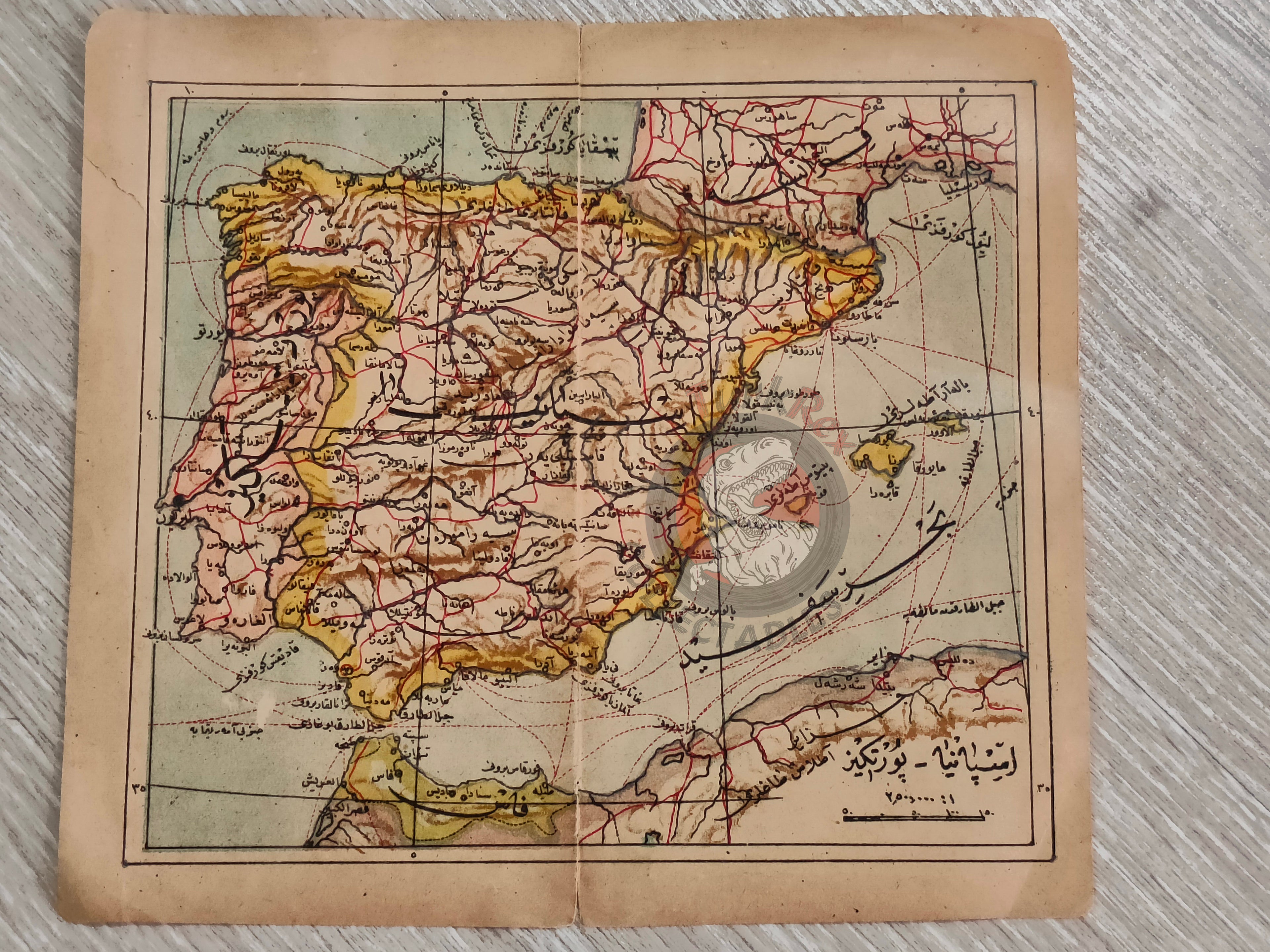
An Ottoman Turkish map of Spain and Portugal, published in the Cumhuriyyet-i Cihan Atlası. The atlas was printed in 1928 in Istanbul by Selamet Matbaası.
The map measures 19.9 × 18.1 cm and shows the Iberian Peninsula, including Spain, Portugal, and surrounding regions. The Strait of Gibraltar is clearly visible, along with portions of Morocco (Fas) and southern France.
Although produced during the early Turkish Republic, the map is still written in Ottoman Turkish using the Arabic script, as the Alphabet Reform (Harf Devrimi) had not yet taken effect at the time of publication.
This piece reflects a transitional moment in Turkish cartographic history, bridging the late Ottoman cartographic tradition and the early Republican period.
Key Features:
-
Title/Subject: Spain and Portugal (Iberian Peninsula)
-
Source: Cumhuriyyet-i Cihan Atlası
-
Publisher: Selamet Matbaası, Istanbul
-
Date: 1928 CE (pre-Alphabet Reform)
-
Dimensions: 19.9 × 18.1 cm
-
Geographic Coverage: Spain, Portugal, Strait of Gibraltar, parts of Morocco and France
-
Language: Ottoman Turkish (Arabic script)
-
Significance: Rare early Republican-era atlas map; produced just before the Alphabet Reform, retaining Ottoman script