


Turkey Administrative Divisions 1928 Ottoman Atlas Map Faik Sabri Middle East Western Anatolia
Ottoman Turkish Double-Sided Map of Turkey - Administrative Divisions / Western Anatolia & Temperature Maps - from Orta Atlas by Faik Sabri Duran (1928)
Description:
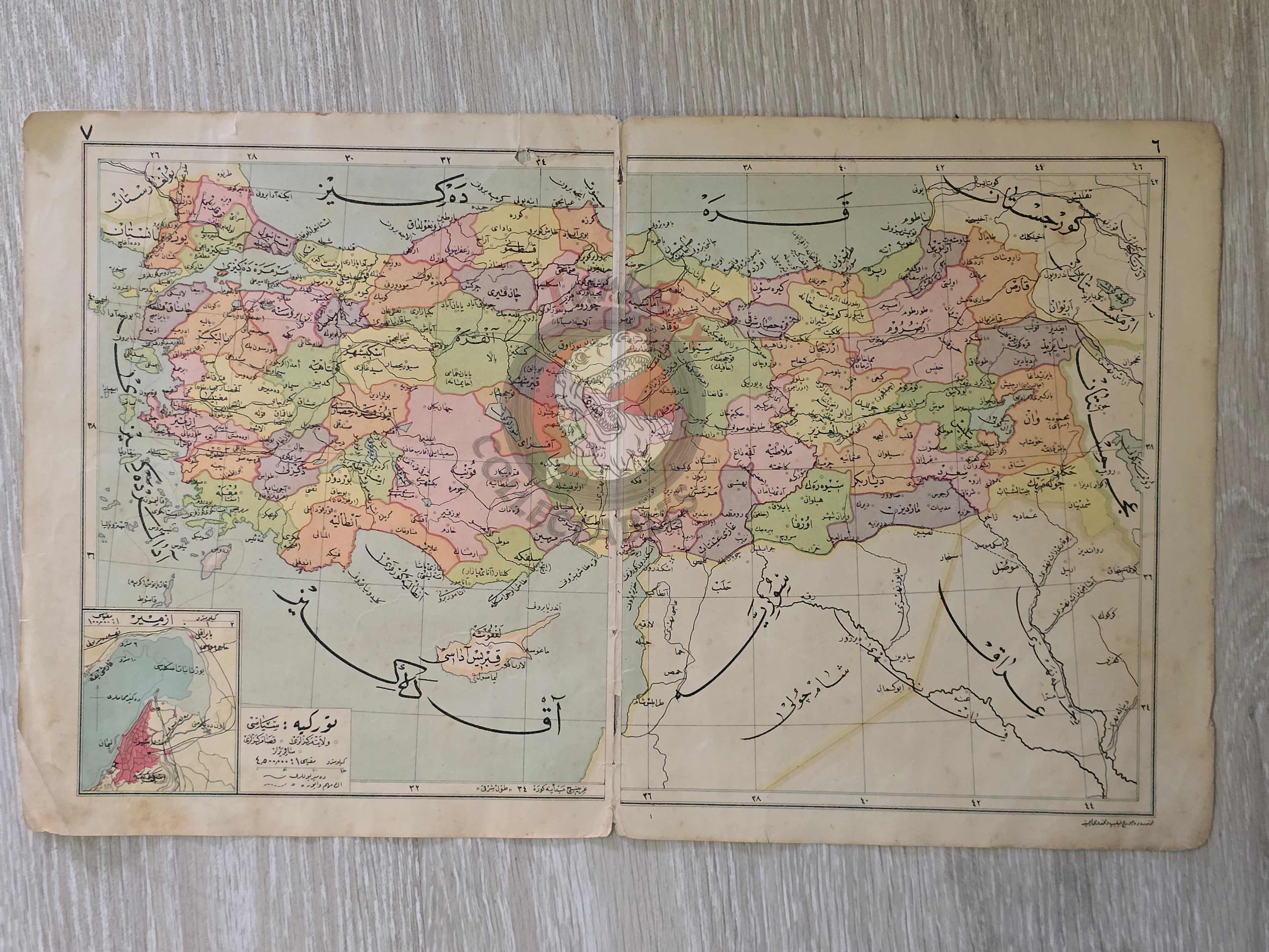
A double-sided Ottoman Turkish atlas sheet, measuring 45.5 × 27.7 cm, from Faik Sabri Duran’s “Orta Atlas” (Middle Atlas), published in Istanbul, 1928 by Kanaat Kütüphanesi.
Although printed during the Republican period, the atlas was produced in the Arabic-based Ottoman script, as it preceded the Alphabet Reform of November 1, 1928, when the Latin alphabet officially replaced Ottoman script. This makes the atlas one of the last geographical works of its kind in Ottoman Turkish.
On one side, the map presents the Political-Administrative Map of Turkey, showing provincial (vilayet) and district (kaza) centers, with clearly marked administrative boundaries.
On the reverse side, there are four separate maps:
-
Western Anatolia (Batı Anadolu Haritası) – depicting the geography and settlement patterns of the region.
2–4. Temperature Maps of Turkey (Türkiye Sıcaklık Haritaları) – illustrating climatic conditions during three different periods, providing comparative insight into seasonal and regional variations.
The author, Faik Sabri Duran (1882–1943), was a leading Turkish geographer, writer, and educator. After completing his studies at the Sorbonne (1908–1912), he introduced modern geographical instruction at Istanbul Darülfünun. Awarded ten medals by Sultan Abdülhamid II, Duran became synonymous with geography in Turkey, producing numerous atlases, textbooks, and travel works, with the Orta Atlas being one of his most influential contributions.
Key Features:
-
Title/Subject: Administrative Map of Turkey / Western Anatolia & Three Temperature Maps
-
Publication Date: 1928 (pre-Alphabet Reform)
-
Atlas: Orta Atlas (Middle Atlas)
-
Author/Editor: Faik Sabri Duran (1882–1943)
-
Publisher: Kanaat Kütüphanesi, Istanbul
-
Language: Ottoman Turkish (Arabic script)
-
Dimensions: 45.5 × 27.7 cm
-
Coverage:
-
Turkey with vilayet and kaza centers (administrative divisions)
-
Western Anatolia map
-
Three temperature/climate maps of Turkey
-
-
Significance: A rare double-sided Ottoman-script atlas map, combining administrative geography with regional and climatic studies, published on the eve of the Alphabet Reform.