


World Map Political Divisions with National Flags 1928 Ottoman Atlas Map Faik Sabri
Ottoman Turkish Double-Sided World Map Political Divisions with National Flags / Rainfall, Population & Hemispheres - from Orta Atlas by Faik Sabri Duran (1928)
Description:
A double-sided Ottoman Turkish atlas sheet, measuring 45.5 × 27.7 cm, from Faik Sabri Duran’s “Orta Atlas” (Middle Atlas), published in Istanbul, 1928 by Kanaat Kütüphanesi.
Although produced during the Republican era, the atlas was printed in the Arabic-based Ottoman script, as it predates the Alphabet Reform of November 1, 1928, when Ottoman letters were replaced by the modern Turkish Latin alphabet.
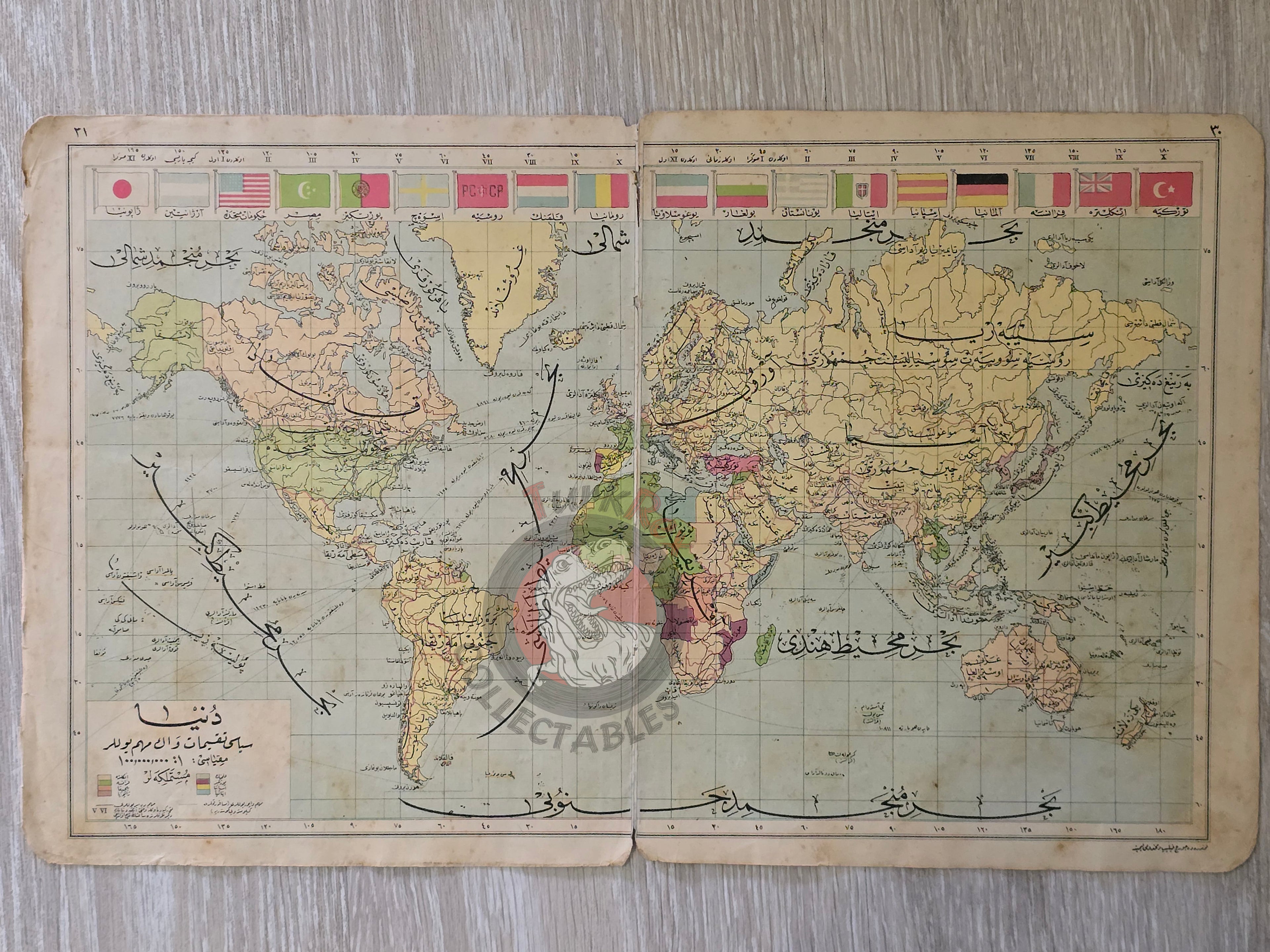
On one side, the map presents the Political Division of the World and Main Routes (Dünya Siyasi Taksimat ve En Mühim Yollar), enhanced with a decorative feature: national flags of major countries including Japan, the United States, Germany, Russia, Portugal, France, Argentina, and others.
On the reverse side, there are four thematic world maps:
-
World Map of Summer Rainfall (Dünya Yaz Yağmurları Haritası)
-
World Map of Winter Rainfall (Dünya Kış Yağmurları Haritası)
-
World Population Density Map (Dünya Nüfus Yoğunluğu Haritası)
-
World Map in Two Hemispheres (Dünya İki Yarım Küre Haritası)
The author, Faik Sabri Duran (1882–1943), was a pioneering Turkish geographer, writer, and educator. Educated at the Sorbonne (1908–1912), he introduced modern geography education at Istanbul Darülfünun and was decorated with ten medals by Sultan Abdülhamid II. Widely regarded as the foremost name in Turkish geography, he authored numerous atlases, textbooks, and travel works, with the Orta Atlas being among his most significant contributions.
Key Features:
-
Title/Subject: World Political Divisions & Major Routes / Thematic World Maps (Rainfall, Population, Hemispheres)
-
Publication Date: 1928 (pre-Alphabet Reform)
-
Atlas: Orta Atlas (Middle Atlas)
-
Author/Editor: Faik Sabri Duran (1882–1943)
-
Publisher: Kanaat Kütüphanesi, Istanbul
-
Language: Ottoman Turkish (Arabic script)
-
Dimensions: 45.5 × 27.7 cm
-
Coverage:
-
Political map of the world with national flags
-
Thematic maps of rainfall, population density, and hemispheres
-
-
Significance: A rare double-sided Ottoman-script world atlas sheet, uniquely illustrated with national flags and thematic maps, published on the eve of the Turkish Alphabet Reform.