


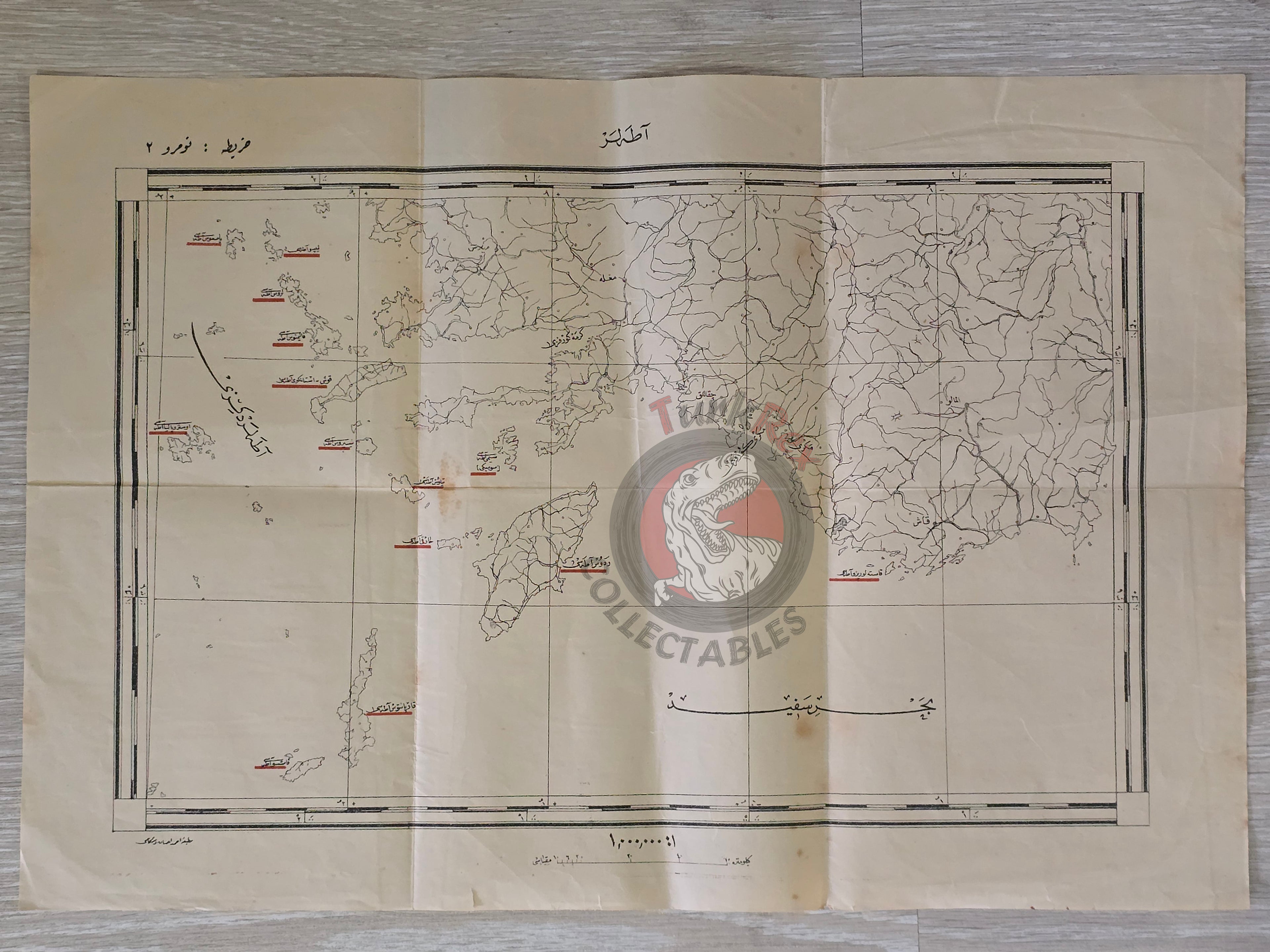


Aegean Islands Greece 1924 Ottoman Script Map The Lausanne Conference Crete Rhodes
Title: Ottoman Turkish Map of the Aegean Islands - From Şark-ı Karîb Umûru Hakkında Lozan Konferansı (1924)
Description:
An original map of the Aegean Islands, published in 1340 AH (1924 CE) in the book Şark-ı Karîb Umûru Hakkında Lozan Konferansı, 1922–1923: Konferansda Tezekkür Olunan Senedât Mecmûası (“On Eastern Affairs: The Lausanne Conference, 1922–1923 – Collection of Documents Discussed at the Conference”). The book was printed in Istanbul by Matbaa-i Ahmed İhsan ve Şürekâsı, a leading Ottoman Turkish publishing house of the early 20th century.
Measuring 49.7 × 33.8 cm, this large-format map is one of several included in the volume, which illustrated the new borders and territorial arrangements following the Treaty of Lausanne (1923). This particular sheet focuses on the Aegean Islands, a critical area of negotiation in defining the maritime and territorial boundaries of the newly established Republic of Turkey.
Such maps are of great historical importance, as they document the transition from the Ottoman Empire to the modern Turkish state, and they represent the official perspective presented during and after the Lausanne Peace Conference.
Key Features:
- Date: 1340 AH (1924 CE)
- Title/Region: Aegean Islands (Adalar Haritası)
- Source: Şark-ı Karîb Umûru Hakkında Lozan Konferansı, 1922–1923
- Publisher: Matbaa-i Ahmed İhsan ve Şürekâsı, Istanbul
- Dimensions: 49.7 × 33.8 cm
- Historical Context: Produced in the aftermath of the Lausanne Peace Conference, showing new borders and territorial arrangements of modern Turkey
- Cultural Significance: Rare survival of a transitional map documenting the birth of the Turkish Republic and its maritime frontiers