


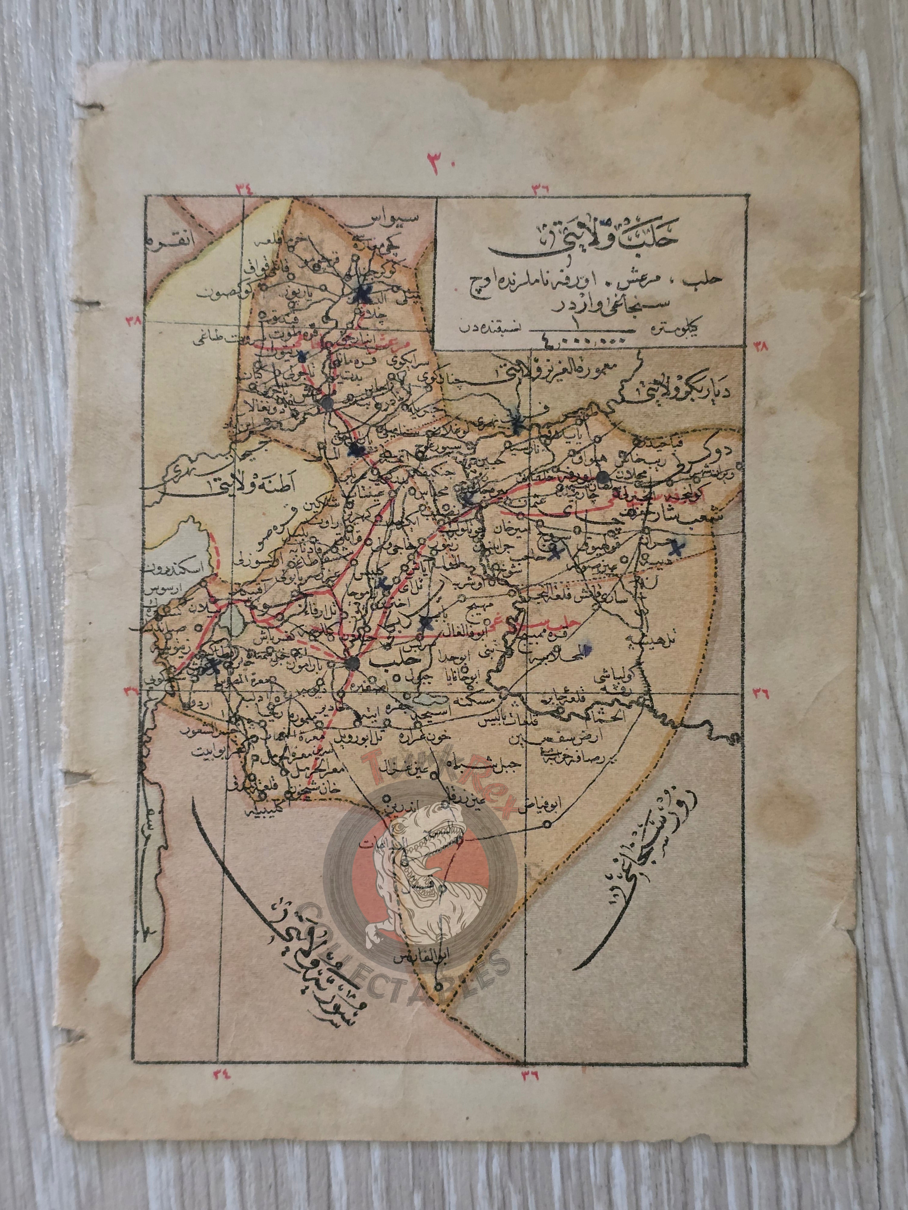


Aleppo and Adana Vilayet 1905 Ottoman Empire Map Middle East Syria
Ottoman Double-Sided Map of Aleppo & Adana - From Memâlik-i Osmaniye Ceyb Atlası (1905)
Description:
An original double-sided Ottoman Turkish map, showing Halep Vilayeti (Aleppo Province) on one side and Adana Vilayeti on the reverse. Published in 1323 AH (1905 CE) as part of Memâlik-i Osmaniye Ceyb Atlası (“Pocket Atlas of Ottoman Lands”), authored by Tüccarzade İbrahim Hilmi and printed in Istanbul by Kitabhane-i İslam ve Askerî.
Measuring 11.8 × 16.1 cm, this small-format atlas sheet was designed for portability and everyday reference. The atlas, one of the earliest Ottoman attempts at a comprehensive pocket atlas, provided geographic and administrative information on the provinces of the empire at the dawn of the 20th century.
This map is particularly significant as it documents the provincial borders and administrative geography of the Ottoman Empire in the early 1900s, just a decade before World War I and the dramatic political changes that reshaped the Middle East.
Key Features:
- Date: 1323 AH (1905 CE)
- Title/Region: Halep Vilayeti (Aleppo) / Adana Vilayeti (double-sided map)
- Source: Memâlik-i Osmaniye Ceyb Atlası
- Author: Tüccarzade İbrahim Hilmi
- Publisher: Kitabhane-i İslam ve Askerî, Istanbul
- Dimensions: 11.8 × 16.1 cm
- Format: Double-sided pocket atlas map
- Historical Context: Shows Ottoman provincial divisions before WWI; reflects the empire’s efforts to modernize cartography and education
- Cultural Significance: Rare survival from one of the earliest Ottoman pocket atlases; illustrates the geography of two key provinces (Aleppo and Adana) in the late imperial period